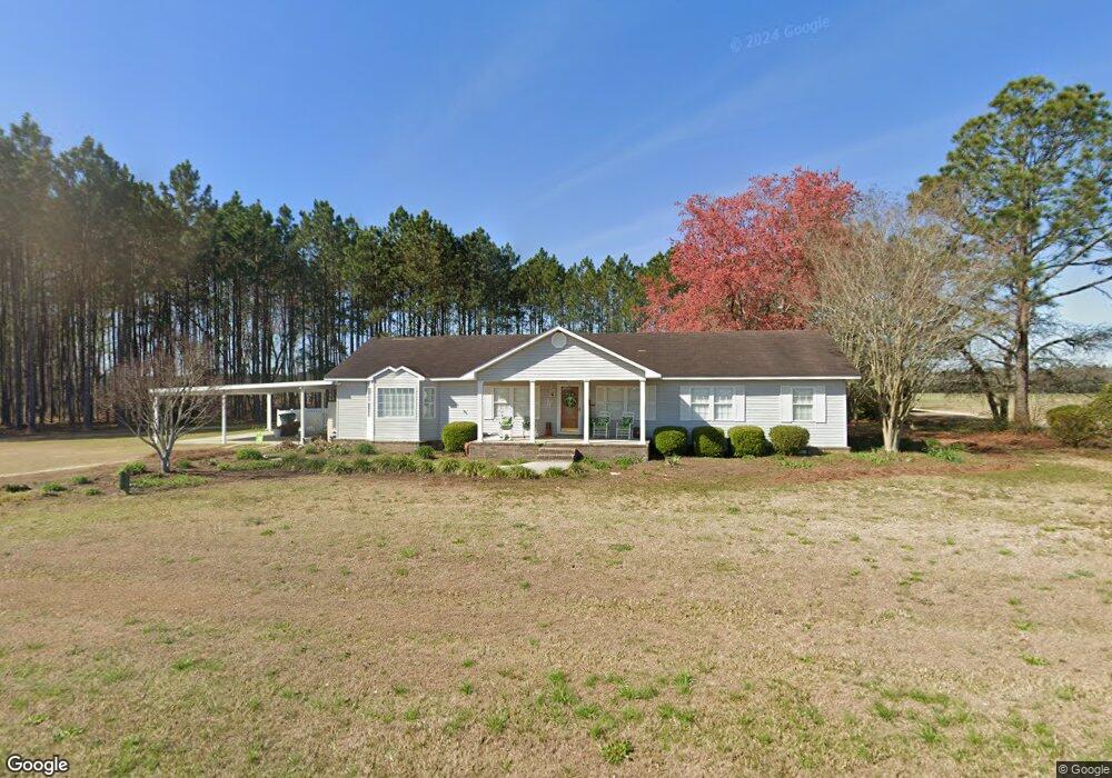
6537 Ga Highway 169 Claxton, GA 30417
Estimated Value: $67,642 - $144,000
1
Bed
2
Baths
748
Sq Ft
$150/Sq Ft
Est. Value
About This Home
This home is located at 6537 Ga Highway 169, Claxton, GA 30417 and is currently estimated at $112,161, approximately $149 per square foot. 6537 Ga Highway 169 is a home located in Evans County with nearby schools including Claxton Elementary School, Second Chance, and Claxton Middle School.
Ownership History
Date
Name
Owned For
Owner Type
Purchase Details
Closed on
Apr 10, 2015
Sold by
Pinckard Tom
Bought by
Pinckard James Casey
Current Estimated Value
Purchase Details
Closed on
Mar 13, 2014
Sold by
Pinckard Tom
Bought by
Hunter Dianne P
Purchase Details
Closed on
Dec 20, 2013
Sold by
Federal Home Loan Mortgage Corporation
Bought by
Pinckard Tom
Purchase Details
Closed on
Sep 3, 2013
Sold by
Pnc Bank National Association
Bought by
Federal Home Loan Mortgage Corporation
Purchase Details
Closed on
Apr 3, 2002
Sold by
Brown James E
Bought by
Brown James Joshua
Purchase Details
Closed on
Nov 7, 1989
Sold by
Brown James E and Martha Jane J
Bought by
Brown James E
Create a Home Valuation Report for This Property
The Home Valuation Report is an in-depth analysis detailing your home's value as well as a comparison with similar homes in the area
Home Values in the Area
Average Home Value in this Area
Purchase History
| Date | Buyer | Sale Price | Title Company |
|---|---|---|---|
| Pinckard James Casey | -- | -- | |
| Hunter Dianne P | $8,000 | -- | |
| Pinckard Tom | -- | -- | |
| Federal Home Loan Mortgage Corporation | $24,800 | -- | |
| Brown James Joshua | -- | -- | |
| Brown James E | -- | -- |
Source: Public Records
Tax History Compared to Growth
Tax History
| Year | Tax Paid | Tax Assessment Tax Assessment Total Assessment is a certain percentage of the fair market value that is determined by local assessors to be the total taxable value of land and additions on the property. | Land | Improvement |
|---|---|---|---|---|
| 2024 | $864 | $23,760 | $1,600 | $22,160 |
| 2023 | $506 | $13,800 | $1,160 | $12,640 |
| 2022 | $354 | $13,800 | $1,160 | $12,640 |
| 2021 | $510 | $13,800 | $1,160 | $12,640 |
| 2020 | $511 | $13,800 | $1,160 | $12,640 |
| 2019 | $474 | $13,800 | $1,160 | $12,640 |
| 2018 | $632 | $13,600 | $1,160 | $12,440 |
| 2017 | $608 | $13,800 | $1,160 | $12,640 |
| 2016 | $595 | $12,760 | $800 | $11,960 |
| 2015 | -- | $13,040 | $920 | $12,120 |
| 2014 | -- | $13,360 | $920 | $12,440 |
| 2013 | -- | $17,480 | $2,480 | $15,000 |
Source: Public Records
Map
Nearby Homes
- 4909 Perry Rd
- 147 Creek Ridge Rd
- 179 Creek Ridge Rd
- 29 Grove Ln
- 19 Collins St
- 319 A Rupert Wood Ln
- 4164 Perry Rd
- 47 Manassas Station Rd
- 0 Turnpike Rd Unit SA339603
- 62 Manassas Station Rd
- 0 Dublin Rd
- 308 Old Metter Rd
- 1302 Jim Sapp Rd
- 19 Wysteria Ln
- 92 Graham Ln
- 12 Wisteria Ln
- 12 Wysteria Ln
- 606 Park Ave
- 10 Honeysuckle Dr
- 15683 Ga Highway 129 N
- 6537 Ga Highway 169
- 6537 Ga Highway 169
- 6537 Ga Highway 169
- 6537 Georgia Highway 169
- 6537 Georgia Hwy 169
- 6347 Ga Highway 169
- 6308 Ga Highway 169
- 6308 Ga Highway 169
- 6308 Ga Highway 169
- 6269 Ga Highway 169
- 6308 Georgia 169
- 6234 Ga Highway 169
- 6160 Ga Highway 169
- 6160 Ga Highway 169
- 6133 Ga Highway 169
- 6144 Ga Highway 169
- 69 Rogers St
- 107 Rogers St
- 143 Rogers St
- 7170 Ga Highway 169