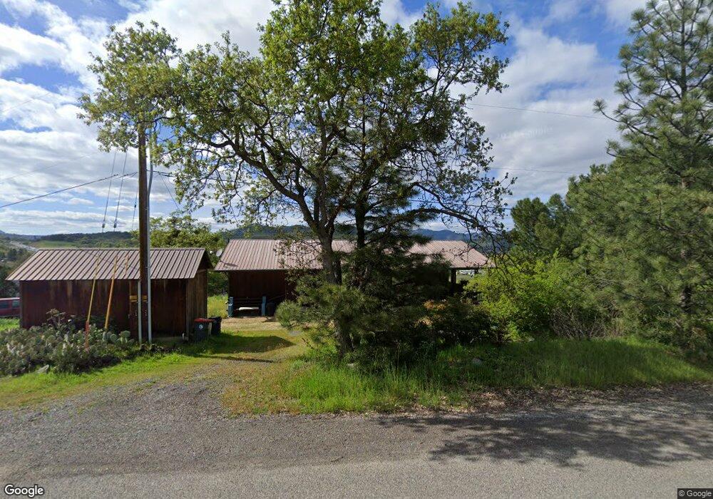
6539 Tolo Rd Central Point, OR 97502
Estimated Value: $390,653 - $504,000
3
Beds
2
Baths
1,488
Sq Ft
$303/Sq Ft
Est. Value
About This Home
This home is located at 6539 Tolo Rd, Central Point, OR 97502 and is currently estimated at $450,218, approximately $302 per square foot. 6539 Tolo Rd is a home located in Jackson County with nearby schools including Patrick Elementary School, Scenic Middle School, and Crater High School.
Ownership History
Date
Name
Owned For
Owner Type
Purchase Details
Closed on
Dec 1, 2006
Sold by
Snook Richard and Snook Cheryl Rene
Bought by
Snook Cheryl Rene
Current Estimated Value
Home Financials for this Owner
Home Financials are based on the most recent Mortgage that was taken out on this home.
Original Mortgage
$64,000
Interest Rate
6.38%
Mortgage Type
New Conventional
Purchase Details
Closed on
Sep 24, 2002
Sold by
Snook Cheryl Rene and Whitehead Cheryl Rene
Bought by
Snook Richard and Snook Cheryl Rene
Home Financials for this Owner
Home Financials are based on the most recent Mortgage that was taken out on this home.
Original Mortgage
$112,500
Interest Rate
6.16%
Create a Home Valuation Report for This Property
The Home Valuation Report is an in-depth analysis detailing your home's value as well as a comparison with similar homes in the area
Purchase History
| Date | Buyer | Sale Price | Title Company |
|---|---|---|---|
| Snook Cheryl Rene | -- | First American Title Insuran | |
| Snook Richard | -- | Multiple |
Source: Public Records
Mortgage History
| Date | Status | Borrower | Loan Amount |
|---|---|---|---|
| Closed | Snook Cheryl Rene | $64,000 | |
| Closed | Snook Richard | $112,500 |
Source: Public Records
Tax History
| Year | Tax Paid | Tax Assessment Tax Assessment Total Assessment is a certain percentage of the fair market value that is determined by local assessors to be the total taxable value of land and additions on the property. | Land | Improvement |
|---|---|---|---|---|
| 2026 | $2,804 | $228,900 | -- | -- |
| 2025 | $2,730 | $222,240 | $80,870 | $141,370 |
| 2024 | $2,730 | $215,770 | $80,370 | $135,400 |
| 2023 | $2,641 | $209,490 | $78,030 | $131,460 |
| 2022 | $2,587 | $209,490 | $78,030 | $131,460 |
| 2021 | $2,516 | $203,390 | $75,750 | $127,640 |
| 2020 | $2,444 | $197,470 | $73,540 | $123,930 |
| 2019 | $2,390 | $186,140 | $69,310 | $116,830 |
| 2018 | $2,318 | $180,720 | $67,290 | $113,430 |
| 2017 | $2,264 | $180,720 | $67,290 | $113,430 |
| 2016 | $2,200 | $170,350 | $63,440 | $106,910 |
| 2015 | $2,116 | $170,350 | $63,440 | $106,910 |
| 2014 | $2,024 | $160,250 | $39,890 | $120,360 |
Source: Public Records
Map
Nearby Homes
- 4223 Merita Terrace
- 6251 Ventura Ln
- 6048 Tolo Rd
- 4413 Merita Terrace
- 8785 Blackwell Rd Unit North Side
- 8785 Blackwell Rd Unit South Side
- 8785 Blackwell Rd
- 6169 Tamarack Ln
- 7505 Blackwell Rd
- 4640 Scenic Ave
- 4533 Old Stage Rd
- 10585 Blackwell Rd
- 335 Applewood Dr
- 1860 Cottonwood Dr
- 1317 River Run St
- 5030 Del Mar Dr
- 1855 Nancy Ave
- 545 Bridge Creek Dr
- 8184 Old Stage Rd
- 6060 Old Stage Rd
- 6535 Tolo Rd
- 6531 Tolo Rd
- 6619 Tolo Rd
- 6620 Tolo Rd
- 6530 Tolo Rd
- 6523 Tolo Rd
- 6646 Tolo Rd
- 6519 Tolo Rd
- 6423 Tolo Rd
- 4075 Merita Terrace
- 0 Tolo Rd Unit 100056778
- 0 Tolo Rd Unit 100993397
- 0 Tolo Rd Unit 100077277
- 0 Tolo Rd Unit 100970097
- 0 Tolo Rd Unit 100214464
- 0 Tolo Rd Unit 100202226
- 0 Tolo Rd Unit 220140022
- 6650 Tolo Rd
- 6460 Tolo Rd
- 6755 Tolo Rd
Your Personal Tour Guide
Ask me questions while you tour the home.