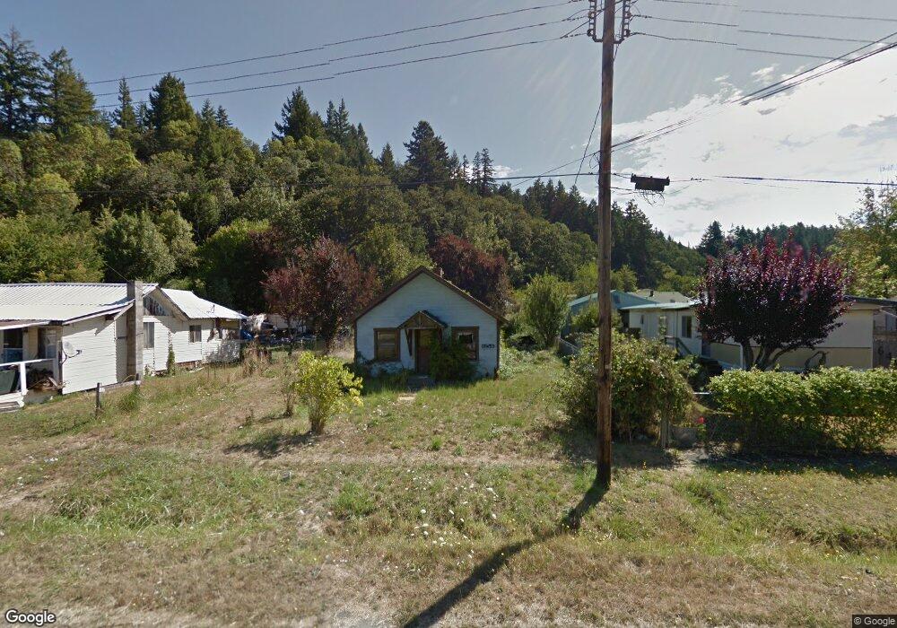
654 2nd Ave Powers, OR 97466
Estimated Value: $86,606 - $224,000
1
Bed
1
Bath
652
Sq Ft
$238/Sq Ft
Est. Value
About This Home
This home is located at 654 2nd Ave, Powers, OR 97466 and is currently estimated at $155,303, approximately $238 per square foot. 654 2nd Ave is a home located in Coos County with nearby schools including Powers High School.
Ownership History
Date
Name
Owned For
Owner Type
Purchase Details
Closed on
Nov 8, 2013
Sold by
Venable Richard Dean and Venable Donna
Bought by
Smith Geneva and Van Wingerden Pamela Durham
Current Estimated Value
Purchase Details
Closed on
Oct 28, 2013
Sold by
Vasey William G
Bought by
Venable Richard Dean and Venable Donna
Purchase Details
Closed on
Apr 27, 2011
Sold by
Vasey William G
Bought by
Venable Donna and Venable Richard Dean
Purchase Details
Closed on
Jan 7, 2011
Sold by
Ryals Linda R
Bought by
Vasey William G
Create a Home Valuation Report for This Property
The Home Valuation Report is an in-depth analysis detailing your home's value as well as a comparison with similar homes in the area
Purchase History
| Date | Buyer | Sale Price | Title Company |
|---|---|---|---|
| Smith Geneva | $15,399 | First American Title | |
| Venable Richard Dean | -- | First American Title | |
| Venable Donna | $18,500 | Accommodation | |
| Vasey William G | $500 | None Available |
Source: Public Records
Mortgage History
| Date | Status | Borrower | Loan Amount |
|---|---|---|---|
| Closed | Venable Donna | $0 |
Source: Public Records
Tax History
| Year | Tax Paid | Tax Assessment Tax Assessment Total Assessment is a certain percentage of the fair market value that is determined by local assessors to be the total taxable value of land and additions on the property. | Land | Improvement |
|---|---|---|---|---|
| 2025 | $395 | $24,500 | -- | -- |
| 2024 | $375 | $23,790 | -- | -- |
| 2023 | $364 | $23,100 | $0 | $0 |
| 2022 | $358 | $22,430 | $0 | $0 |
| 2021 | $347 | $21,780 | $0 | $0 |
| 2020 | $321 | $21,600 | $0 | $0 |
| 2019 | $307 | $20,540 | $0 | $0 |
| 2018 | $279 | $18,710 | $0 | $0 |
| 2017 | $263 | $17,650 | $0 | $0 |
| 2016 | $263 | $17,650 | $0 | $0 |
| 2015 | $305 | $20,540 | $0 | $0 |
| 2014 | $305 | $19,950 | $0 | $0 |
Source: Public Records
Map
Nearby Homes
- 631 2nd Ave
- 510 Fir St
- 141 Poplar St
- 410 3rd Ave
- 130 E Date St
- 173 E Date St
- 309 4th Ave
- 815 E Ave
- 930 C Ave
- 889 H Ave
- 711 H Ave
- 45651 Johnson Mountain Rd
- 0 Johnson Mt Rd Unit 600 168667991
- 41308 S Powers Rd
- 46255 Highway 242
- 51014 Dement Creek Rd
- 15779 Oregon 42
- 20191 Highway 42
- 16855 Highway 42
- 000 Eden Valley Rd Unit 600
Your Personal Tour Guide
Ask me questions while you tour the home.