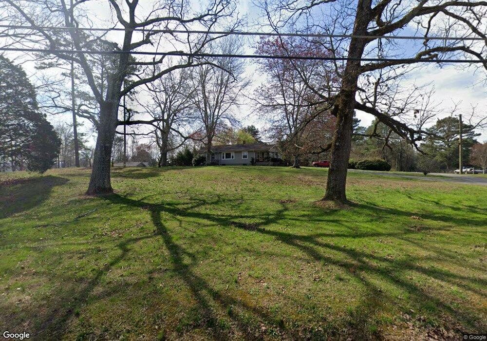
654 Kay Conley Rd Rock Spring, GA 30739
Rock Spring NeighborhoodEstimated Value: $251,413 - $322,000
Studio
2
Baths
1,804
Sq Ft
$163/Sq Ft
Est. Value
About This Home
This home is located at 654 Kay Conley Rd, Rock Spring, GA 30739 and is currently estimated at $294,853, approximately $163 per square foot. 654 Kay Conley Rd is a home located in Walker County with nearby schools including Rock Spring Elementary School, Lafayette High School, and Alice M Daley Adventist School.
Ownership History
Date
Name
Owned For
Owner Type
Purchase Details
Closed on
Jun 7, 2005
Sold by
Not Provided
Bought by
Smith Smith Thurlo Grady Thurlo Grady and Smith Shields
Current Estimated Value
Purchase Details
Closed on
May 29, 1978
Sold by
Shields Ralph E
Bought by
Shields Annie and Micki Smith
Purchase Details
Closed on
Jan 1, 1972
Bought by
Shields Ralph E
Create a Home Valuation Report for This Property
The Home Valuation Report is an in-depth analysis detailing your home's value as well as a comparison with similar homes in the area
Home Values in the Area
Average Home Value in this Area
Purchase History
| Date | Buyer | Sale Price | Title Company |
|---|---|---|---|
| Smith Smith Thurlo Grady Thurlo Grady | -- | -- | |
| Shields Annie | -- | -- | |
| Shields Ralph E | -- | -- |
Source: Public Records
Tax History Compared to Growth
Tax History
| Year | Tax Paid | Tax Assessment Tax Assessment Total Assessment is a certain percentage of the fair market value that is determined by local assessors to be the total taxable value of land and additions on the property. | Land | Improvement |
|---|---|---|---|---|
| 2024 | $1,927 | $82,424 | $17,104 | $65,320 |
| 2023 | $1,813 | $75,303 | $13,574 | $61,729 |
| 2022 | $1,789 | $69,240 | $12,008 | $57,232 |
| 2021 | $1,671 | $57,969 | $12,008 | $45,961 |
| 2020 | $1,484 | $48,854 | $12,008 | $36,846 |
| 2019 | $1,510 | $48,854 | $12,008 | $36,846 |
| 2018 | $1,293 | $48,854 | $12,008 | $36,846 |
| 2017 | $2,840 | $88,764 | $50,766 | $37,998 |
| 2016 | $2,302 | $88,764 | $50,766 | $37,998 |
| 2015 | $2,147 | $77,447 | $50,844 | $26,603 |
| 2014 | $2,019 | $77,447 | $50,844 | $26,603 |
| 2013 | -- | $77,446 | $50,844 | $26,602 |
Source: Public Records
Map
Nearby Homes
- 195 Honeysuckle Dr
- 1902 Long Hollow Rd
- 36 Pheonix Cir
- 5602 Georgia 95
- 00 Georgia 95
- 285 Cooper Rd
- 1003 Highway N Old 27
- 1370 Old Highway 27
- 1476 Arnold Rd
- 10180 Us Highway 27
- 1121 Arnold Rd
- 40 Blessed Way
- 136 Ginger Lake Dr
- 514 Ginger Lake Dr
- 918 Old Lafayette Rd
- 23 Willow Cir
- 11 Willow Cir
- 16 Willow Cir
- The Pearson Plan at Laurel Ridge
- The Benson II Plan at Laurel Ridge
- 622 Kay Conley Rd
- 72 Roy Bird Rd
- 0 Roy Bird Rd
- 0 Roy Bird Rd Unit 1048872
- 0 Roy Bird Rd Unit 1246271
- 0 Roy Bird Rd Unit 1239136
- 0 Roy Bird Rd Unit 1105367
- 0 Roy Bird Rd Unit 1048868
- 0 Roy Bird Rd Unit 18420
- 803 Kay Conley Rd
- 617 Kay Conley Rd
- 665 Kay Conley Rd
- 771 Kay Conley Rd
- 643 Kay Conley Rd
- 561 Kay Conley Rd
- 898 Kay Conley Rd
- 905 Kay Conley Rd
- 2847 Peavine Rd
- 2707 Peavine Rd
- 544 Kay Conley Rd