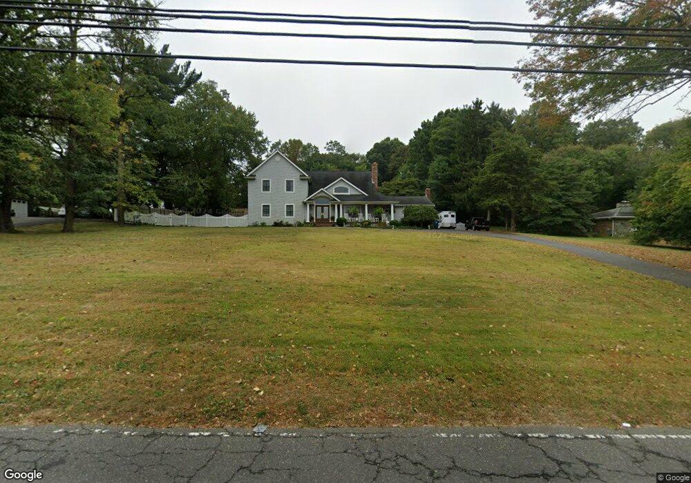
654 Locust Point Rd Rumson, NJ 07760
Locust NeighborhoodEstimated Value: $1,160,000 - $1,720,000
4
Beds
3
Baths
3,319
Sq Ft
$429/Sq Ft
Est. Value
About This Home
This home is located at 654 Locust Point Rd, Rumson, NJ 07760 and is currently estimated at $1,424,821, approximately $429 per square foot. 654 Locust Point Rd is a home located in Monmouth County with nearby schools including Navesink Elementary School, Bayshore Middle School, and Middletown - South High School.
Ownership History
Date
Name
Owned For
Owner Type
Purchase Details
Closed on
May 11, 1990
Bought by
Lino Robert and Mary Spence
Current Estimated Value
Create a Home Valuation Report for This Property
The Home Valuation Report is an in-depth analysis detailing your home's value as well as a comparison with similar homes in the area
Home Values in the Area
Average Home Value in this Area
Purchase History
| Date | Buyer | Sale Price | Title Company |
|---|---|---|---|
| Lino Robert | $207,000 | -- |
Source: Public Records
Tax History
| Year | Tax Paid | Tax Assessment Tax Assessment Total Assessment is a certain percentage of the fair market value that is determined by local assessors to be the total taxable value of land and additions on the property. | Land | Improvement |
|---|---|---|---|---|
| 2025 | $15,863 | $1,090,000 | $556,400 | $533,600 |
| 2024 | $17,517 | $964,300 | $440,500 | $523,800 |
| 2023 | $17,517 | $1,007,900 | $423,500 | $584,400 |
| 2022 | $17,824 | $918,500 | $362,000 | $556,500 |
| 2021 | $17,824 | $856,900 | $362,000 | $494,900 |
| 2020 | $18,083 | $845,800 | $362,000 | $483,800 |
| 2019 | $17,804 | $843,000 | $362,000 | $481,000 |
| 2018 | $17,782 | $820,600 | $362,000 | $458,600 |
| 2017 | $18,094 | $826,600 | $362,000 | $464,600 |
| 2016 | $17,366 | $814,900 | $362,000 | $452,900 |
| 2015 | $17,791 | $806,100 | $362,000 | $444,100 |
| 2014 | $17,378 | $767,900 | $362,000 | $405,900 |
Source: Public Records
Map
Nearby Homes
- 96 East Ave Unit 82
- 96 East Ave Unit 76
- 96 East Ave Unit 97
- 498 Central Ave
- 502 Central Ave
- 500 Central Ave
- 7100 Prospect Ave
- 6998 Prospect Ave
- 26 King James Ln
- 96 E East Ave Unit 37
- 114 Memorial Pkwy
- 254 1st Ave
- 50 Memorial Pkwy
- 119 Chestnut Ave
- 19 Summit Ave
- 104 E Washington Ave
- 48 Starr Ct
- 16 E Garfield Ave
- 12 E Garfield Ave
- 8 E Garfield Ave
- 658 Locust Point Rd
- 650 Locust Point Rd
- 653 Locust Point Rd
- 657 Locust Point Rd
- 649 Locust Point Rd
- 642 Locust Point Rd
- 645 Locust Point Rd
- 661 Locust Point Rd
- 638 Locust Point Rd
- 641 Locust Point Rd
- 637 Locust Point Rd
- 668 Locust Point Rd
- 32 Meadowbrook Ave
- 32 Meadowbrook Ave
- 634 Locust Point Rd
- 33 Meadowbrook Ave
- 28 Meadowbrook Ave
- 633 Locust Point Rd
- 664 Locust Point Rd
- 21 Meadowbrook Ave
Your Personal Tour Guide
Ask me questions while you tour the home.