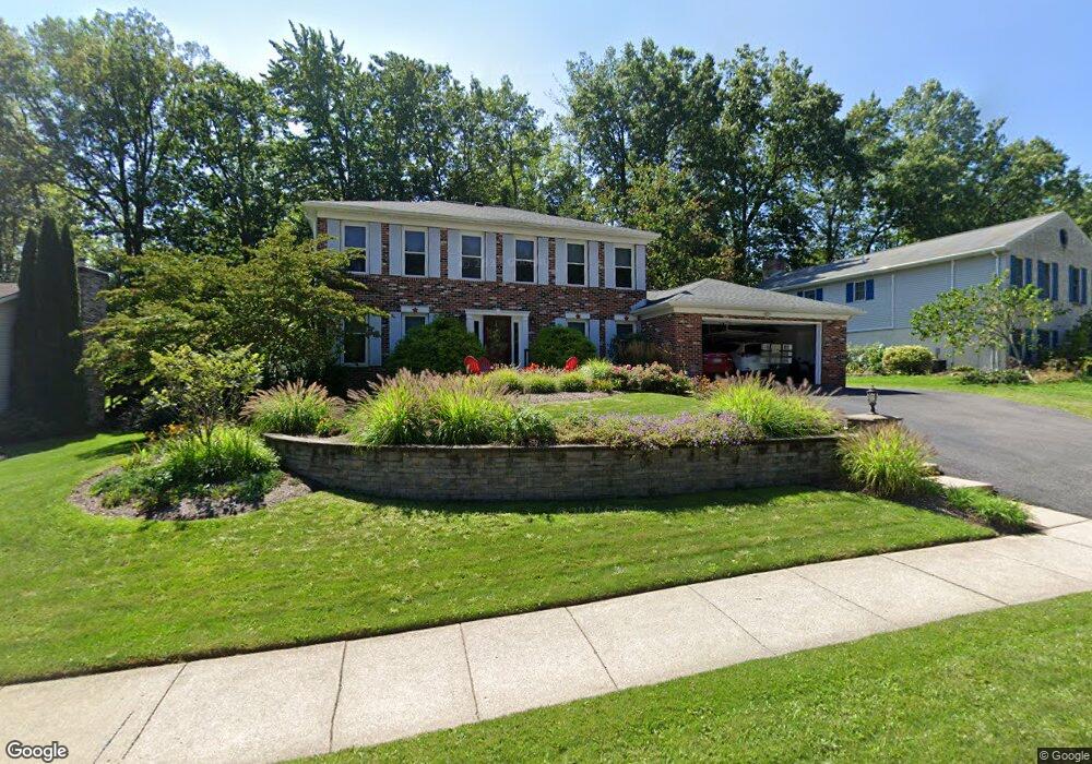
654 Stoneledge Rd State College, PA 16803
Patton NeighborhoodEstimated Value: $500,000 - $561,000
5
Beds
3
Baths
2,640
Sq Ft
$203/Sq Ft
Est. Value
About This Home
This home is located at 654 Stoneledge Rd, State College, PA 16803 and is currently estimated at $535,813, approximately $202 per square foot. 654 Stoneledge Rd is a home located in Centre County with nearby schools including Park Forest Elementary School, Park Forest Middle School, and State College Area High School.
Ownership History
Date
Name
Owned For
Owner Type
Purchase Details
Closed on
Oct 1, 2004
Sold by
Friedlander Alan M and Friedlander Margaret M
Bought by
Lynn P Stevens and Lynn Lois L
Current Estimated Value
Home Financials for this Owner
Home Financials are based on the most recent Mortgage that was taken out on this home.
Original Mortgage
$191,000
Outstanding Balance
$46,319
Interest Rate
5.81%
Mortgage Type
Purchase Money Mortgage
Estimated Equity
$489,494
Create a Home Valuation Report for This Property
The Home Valuation Report is an in-depth analysis detailing your home's value as well as a comparison with similar homes in the area
Home Values in the Area
Average Home Value in this Area
Purchase History
| Date | Buyer | Sale Price | Title Company |
|---|---|---|---|
| Lynn P Stevens | $273,000 | -- |
Source: Public Records
Mortgage History
| Date | Status | Borrower | Loan Amount |
|---|---|---|---|
| Open | Lynn P Stevens | $191,000 |
Source: Public Records
Tax History Compared to Growth
Tax History
| Year | Tax Paid | Tax Assessment Tax Assessment Total Assessment is a certain percentage of the fair market value that is determined by local assessors to be the total taxable value of land and additions on the property. | Land | Improvement |
|---|---|---|---|---|
| 2025 | $7,379 | $105,925 | $12,335 | $93,590 |
| 2024 | $6,884 | $105,925 | $12,335 | $93,590 |
| 2023 | $6,884 | $105,925 | $12,335 | $93,590 |
| 2022 | $6,719 | $105,925 | $12,335 | $93,590 |
| 2021 | $6,719 | $105,925 | $12,335 | $93,590 |
| 2020 | $6,719 | $105,925 | $12,335 | $93,590 |
| 2019 | $4,773 | $105,925 | $12,335 | $93,590 |
| 2018 | $6,513 | $105,925 | $12,335 | $93,590 |
| 2017 | $6,442 | $105,925 | $12,335 | $93,590 |
| 2016 | -- | $105,925 | $12,335 | $93,590 |
| 2015 | -- | $105,925 | $12,335 | $93,590 |
| 2014 | -- | $105,925 | $12,335 | $93,590 |
Source: Public Records
Map
Nearby Homes
- 291 Oakley Dr
- 479 Westgate Dr
- 1635 Princeton Dr
- 1765 Cambridge Dr
- 169 Sandy Ridge Rd
- 2251 Red Oak Ln
- 2292 Oak Leaf Dr
- 1111-C W Aaron Dr
- 835 Galen Dr Unit 835
- 833 Galen Dr
- 1832 Waddle Rd
- 1836 Waddle Rd
- 253 Bolton Ave
- 1383 N Allen St
- 3182 Carnegie Dr
- 1457 Curtin St
- 257 Oakwood Ave
- 505 Hillcrest Ave
- 465 Hillcrest Ave
- 936 Taylor St
- 648 Stoneledge Rd
- 660 Stoneledge Rd
- 567 Longbarn Rd
- 561 Longbarn Rd
- 668 Stoneledge Rd
- 573 Longbarn Rd
- 665 Stoneledge Rd
- 663 Stoneledge Rd
- 555 Longbarn Rd
- 669 Stoneledge Rd
- 657 Stoneledge Rd
- 636 Stoneledge Rd
- 672 Stoneledge Rd
- 673 Stoneledge Rd
- 556 Longbarn Rd
- 678 Stoneledge Rd
- 651 Stoneledge Rd
- 549 Longbarn Rd
- 562 Longbarn Rd
- 550 Longbarn Rd