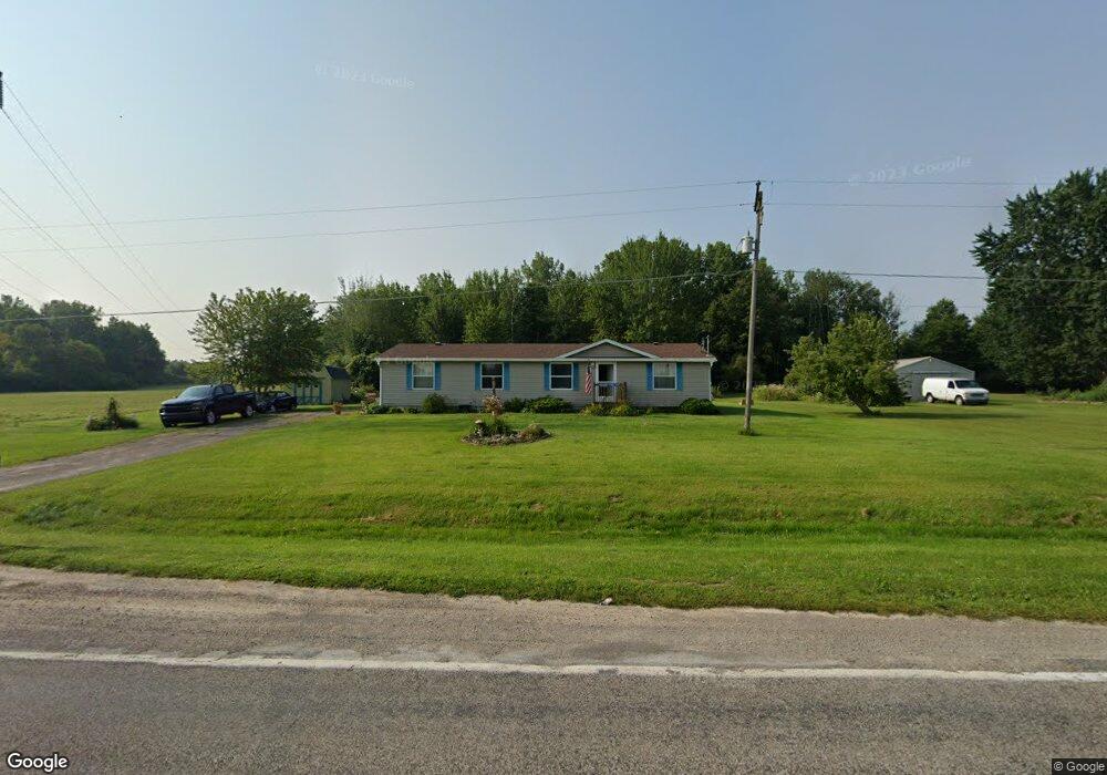
6540 Curtis Rd Bridgeport, MI 48722
Estimated Value: $179,000 - $187,000
3
Beds
1
Bath
1,456
Sq Ft
$125/Sq Ft
Est. Value
About This Home
This home is located at 6540 Curtis Rd, Bridgeport, MI 48722 and is currently estimated at $182,333, approximately $125 per square foot. 6540 Curtis Rd is a home located in Saginaw County with nearby schools including Thomas White School, Martin G. Atkins Elementary School, and Bridgeport High School.
Ownership History
Date
Name
Owned For
Owner Type
Purchase Details
Closed on
May 8, 2024
Sold by
Jackson Cheri and Sabraw Cheri
Bought by
Jackson Cheri and Jackson Jeffrey
Current Estimated Value
Home Financials for this Owner
Home Financials are based on the most recent Mortgage that was taken out on this home.
Original Mortgage
$63,000
Outstanding Balance
$59,418
Interest Rate
6.06%
Mortgage Type
New Conventional
Estimated Equity
$122,915
Purchase Details
Closed on
May 25, 2005
Sold by
Sabraw Michael J and Sabraw Cheri L
Bought by
Sabraw Cheri
Purchase Details
Closed on
May 13, 2002
Home Financials for this Owner
Home Financials are based on the most recent Mortgage that was taken out on this home.
Original Mortgage
$83,140
Interest Rate
6.87%
Create a Home Valuation Report for This Property
The Home Valuation Report is an in-depth analysis detailing your home's value as well as a comparison with similar homes in the area
Home Values in the Area
Average Home Value in this Area
Purchase History
| Date | Buyer | Sale Price | Title Company |
|---|---|---|---|
| Jackson Cheri | -- | Michigan Trusted Title | |
| Sabraw Cheri | -- | -- | |
| -- | $7,000 | -- | |
| Sabraw Michael James | $7,000 | -- |
Source: Public Records
Mortgage History
| Date | Status | Borrower | Loan Amount |
|---|---|---|---|
| Open | Jackson Cheri | $63,000 | |
| Previous Owner | Sabraw Michael James | $83,140 |
Source: Public Records
Tax History Compared to Growth
Tax History
| Year | Tax Paid | Tax Assessment Tax Assessment Total Assessment is a certain percentage of the fair market value that is determined by local assessors to be the total taxable value of land and additions on the property. | Land | Improvement |
|---|---|---|---|---|
| 2025 | $1,986 | $79,300 | $0 | $0 |
| 2024 | $509 | $76,800 | $0 | $0 |
| 2023 | $484 | $68,500 | $0 | $0 |
| 2022 | $1,664 | $61,400 | $0 | $0 |
| 2021 | $1,528 | $53,900 | $0 | $0 |
| 2020 | $1,488 | $49,500 | $0 | $0 |
| 2019 | $1,416 | $46,300 | $4,800 | $41,500 |
| 2018 | $422 | $45,200 | $0 | $0 |
| 2017 | $1,282 | $45,300 | $0 | $0 |
| 2016 | $1,385 | $42,300 | $0 | $0 |
| 2014 | -- | $36,700 | $0 | $31,900 |
| 2013 | -- | $36,300 | $0 | $0 |
Source: Public Records
Map
Nearby Homes
- 7965 Dixie Hwy
- 7720 Rookway Rd
- 7110 Townline Rd
- Parcel E W Rolling Hills Dr
- Parcel B W Rolling Hills Dr
- Parcel D W Rolling Hills Dr
- Parcel F W Rolling Hills Dr
- Parcel C W Rolling Hills Dr
- 8780 Dixie Hwy
- 5400 Maple Rd
- 5430 Busch Rd
- 0 W Tuscola Rd Unit 50182343
- 6605 Bridgeport Hwy
- 4333 Riverview Dr
- 5885 McGrandy Rd
- 3875 Curtis Rd
- 6412 Tin Lizzy Ln
- 6977 Rathbun Rd
- 9750 Marshall Rd
- VL Fort Rd
- 6450 Curtis Rd
- 6430 Curtis Rd
- 6562 Curtis Rd
- 6562 Curtis Rd
- 6340 Curtis Rd
- 7422 Dixie Hwy
- 7483 Dixie Hwy
- 7578 Dixie Hwy
- 6722 E Curtis Rd
- 6722 E Curtis Rd Unit 2336
- 6722 Curtis Rd
- 6110 Curtis Rd
- 6700 Curtis Rd
- 6770 Curtis Rd
- 6770 E Curtis Rd
- 6258 Curtis Rd
- 6258 Curtis Rd
- 7590 Dixie Hwy
- 6774 Curtis Rd
- 7620 Dixie Hwy