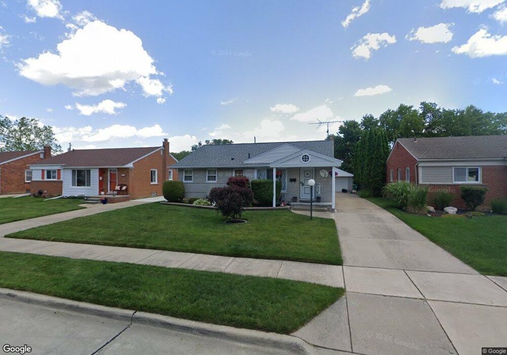
6540 Whitby St Garden City, MI 48135
Estimated Value: $224,190 - $255,000
3
Beds
2
Baths
1,300
Sq Ft
$185/Sq Ft
Est. Value
About This Home
This home is located at 6540 Whitby St, Garden City, MI 48135 and is currently estimated at $240,548, approximately $185 per square foot. 6540 Whitby St is a home located in Wayne County with nearby schools including Douglas Elementary 3-4 Campus, Memorial Elementary 1-2 Campus, and Garden City Middle School.
Ownership History
Date
Name
Owned For
Owner Type
Purchase Details
Closed on
Oct 28, 2011
Sold by
Melowski Casimere Richard and Lysaght Jennifer L
Bought by
Whitley Reginald
Current Estimated Value
Purchase Details
Closed on
Mar 21, 2005
Sold by
Melowski Dennis M
Bought by
Melowksi Casimere Richard
Purchase Details
Closed on
Mar 19, 2005
Sold by
Melowski Mark A
Bought by
Melowski Casimere Richard
Purchase Details
Closed on
Nov 9, 2001
Sold by
Melowski Casimere R
Bought by
Jensen Karen E
Create a Home Valuation Report for This Property
The Home Valuation Report is an in-depth analysis detailing your home's value as well as a comparison with similar homes in the area
Home Values in the Area
Average Home Value in this Area
Purchase History
| Date | Buyer | Sale Price | Title Company |
|---|---|---|---|
| Whitley Reginald | $65,000 | First American Title Ins Co | |
| Melowksi Casimere Richard | -- | Title Source Inc | |
| Melowski Casimere Richard | -- | Title Source Inc | |
| Jensen Karen E | -- | -- |
Source: Public Records
Tax History Compared to Growth
Tax History
| Year | Tax Paid | Tax Assessment Tax Assessment Total Assessment is a certain percentage of the fair market value that is determined by local assessors to be the total taxable value of land and additions on the property. | Land | Improvement |
|---|---|---|---|---|
| 2025 | $2,685 | $110,800 | $0 | $0 |
| 2024 | $2,685 | $103,400 | $0 | $0 |
| 2023 | $2,553 | $89,800 | $0 | $0 |
| 2022 | $2,859 | $76,200 | $0 | $0 |
| 2021 | $2,797 | $72,200 | $0 | $0 |
| 2020 | $2,805 | $67,400 | $0 | $0 |
| 2019 | $2,307 | $61,800 | $0 | $0 |
| 2018 | $2,052 | $54,900 | $0 | $0 |
| 2017 | $660 | $52,700 | $0 | $0 |
| 2016 | $2,330 | $51,500 | $0 | $0 |
| 2015 | $4,150 | $46,900 | $0 | $0 |
| 2013 | $4,020 | $41,000 | $0 | $0 |
| 2012 | $2,109 | $42,400 | $12,600 | $29,800 |
Source: Public Records
Map
Nearby Homes
- 6649 Burnly St
- 6705 Whitby St
- 6747 Burnly St
- 29801 Bridge St
- 29498 Bridge St
- 6727 Hawthorne St
- 29825 Dawson Ave
- 29825 Dawson St
- 29878 Malvern St
- 6557 Huntleigh St
- 6439 Huntleigh St
- 30436 Beechwood St
- 5689 Brandt St
- 28912 Cambridge St
- 7505 Donna St
- 31208 Windsor St
- 28843 Balmoral St
- 28832 Block St
- 31022 Birchlawn St Unit 20
- 6555 Merriman Rd