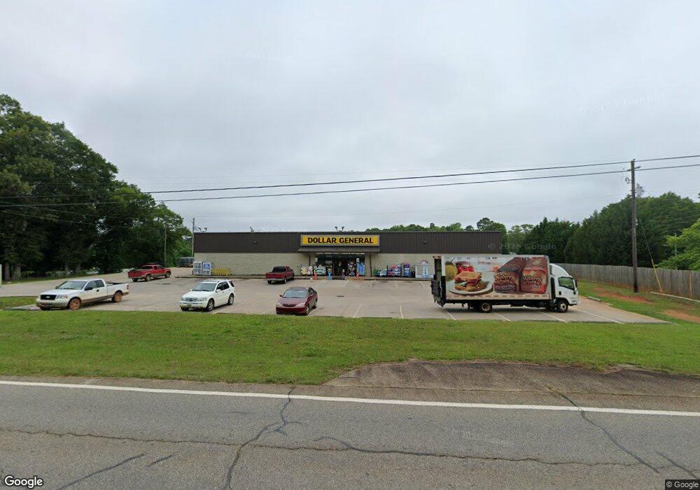
6542 Yatesville Hwy Yatesville, GA 31097
Estimated Value: $2,167,934
--
Bed
1
Bath
8,960
Sq Ft
$242/Sq Ft
Est. Value
About This Home
This home is located at 6542 Yatesville Hwy, Yatesville, GA 31097 and is currently estimated at $2,167,934, approximately $241 per square foot. 6542 Yatesville Hwy is a home located in Upson County with nearby schools including Upson-Lee South Elementary School, Upson-Lee North Elementary School, and Upson-Lee Middle School.
Ownership History
Date
Name
Owned For
Owner Type
Purchase Details
Closed on
Dec 2, 2019
Sold by
Cole Dg Yatesville Ga Llc
Bought by
Mdc Coast 20 Llc
Current Estimated Value
Purchase Details
Closed on
Mar 25, 2013
Sold by
The Braodway Grp Llc
Bought by
Cole Dg Yatesville Ga Llc
Purchase Details
Closed on
Nov 15, 2012
Sold by
Wilkinson Barbara
Bought by
The Braodway Grp Llc
Purchase Details
Closed on
Feb 6, 2012
Sold by
Wilkinson Barbara
Bought by
Wilkinson Barbara
Create a Home Valuation Report for This Property
The Home Valuation Report is an in-depth analysis detailing your home's value as well as a comparison with similar homes in the area
Home Values in the Area
Average Home Value in this Area
Purchase History
| Date | Buyer | Sale Price | Title Company |
|---|---|---|---|
| Mdc Coast 20 Llc | $1,300,787 | -- | |
| Cole Dg Yatesville Ga Llc | $1,128,958 | -- | |
| The Braodway Grp Llc | $115,000 | -- | |
| Wilkinson Barbara | -- | -- | |
| Wilkinson Barbara | -- | -- |
Source: Public Records
Tax History Compared to Growth
Tax History
| Year | Tax Paid | Tax Assessment Tax Assessment Total Assessment is a certain percentage of the fair market value that is determined by local assessors to be the total taxable value of land and additions on the property. | Land | Improvement |
|---|---|---|---|---|
| 2024 | $6,103 | $183,716 | $4,321 | $179,395 |
| 2023 | $5,094 | $183,716 | $4,321 | $179,395 |
| 2022 | $5,094 | $183,716 | $4,321 | $179,395 |
| 2021 | $4,841 | $183,716 | $4,321 | $179,395 |
| 2020 | $5,183 | $183,716 | $4,321 | $179,395 |
| 2019 | $5,629 | $183,716 | $4,321 | $179,395 |
| 2018 | $5,633 | $183,716 | $4,321 | $179,395 |
| 2017 | $5,918 | $176,019 | $4,321 | $171,698 |
Source: Public Records
Map
Nearby Homes
- 1338 Edwards Rd
- 305 Zellner Rd
- 0 Rest Haven Rd Unit 10652109
- 2200 Rest Haven Rd
- 351 Main St
- 0 Ramah Church Rd Unit 10480661
- 0 Ramah Church Rd Unit 7542675
- 832 Jackson Dr
- 1505 Willis Rd
- 144 Means Rd
- 1972 Rest Haven Rd
- 235 Rocky Branch Rd
- 1904 U S 341
- 3487 Yatesville Hwy
- 1570 the Rock Rd
- 1518 the Rock Rd
- 202 Community House Rd
- 208 Community House Rd
- 1031 the Rock Rd
- 2222 Barnesville Hwy
- 6530 Yatesville Hwy
- 6510 Yatesville Hwy
- 185 Johnson St
- 193 Johnson St
- 134 Cross St
- 79 Belmont St
- 207 Johnson St
- 164 Florence St
- 104 Cross St
- 104 Cross St
- 239 Johnson St
- 6440 Yatesville Hwy
- 20 Cross St
- 6524 Yatesville Hwy
- 118 Florence St
- 47 Glendale St
- 71 Glendale St
- 59 Johnson St
- 59 Edwards Rd
- 6254 Yatesville Hwy