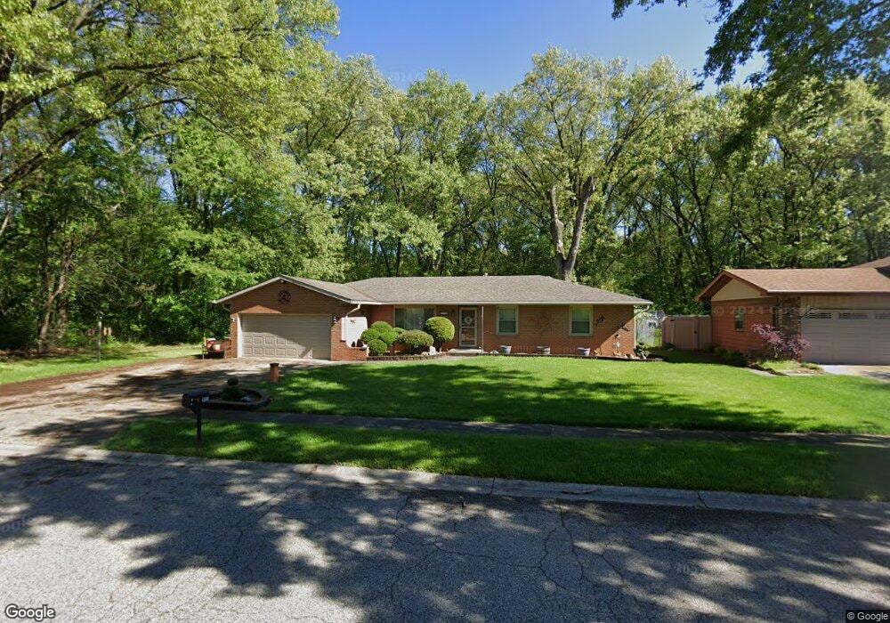
6544 Kandi Ave Portage, IN 46368
Estimated Value: $254,000 - $266,000
3
Beds
2
Baths
1,550
Sq Ft
$167/Sq Ft
Est. Value
About This Home
This home is located at 6544 Kandi Ave, Portage, IN 46368 and is currently estimated at $259,485, approximately $167 per square foot. 6544 Kandi Ave is a home located in Porter County with nearby schools including Crisman Elementary School, Willowcreek Middle School, and Portage High School.
Ownership History
Date
Name
Owned For
Owner Type
Purchase Details
Closed on
May 19, 2009
Sold by
Dominguez Genoveva and Dominguez Richard
Bought by
Dominguez Richard and Dominguez Kathleen M
Current Estimated Value
Home Financials for this Owner
Home Financials are based on the most recent Mortgage that was taken out on this home.
Original Mortgage
$50,000
Interest Rate
4.84%
Mortgage Type
New Conventional
Create a Home Valuation Report for This Property
The Home Valuation Report is an in-depth analysis detailing your home's value as well as a comparison with similar homes in the area
Home Values in the Area
Average Home Value in this Area
Purchase History
| Date | Buyer | Sale Price | Title Company |
|---|---|---|---|
| Dominguez Richard | -- | Chicago Title Insurance Co |
Source: Public Records
Mortgage History
| Date | Status | Borrower | Loan Amount |
|---|---|---|---|
| Closed | Dominguez Richard | $50,000 |
Source: Public Records
Tax History Compared to Growth
Tax History
| Year | Tax Paid | Tax Assessment Tax Assessment Total Assessment is a certain percentage of the fair market value that is determined by local assessors to be the total taxable value of land and additions on the property. | Land | Improvement |
|---|---|---|---|---|
| 2024 | $2,268 | $224,300 | $32,000 | $192,300 |
| 2023 | $2,248 | $222,900 | $30,800 | $192,100 |
| 2022 | $2,009 | $200,100 | $30,800 | $169,300 |
| 2021 | $1,766 | $175,700 | $30,800 | $144,900 |
| 2020 | $1,602 | $158,200 | $26,700 | $131,500 |
| 2019 | $1,504 | $148,400 | $26,700 | $121,700 |
| 2018 | $1,461 | $144,100 | $26,700 | $117,400 |
| 2017 | $1,375 | $140,900 | $26,700 | $114,200 |
| 2016 | $1,397 | $137,700 | $33,200 | $104,500 |
| 2014 | $1,383 | $135,700 | $32,800 | $102,900 |
| 2013 | -- | $130,400 | $33,500 | $96,900 |
Source: Public Records
Map
Nearby Homes
- 1902 Driftwood St
- 6490 Old Porter Rd
- 6540 Monument Ave
- 6340 Melton Rd
- 1766 Samuelson Rd
- 6698 Monument Ave
- 2065 Jefferson St
- 1935 Samuelson Rd
- 0 Northwood Trail Unit NRA811704
- 1980 Crisman Rd
- 2191 Hamilton St
- 1848 Truman St
- 2183 Foley St
- 2230 Foley St
- 2182 Foley St
- 6697 Federal Ave
- 2262 Rodeo St
- 2086 Bluebird Ct
- 0 Airport Us 6 Unit NRA829208
- 0 Central Ave Unit NRA826855