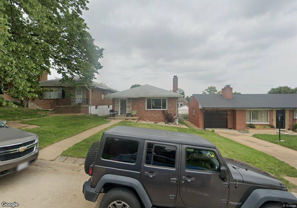
6545 Bancroft Ave Saint Louis, MO 63109
Lindenwood Park NeighborhoodEstimated Value: $286,869 - $329,000
--
Bed
2
Baths
2,250
Sq Ft
$137/Sq Ft
Est. Value
About This Home
This home is located at 6545 Bancroft Ave, Saint Louis, MO 63109 and is currently estimated at $307,217, approximately $136 per square foot. 6545 Bancroft Ave is a home located in St. Louis City with nearby schools including Mason Elementary School, Long International Middle School, and Roosevelt High School.
Ownership History
Date
Name
Owned For
Owner Type
Purchase Details
Closed on
May 31, 2005
Sold by
Aboussle Betty Jane
Bought by
Foiles Marcus and Foiles Melanie
Current Estimated Value
Home Financials for this Owner
Home Financials are based on the most recent Mortgage that was taken out on this home.
Original Mortgage
$113,600
Outstanding Balance
$59,420
Interest Rate
5.79%
Mortgage Type
Fannie Mae Freddie Mac
Estimated Equity
$247,797
Purchase Details
Closed on
Mar 11, 1997
Sold by
Aboussie Edw J Betty J and Aboussie Jeffrey
Bought by
Aboussie Betty Jane
Home Financials for this Owner
Home Financials are based on the most recent Mortgage that was taken out on this home.
Original Mortgage
$57,850
Interest Rate
7.55%
Mortgage Type
Purchase Money Mortgage
Create a Home Valuation Report for This Property
The Home Valuation Report is an in-depth analysis detailing your home's value as well as a comparison with similar homes in the area
Home Values in the Area
Average Home Value in this Area
Purchase History
| Date | Buyer | Sale Price | Title Company |
|---|---|---|---|
| Foiles Marcus | -- | Freedom Title Llc | |
| Aboussie Betty Jane | -- | -- |
Source: Public Records
Mortgage History
| Date | Status | Borrower | Loan Amount |
|---|---|---|---|
| Open | Foiles Marcus | $113,600 | |
| Previous Owner | Aboussie Betty Jane | $57,850 |
Source: Public Records
Tax History Compared to Growth
Tax History
| Year | Tax Paid | Tax Assessment Tax Assessment Total Assessment is a certain percentage of the fair market value that is determined by local assessors to be the total taxable value of land and additions on the property. | Land | Improvement |
|---|---|---|---|---|
| 2025 | $2,959 | $41,350 | $3,330 | $38,020 |
| 2024 | $2,815 | $35,010 | $3,330 | $31,680 |
| 2023 | $2,815 | $35,010 | $3,330 | $31,680 |
| 2022 | $2,684 | $32,130 | $3,330 | $28,800 |
| 2021 | $2,680 | $32,130 | $3,330 | $28,800 |
| 2020 | $2,445 | $29,510 | $3,330 | $26,180 |
| 2019 | $2,437 | $29,510 | $3,330 | $26,180 |
| 2018 | $2,221 | $26,050 | $3,000 | $23,050 |
| 2017 | $2,184 | $26,050 | $3,000 | $23,050 |
| 2016 | $1,989 | $23,390 | $3,000 | $20,390 |
| 2015 | $1,803 | $23,390 | $3,000 | $20,390 |
| 2014 | $1,714 | $23,390 | $3,000 | $20,390 |
| 2013 | -- | $22,230 | $3,000 | $19,230 |
Source: Public Records
Map
Nearby Homes
- 6561 Bancroft Ave
- 3914 Watson Rd
- 6409 Sutherland Ave
- 6709 Lansdowne Ave
- 6646 Mardel Ave
- 6561 Mardel Ave
- 6600 Devonshire Ave Unit 5
- 6637 Devonshire Ave Unit 2
- 6621 Tholozan Ave
- 6439 Mardel Ave
- 6659 Tholozan Ave
- 3807 Tamm Ave
- 3905 Tamm Ave
- 6927-6931 Sutherland Ave
- 6611 Pernod Ave
- 6631 Pernod Ave
- 6562 Oleatha Ave
- 6534 Neosho St
- 6973 Winona Ave
- 6968 Winona Ave
- 6551 Bancroft Ave
- 6539 Bancroft Ave
- 6555 Bancroft Ave
- 6533 Bancroft Ave
- 6542 Winona Ave
- 6540 Winona Ave
- 6546 Winona Ave
- 6531 Bancroft Ave
- 6536 Winona Ave
- 6550 Winona Ave
- 6540 Bancroft Ave
- 6552 Winona Ave
- 6527 Bancroft Ave
- 6544 Bancroft Ave
- 6548 Bancroft Ave
- 6528 Winona Ave
- 6556 Winona Ave
- 6552 Bancroft Ave
- 6523 Bancroft Ave
- 6556 Bancroft Ave