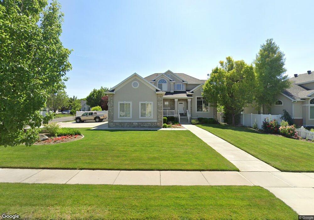
6547 Pilot Peak Cir Salt Lake City, UT 84129
Estimated Value: $740,522 - $863,000
5
Beds
4
Baths
2,556
Sq Ft
$316/Sq Ft
Est. Value
About This Home
This home is located at 6547 Pilot Peak Cir, Salt Lake City, UT 84129 and is currently estimated at $807,881, approximately $316 per square foot. 6547 Pilot Peak Cir is a home located in Salt Lake County with nearby schools including Bennion Elementary School, Bennion Junior High School, and Taylorsville High School.
Ownership History
Date
Name
Owned For
Owner Type
Purchase Details
Closed on
Aug 12, 2024
Sold by
Orchard Russell K and Orchard Jenny L
Bought by
Russell K Orchard Trust and Jenny L Orchard Trust
Current Estimated Value
Purchase Details
Closed on
Dec 21, 2000
Sold by
Ivory Homes Ltd
Bought by
Orchard Russell K and Orchard Jenny L
Home Financials for this Owner
Home Financials are based on the most recent Mortgage that was taken out on this home.
Original Mortgage
$248,600
Interest Rate
7.81%
Create a Home Valuation Report for This Property
The Home Valuation Report is an in-depth analysis detailing your home's value as well as a comparison with similar homes in the area
Home Values in the Area
Average Home Value in this Area
Purchase History
| Date | Buyer | Sale Price | Title Company |
|---|---|---|---|
| Russell K Orchard Trust | -- | Northern Title Company | |
| Orchard Russell K | -- | Guardian Title |
Source: Public Records
Mortgage History
| Date | Status | Borrower | Loan Amount |
|---|---|---|---|
| Previous Owner | Orchard Russell K | $248,600 |
Source: Public Records
Tax History Compared to Growth
Tax History
| Year | Tax Paid | Tax Assessment Tax Assessment Total Assessment is a certain percentage of the fair market value that is determined by local assessors to be the total taxable value of land and additions on the property. | Land | Improvement |
|---|---|---|---|---|
| 2025 | $4,574 | $741,800 | $253,100 | $488,700 |
| 2024 | $4,574 | $750,100 | $250,500 | $499,600 |
| 2023 | $4,220 | $678,900 | $240,900 | $438,000 |
| 2022 | $4,095 | $664,400 | $236,200 | $428,200 |
| 2021 | $3,906 | $552,000 | $234,400 | $317,600 |
| 2020 | $3,704 | $495,400 | $234,400 | $261,000 |
| 2019 | $3,574 | $466,800 | $221,100 | $245,700 |
| 2018 | $3,441 | $433,200 | $221,100 | $212,100 |
| 2017 | $3,120 | $406,500 | $221,100 | $185,400 |
| 2016 | $2,854 | $377,400 | $221,100 | $156,300 |
| 2015 | $2,971 | $367,200 | $190,500 | $176,700 |
| 2014 | $2,760 | $335,000 | $175,500 | $159,500 |
Source: Public Records
Map
Nearby Homes
- 6512 Timpanogos Way
- 6453 Fremont Peak Cir
- 3052 W Matterhorn Dr
- 3226 Tysonbrook Ct
- 2683 W Carson Ln
- 6672 S 3335 W
- 3305 W Kingsbrook Ave
- 6893 S 3200 W
- 1824 W 6200 S
- 6918 S Harvest Cir
- 8524 S Michele River Ave W Unit 109
- 6482 S Gold Medal Dr
- 6095 S Sierra Grande Dr
- 3383 W 6880 S
- 6222 S Westbrook Dr
- 3537 W Green Springs Ln
- 2333 W Ledgewood Dr
- 3538 W Biathlon Cir
- 2332 Broderick Dr
- 2421 W 6900 S
- 6559 Pilot Peak Cir
- 6523 S Andes Way
- 6523 Andes Way
- 6573 S Pilot Peak Cir
- 6573 Pilot Peak Cir
- 6524 S Timpanogos Way
- 6546 Pilot Peak Cir
- 6558 Pilot Peak Cir
- 6507 Andes Way
- 3014 Ivory Way
- 6583 Pilot Peak Cir
- 6574 Pilot Peak Cir
- 6518 Timpanogos Way
- 6523 S Timpanogos Way
- 6523 Timpanogos Way
- 6508 Andes Way
- 6508 S Andes Way
- 6582 Pilot Peak Cir
- 6497 Andes Way
- 3042 W Ivory Way