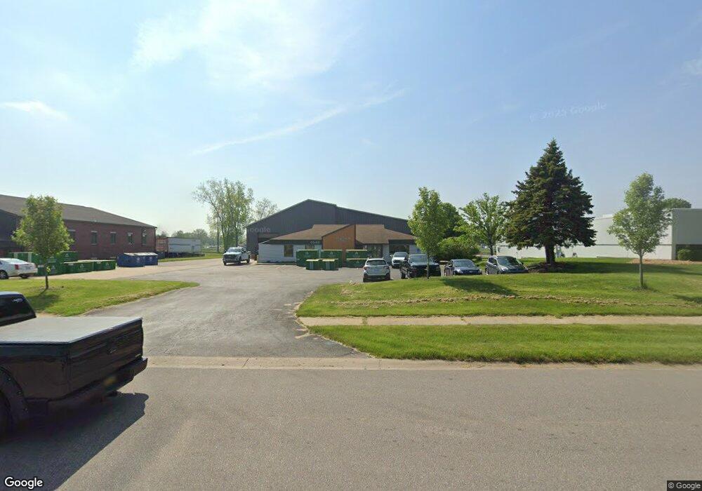
6548 Center Industrial Dr Jenison, MI 49428
Estimated Value: $864,498
--
Bed
--
Bath
14,436
Sq Ft
$60/Sq Ft
Est. Value
About This Home
This home is located at 6548 Center Industrial Dr, Jenison, MI 49428 and is currently estimated at $864,498, approximately $59 per square foot. 6548 Center Industrial Dr is a home located in Ottawa County with nearby schools including Rosewood Elementary School, Jenison Junior High School, and Jenison High School.
Ownership History
Date
Name
Owned For
Owner Type
Purchase Details
Closed on
Mar 11, 2014
Sold by
Merlain Llc
Bought by
Bluestone Llc
Current Estimated Value
Home Financials for this Owner
Home Financials are based on the most recent Mortgage that was taken out on this home.
Original Mortgage
$232,000
Outstanding Balance
$175,178
Interest Rate
4.24%
Mortgage Type
Commercial
Estimated Equity
$689,320
Purchase Details
Closed on
Oct 23, 2012
Sold by
Hovingh Morris F and Hovingh Phyllis M
Bought by
Merlain Llc
Purchase Details
Closed on
Dec 22, 2003
Sold by
Hovingh Morris F and Hovingh Phyllis M
Bought by
Merlain Llc and Wike Don
Create a Home Valuation Report for This Property
The Home Valuation Report is an in-depth analysis detailing your home's value as well as a comparison with similar homes in the area
Home Values in the Area
Average Home Value in this Area
Purchase History
| Date | Buyer | Sale Price | Title Company |
|---|---|---|---|
| Bluestone Llc | -- | None Available | |
| Merlain Llc | $313,000 | None Available | |
| Merlain Llc | -- | -- |
Source: Public Records
Mortgage History
| Date | Status | Borrower | Loan Amount |
|---|---|---|---|
| Open | Bluestone Llc | $232,000 |
Source: Public Records
Tax History Compared to Growth
Tax History
| Year | Tax Paid | Tax Assessment Tax Assessment Total Assessment is a certain percentage of the fair market value that is determined by local assessors to be the total taxable value of land and additions on the property. | Land | Improvement |
|---|---|---|---|---|
| 2025 | $17,387 | $685,100 | $0 | $0 |
| 2024 | $15,982 | $732,300 | $0 | $0 |
| 2023 | $15,242 | $635,900 | $0 | $0 |
| 2022 | $15,795 | $400,400 | $0 | $0 |
| 2021 | $7,404 | $205,000 | $0 | $0 |
| 2020 | $7,337 | $185,300 | $0 | $0 |
| 2019 | $7,369 | $174,100 | $0 | $0 |
| 2018 | $6,997 | $186,600 | $0 | $0 |
| 2017 | $6,858 | $171,800 | $0 | $0 |
| 2016 | $6,840 | $169,400 | $0 | $0 |
| 2015 | $6,575 | $148,600 | $0 | $0 |
| 2014 | $6,575 | $145,700 | $0 | $0 |
Source: Public Records
Map
Nearby Homes
- 6363 Eastridge Ct
- 6293 Eastridge Dr
- 6129 W Bay Ct
- 2101 Rosewood St
- 2072 Oak Hollow Dr
- 2323 Rosewood St
- 6905 Maple Ave
- 1520 Winifred St
- 7107 Westwood Dr
- 7165 Keystone Ct
- 1433 Winifred St
- 6724 28th Ave
- 5833 Nelson Dr
- 6714 Cedar Grove W
- 6340 Summer Dr
- 1519 Eagle Shore Ct Unit Lot 33
- 1481 Eagle Shore Ct
- 1496 Eagle Shore Ct Unit 13
- 1481 Eagle Shore Ct Unit 39
- 0 V/L Edson (Parcel B) Dr
- 2141 Port Sheldon St
- 6600 Center Industrial Dr
- 6069 Glen Eagle Highlands Dr
- 6073 Glen Eagle Highlands Dr
- 2110 Chicago Dr
- 2065 Port Sheldon St
- 2120 Chicago Dr Unit 62
- 2120 Chicago Dr
- 6578 Roger Dr
- 2206 Pine Ridge Dr
- 2026 Port Sheldon St
- 2323 Port Sheldon St Unit 102
- 6395 Springmont Ct
- 2197 Pine Ridge Dr SW Unit D
- 2197 Pine Ridge Dr Unit D
- 1910 Port Sheldon St
- 6379 Springmont Ct
- 6379 Springmont Ct Unit 72
- 2104 Timberlane Dr
- 2120 Timberlane Dr