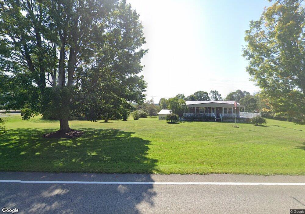
6548 Highway 173 Cochranton, PA 16314
Estimated Value: $109,000 - $183,000
--
Bed
--
Bath
--
Sq Ft
2.5
Acres
About This Home
This home is located at 6548 Highway 173, Cochranton, PA 16314 and is currently estimated at $154,922. 6548 Highway 173 is a home located in Crawford County with nearby schools including Cochranton Elementary School, Cochranton Junior/Senior High School, and Melody Echoes School.
Ownership History
Date
Name
Owned For
Owner Type
Purchase Details
Closed on
Sep 11, 2019
Sold by
Mccurdy Scott C and Mccurdy Tiffany L
Bought by
Bowser Robert R and Bowser Paige L
Current Estimated Value
Home Financials for this Owner
Home Financials are based on the most recent Mortgage that was taken out on this home.
Original Mortgage
$100,000
Outstanding Balance
$87,771
Interest Rate
3.7%
Mortgage Type
New Conventional
Estimated Equity
$67,151
Purchase Details
Closed on
Jun 11, 2015
Sold by
Burrows Luella Jean and Burrows Luella J
Bought by
Mccurdy Scott C and Mccurdy Tiffany L
Create a Home Valuation Report for This Property
The Home Valuation Report is an in-depth analysis detailing your home's value as well as a comparison with similar homes in the area
Home Values in the Area
Average Home Value in this Area
Purchase History
| Date | Buyer | Sale Price | Title Company |
|---|---|---|---|
| Bowser Robert R | $125,000 | None Available | |
| Mccurdy Scott C | $110,000 | None Available |
Source: Public Records
Mortgage History
| Date | Status | Borrower | Loan Amount |
|---|---|---|---|
| Open | Bowser Robert R | $100,000 |
Source: Public Records
Tax History Compared to Growth
Tax History
| Year | Tax Paid | Tax Assessment Tax Assessment Total Assessment is a certain percentage of the fair market value that is determined by local assessors to be the total taxable value of land and additions on the property. | Land | Improvement |
|---|---|---|---|---|
| 2025 | $792 | $27,455 | $650 | $26,805 |
| 2024 | $1,149 | $27,455 | $650 | $26,805 |
| 2023 | $1,149 | $27,455 | $650 | $26,805 |
| 2022 | $2,288 | $27,455 | $650 | $26,805 |
| 2021 | $2,236 | $27,455 | $650 | $26,805 |
| 2020 | $2,236 | $27,455 | $650 | $26,805 |
| 2019 | $2,236 | $27,455 | $650 | $26,805 |
| 2018 | $2,386 | $30,700 | $650 | $30,050 |
| 2017 | $2,361 | $30,700 | $650 | $30,050 |
| 2016 | $794 | $30,700 | $650 | $30,050 |
| 2015 | $794 | $30,700 | $650 | $30,050 |
| 2014 | -- | $30,700 | $650 | $30,050 |
Source: Public Records
Map
Nearby Homes
- 4129 Pine Dr
- 0 Deckards Run Rd and Judson Rd Unit 11536704
- Deckard's Run Rd and Judson Rd
- 119 W Pine St
- 179 S Franklin St
- 00 Deckards Run Rd
- 23755 State Highway 285
- 0 Pettis Rd Unit 187939
- 315 Long Rd
- 0 Donation Hill Rd Unit 24033249
- 23078 Mallard Ln
- 236 Rice Rd
- 8883 Luce Rd
- 9685 Pettis Rd
- 16 Blair Ln
- 6528 Mccracken Rd
- 24155 State Route 27
- 21412 Shick Dr
- 21427 Phelps Rd
- 21700 Springs Rd
- 6528 Highway 173
- 6476 Highway 173
- 6487 Cotterman Rd
- 6501 Highway 173
- 6200 Miller Farm Ln
- 6777 Highway 173
- 6323 Highway 173
- 6877 Highway 173
- 6860 Highway 173
- 6277 State Highway 173
- 6255 Highway 173
- 7048 State Highway 173
- 27397 Deeter Rd
- 27214 Deeter Rd
- 27214 Deeter Rd
- 6776 Galmish Rd
- 27263 Deeter Rd
- 7175 State Highway 173
- 6350 Galmish Rd
- 6117 Highway 173