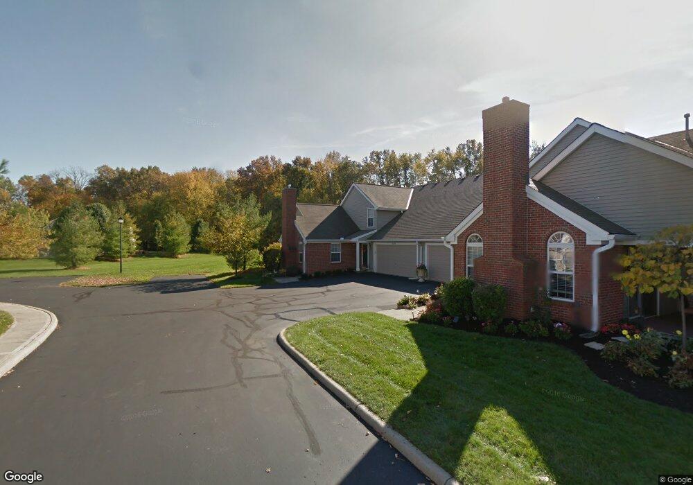
6548 Mount Royal Ave Westerville, OH 43082
Genoa NeighborhoodEstimated Value: $310,430 - $345,000
3
Beds
3
Baths
1,485
Sq Ft
$223/Sq Ft
Est. Value
About This Home
This home is located at 6548 Mount Royal Ave, Westerville, OH 43082 and is currently estimated at $331,358, approximately $223 per square foot. 6548 Mount Royal Ave is a home located in Delaware County with nearby schools including Alcott Elementary School, Genoa Middle School, and Westerville Central High School.
Ownership History
Date
Name
Owned For
Owner Type
Purchase Details
Closed on
Jun 1, 2000
Sold by
Rockford Homes Inc
Bought by
Wolfert Donald Bozzo Paula A
Current Estimated Value
Home Financials for this Owner
Home Financials are based on the most recent Mortgage that was taken out on this home.
Original Mortgage
$108,448
Outstanding Balance
$37,987
Interest Rate
8.13%
Mortgage Type
New Conventional
Estimated Equity
$293,371
Create a Home Valuation Report for This Property
The Home Valuation Report is an in-depth analysis detailing your home's value as well as a comparison with similar homes in the area
Home Values in the Area
Average Home Value in this Area
Purchase History
| Date | Buyer | Sale Price | Title Company |
|---|---|---|---|
| Wolfert Donald Bozzo Paula A | $135,560 | -- |
Source: Public Records
Mortgage History
| Date | Status | Borrower | Loan Amount |
|---|---|---|---|
| Open | Wolfert Donald Bozzo Paula A | $108,448 |
Source: Public Records
Tax History Compared to Growth
Tax History
| Year | Tax Paid | Tax Assessment Tax Assessment Total Assessment is a certain percentage of the fair market value that is determined by local assessors to be the total taxable value of land and additions on the property. | Land | Improvement |
|---|---|---|---|---|
| 2024 | $3,544 | $78,300 | $11,200 | $67,100 |
| 2023 | $3,505 | $78,300 | $11,200 | $67,100 |
| 2022 | $3,766 | $65,910 | $12,600 | $53,310 |
| 2021 | $3,804 | $65,910 | $12,600 | $53,310 |
| 2020 | $3,827 | $65,910 | $12,600 | $53,310 |
| 2019 | $3,049 | $52,470 | $10,500 | $41,970 |
| 2018 | $2,955 | $52,470 | $10,500 | $41,970 |
| 2017 | $2,785 | $45,850 | $8,750 | $37,100 |
| 2016 | $2,697 | $45,850 | $8,750 | $37,100 |
| 2015 | $2,675 | $45,850 | $8,750 | $37,100 |
| 2014 | $2,643 | $45,850 | $8,750 | $37,100 |
| 2013 | $2,627 | $45,850 | $8,750 | $37,100 |
Source: Public Records
Map
Nearby Homes
- 6410 Steinbeck Way
- 0 Paul Rd Unit 225001038
- 754 Kingsmead Rd Unit 18754
- 7268 Clancy Way
- 6685 Tussic Street Rd
- 6394 Mission Hills Place
- 6082 Hilmar Dr
- 6623 Henschen Cir
- 6086 Hemingway Place
- 656 Olde Mill Dr
- 6311 Legends Ct
- 6573 Kenwood Place
- 6460 Bromfield Dr
- 705 N State St Unit 211
- 6618 Wild Rose Ln
- 5552 Quail Hollow Way
- 7663 Rolling Ridge Way
- 7581 Lanetta Ln
- 7568 Park Bend Ct
- 5515 Stillwater Ave
- 6546 Mount Royal Ave
- 6540 Mount Royal Ave Unit 6540
- 6556 Mount Royal Ave
- 6562 Mount Royal Ave
- 6512 Mount Royal Ave
- 6512 Mount Royal Ave
- 6506 Mount Royal Ave
- 6530 Mount Royal Ave
- 6762 Alberta Place
- 6554 Mount Royal Ave Unit 6554
- 6532 Mount Royal Ave Unit 6532
- 6564 Mount Royal Ave Unit 6564
- 6564 Mount Royal Ave Unit 6564
- 6772 Alberta Place
- 6524 Mount Royal Ave Unit 6524
- 6522 Mount Royal Ave
- 6514 Mount Royal Ave
- 6574 Mount Royal Ave
- 6752 Alberta Place
- 6500 Mount Royal Ave Unit 6500