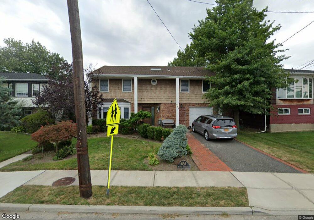
655 Branch Blvd Cedarhurst, NY 11516
Estimated Value: $1,405,869
4
Beds
3
Baths
3,173
Sq Ft
$443/Sq Ft
Est. Value
About This Home
This home is located at 655 Branch Blvd, Cedarhurst, NY 11516 and is currently estimated at $1,405,869, approximately $443 per square foot. 655 Branch Blvd is a home located in Nassau County with nearby schools including Lawrence Primary School, Lawrence Elementary School, and Lawrence Middle School.
Ownership History
Date
Name
Owned For
Owner Type
Purchase Details
Closed on
Nov 13, 2013
Sold by
Hershman Dwight and Hershman Michelle
Bought by
Farbman Steven and Farbman Michelle
Current Estimated Value
Home Financials for this Owner
Home Financials are based on the most recent Mortgage that was taken out on this home.
Original Mortgage
$200,000
Outstanding Balance
$147,678
Interest Rate
4.29%
Estimated Equity
$1,258,191
Create a Home Valuation Report for This Property
The Home Valuation Report is an in-depth analysis detailing your home's value as well as a comparison with similar homes in the area
Home Values in the Area
Average Home Value in this Area
Purchase History
| Date | Buyer | Sale Price | Title Company |
|---|---|---|---|
| Farbman Steven | $620,000 | Sutton Land Title Agency As |
Source: Public Records
Mortgage History
| Date | Status | Borrower | Loan Amount |
|---|---|---|---|
| Open | Farbman Steven | $200,000 |
Source: Public Records
Tax History
| Year | Tax Paid | Tax Assessment Tax Assessment Total Assessment is a certain percentage of the fair market value that is determined by local assessors to be the total taxable value of land and additions on the property. | Land | Improvement |
|---|---|---|---|---|
| 2025 | $10,856 | $659 | $229 | $430 |
| 2024 | $4,697 | $712 | $247 | $465 |
| 2023 | $10,448 | $787 | $273 | $514 |
| 2022 | $10,448 | $787 | $273 | $514 |
| 2021 | $12,534 | $893 | $281 | $612 |
| 2020 | $11,747 | $1,142 | $734 | $408 |
| 2019 | $12,701 | $1,142 | $734 | $408 |
| 2018 | $12,121 | $1,142 | $0 | $0 |
| 2017 | $6,185 | $1,142 | $635 | $507 |
| 2016 | $10,924 | $1,320 | $734 | $586 |
| 2015 | $5,126 | $1,320 | $734 | $586 |
| 2014 | $5,126 | $1,320 | $734 | $586 |
| 2013 | $4,807 | $1,320 | $734 | $586 |
Source: Public Records
Map
Nearby Homes
- 7 Park Cir
- 569 Peninsula Blvd
- 409 Barnard Ave
- 504 Cedarwood Dr
- 525 Oceanpoint Ave
- 708 Park Ln
- 544 Arlington Rd
- 598 Church Ave
- 548 Albemarle Rd
- 559 Arlington Place
- 536 Albemarle Rd
- 508 Monroe St
- 449 Argyle Rd
- 812 Ibsen St
- 422 Cedarhurst Ave
- 335 Peninsula Blvd
- 833 Glen Dr
- 850 Ibsen St
- 467 W Broadway
- 7 Reyem Dr
- 649 Branch Blvd
- 663 Branch Blvd
- 656 Oakland Ave
- 650 Oakland Ave
- 643 Branch Blvd
- 664 Oakland Ave
- 644 Oakland Ave
- 637 Branch Blvd
- 610 Arbuckle Ave
- 556 Redwood Dr
- 564 Redwood Dr
- 638 Oakland Ave
- 616 Arbuckle Ave
- 631 Branch Blvd
- 622 Arbuckle Ave
- 541 Redwood Dr
- 632 Oakland Ave
- 647 Oakland Ave
- 655 Oakland Ave
- 557 Cedarwood Dr
Your Personal Tour Guide
Ask me questions while you tour the home.