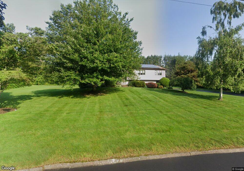
655 Brentwood Rd Orange, CT 06477
Estimated Value: $673,597 - $733,000
4
Beds
3
Baths
1,974
Sq Ft
$361/Sq Ft
Est. Value
About This Home
This home is located at 655 Brentwood Rd, Orange, CT 06477 and is currently estimated at $711,649, approximately $360 per square foot. 655 Brentwood Rd is a home located in New Haven County with nearby schools including Mary L. Tracy School, Peck Place School, and Amity Middle School: Orange.
Ownership History
Date
Name
Owned For
Owner Type
Purchase Details
Closed on
Dec 15, 2021
Sold by
Outhouse Dale
Bought by
Lipsitz Lee
Current Estimated Value
Home Financials for this Owner
Home Financials are based on the most recent Mortgage that was taken out on this home.
Original Mortgage
$332,750
Outstanding Balance
$306,043
Interest Rate
3.11%
Mortgage Type
New Conventional
Estimated Equity
$405,606
Purchase Details
Closed on
Nov 1, 2005
Sold by
Yotef Stewart M
Bought by
Linsite Lee and Outhouse Dale J
Home Financials for this Owner
Home Financials are based on the most recent Mortgage that was taken out on this home.
Original Mortgage
$349,000
Interest Rate
5.79%
Create a Home Valuation Report for This Property
The Home Valuation Report is an in-depth analysis detailing your home's value as well as a comparison with similar homes in the area
Home Values in the Area
Average Home Value in this Area
Purchase History
| Date | Buyer | Sale Price | Title Company |
|---|---|---|---|
| Lipsitz Lee | -- | None Available | |
| Lipsitz Lee | -- | None Available | |
| Linsite Lee | $549,900 | -- | |
| Linsite Lee | $549,900 | -- |
Source: Public Records
Mortgage History
| Date | Status | Borrower | Loan Amount |
|---|---|---|---|
| Open | Lipsitz Lee | $332,750 | |
| Previous Owner | Linsite Lee | $349,000 | |
| Previous Owner | Linsite Lee | $100,000 | |
| Previous Owner | Linsite Lee | $153,000 |
Source: Public Records
Tax History Compared to Growth
Tax History
| Year | Tax Paid | Tax Assessment Tax Assessment Total Assessment is a certain percentage of the fair market value that is determined by local assessors to be the total taxable value of land and additions on the property. | Land | Improvement |
|---|---|---|---|---|
| 2025 | $10,857 | $373,100 | $194,900 | $178,200 |
| 2024 | $11,566 | $373,100 | $194,900 | $178,200 |
| 2023 | $9,283 | $287,300 | $142,300 | $145,000 |
| 2022 | $9,398 | $287,300 | $142,300 | $145,000 |
| 2021 | $9,553 | $287,300 | $142,300 | $145,000 |
| 2020 | $9,406 | $287,300 | $142,300 | $145,000 |
| 2019 | $9,363 | $287,300 | $142,300 | $145,000 |
| 2018 | $9,194 | $287,300 | $142,300 | $145,000 |
| 2017 | $9,026 | $271,200 | $129,400 | $141,800 |
| 2016 | $8,733 | $271,200 | $129,400 | $141,800 |
| 2015 | $8,516 | $271,200 | $129,400 | $141,800 |
| 2014 | $8,272 | $271,200 | $129,400 | $141,800 |
Source: Public Records
Map
Nearby Homes
- 558 Treat Ln
- 400 Butternut Ct
- 26 Myrtlewood Dr
- 918 Wheelers Farms Rd
- 161 Herbert St
- 164 Centennial Dr
- 539 Fairway Rd
- 183 Centennial Dr
- 325 Pine Tree Dr
- 180 Platt Ln
- 306 Hawthorne Ln
- 11A Derby-Milford Rd
- 489 Carriage Dr
- 99 Green Meadow Rd
- 25 Southwick Ct N
- 420 Narrow Ln
- 74 Victory St
- 0 North St
- 492 North St
- 665 River Rd Unit 11
- 715 N Greenbrier Dr
- 661 Brentwood Rd
- 649 Brentwood Rd
- 709 N Greenbrier Dr
- 660 Brentwood Rd
- 654 Brentwood Rd
- 705 N Greenbrier Dr
- 721 N Greenbrier Dr
- 663 Brentwood Rd
- 638 Brentwood Rd
- 697 N Greenbrier Dr
- 637 Brentwood Rd
- 664 Brentwood Rd
- 716 N Greenbrier Dr
- 722 N Greenbrier Dr
- 710 N Greenbrier Dr
- 685 S Greenbrier Dr
- 649 S Greenbrier Dr
- 655 S Greenbrier Dr
- 727 N Greenbrier Dr