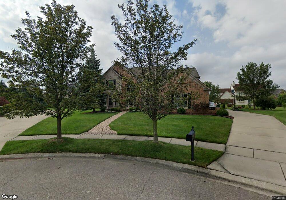
655 Brookmill Ct Canton, MI 48188
Estimated Value: $466,000 - $695,000
Studio
3
Baths
3,174
Sq Ft
$192/Sq Ft
Est. Value
About This Home
This home is located at 655 Brookmill Ct, Canton, MI 48188 and is currently estimated at $610,071, approximately $192 per square foot. 655 Brookmill Ct is a home located in Wayne County with nearby schools including Canton High School, Plymouth High School, and Salem High School.
Ownership History
Date
Name
Owned For
Owner Type
Purchase Details
Closed on
Aug 21, 2006
Sold by
Sirva Relocation Llc
Bought by
Grant Sean P
Current Estimated Value
Purchase Details
Closed on
Jul 20, 2006
Sold by
Mcgraw Timothy P and Mcgraw Karen J
Bought by
Sirva Relocation Llc
Purchase Details
Closed on
Aug 4, 2000
Sold by
Perry Susan Anderson
Bought by
Mcgraw Karen J
Create a Home Valuation Report for This Property
The Home Valuation Report is an in-depth analysis detailing your home's value as well as a comparison with similar homes in the area
Home Values in the Area
Average Home Value in this Area
Purchase History
| Date | Buyer | Sale Price | Title Company |
|---|---|---|---|
| Grant Sean P | $408,500 | Stewart Title Guaranty Compa | |
| Sirva Relocation Llc | $408,500 | Stewart Title | |
| Mcgraw Karen J | $368,500 | -- |
Source: Public Records
Tax History
| Year | Tax Paid | Tax Assessment Tax Assessment Total Assessment is a certain percentage of the fair market value that is determined by local assessors to be the total taxable value of land and additions on the property. | Land | Improvement |
|---|---|---|---|---|
| 2025 | $3,898 | $301,800 | $0 | $0 |
| 2024 | $3,787 | $260,300 | $0 | $0 |
| 2023 | $3,611 | $251,000 | $0 | $0 |
| 2022 | $7,792 | $223,300 | $0 | $0 |
| 2021 | $7,558 | $222,900 | $0 | $0 |
| 2020 | $7,466 | $215,100 | $0 | $0 |
| 2019 | $7,327 | $206,990 | $0 | $0 |
| 2018 | $2,893 | $188,660 | $0 | $0 |
| 2017 | $6,961 | $184,300 | $0 | $0 |
| 2016 | $6,282 | $186,300 | $0 | $0 |
| 2015 | $15,898 | $164,100 | $0 | $0 |
| 2013 | $15,401 | $168,700 | $0 | $0 |
| 2010 | -- | $144,000 | $72,168 | $71,832 |
Source: Public Records
Map
Nearby Homes
- 51083 Meadowlands
- 45246 Gerald Ct
- 45863 Baywood Blvd
- 464 Waterview Ct
- 48030 Cherry Hill Rd
- 8517 N Beck Rd
- 215 Edington Cir
- 1752 Thistle Dr
- 45169 Middlebury Ln
- 47450 Ellery Ln
- 46501 Killarney Cir
- 48318 Manhattan Cir
- 407 Fairfield Ct
- 241 Edington Cir
- 1275 Hendrie
- 45678 Aragon Ln
- 1289 Old Colony Ln Unit 232
- 1244 W Crystal Cir
- 1849 Wentworth Ct
- 1276 W Crystal Cir Unit 202
- 637 Brookmill Ct
- 46692 Inverness Rd
- 46670 Inverness Rd
- 674 Brookmill Ct
- 46714 Inverness Rd
- 46746 Inverness Rd
- 46638 Inverness Rd
- 615 Brookmill Ct
- 652 Brookmill Ct
- 46727 Glengarry Blvd
- 46759 Glengarry Blvd
- 630 Brookmill Ct
- 46576 Inverness Rd
- 46518 Inverness Rd
- 46462 Inverness Rd
- 46807 Glengarry Blvd
- 46681 Inverness Rd
- 46703 Inverness Rd
- 46657 Inverness Rd
- 46553 Glengarry Blvd
Your Personal Tour Guide
Ask me questions while you tour the home.