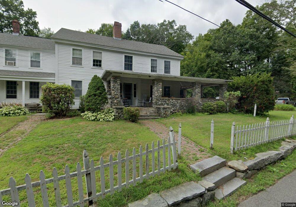
655 Glendale Rd Unit 657 Wilbraham, MA 01095
Estimated Value: $326,000 - $473,746
8
Beds
3
Baths
3,588
Sq Ft
$107/Sq Ft
Est. Value
About This Home
This home is located at 655 Glendale Rd Unit 657, Wilbraham, MA 01095 and is currently estimated at $382,582, approximately $106 per square foot. 655 Glendale Rd Unit 657 is a home located in Hampden County with nearby schools including Minnechaug Regional High School and Wilbraham & Monson Academy.
Ownership History
Date
Name
Owned For
Owner Type
Purchase Details
Closed on
Jan 10, 1992
Sold by
Jackson Prop Inc
Bought by
Surdyka Leonard F and Surdyka Rosemary
Current Estimated Value
Home Financials for this Owner
Home Financials are based on the most recent Mortgage that was taken out on this home.
Original Mortgage
$146,000
Interest Rate
8.64%
Mortgage Type
Purchase Money Mortgage
Purchase Details
Closed on
Oct 29, 1991
Sold by
Corbett Philip B and Corbett Gail M
Bought by
Jackson Prop Inc
Purchase Details
Closed on
Jul 10, 1987
Sold by
Kelleher John J
Bought by
Corbett Philip B
Home Financials for this Owner
Home Financials are based on the most recent Mortgage that was taken out on this home.
Original Mortgage
$95,000
Interest Rate
10.71%
Mortgage Type
Purchase Money Mortgage
Create a Home Valuation Report for This Property
The Home Valuation Report is an in-depth analysis detailing your home's value as well as a comparison with similar homes in the area
Home Values in the Area
Average Home Value in this Area
Purchase History
| Date | Buyer | Sale Price | Title Company |
|---|---|---|---|
| Surdyka Leonard F | $146,000 | -- | |
| Jackson Prop Inc | $125,000 | -- | |
| Corbett Philip B | $192,500 | -- |
Source: Public Records
Mortgage History
| Date | Status | Borrower | Loan Amount |
|---|---|---|---|
| Open | Corbett Philip B | $43,000 | |
| Closed | Corbett Philip B | $146,000 | |
| Previous Owner | Corbett Philip B | $95,000 |
Source: Public Records
Tax History Compared to Growth
Tax History
| Year | Tax Paid | Tax Assessment Tax Assessment Total Assessment is a certain percentage of the fair market value that is determined by local assessors to be the total taxable value of land and additions on the property. | Land | Improvement |
|---|---|---|---|---|
| 2025 | $5,784 | $323,500 | $108,000 | $215,500 |
| 2024 | $5,622 | $303,900 | $108,000 | $195,900 |
| 2023 | $5,488 | $293,500 | $108,000 | $185,500 |
| 2022 | $6,825 | $333,100 | $108,000 | $225,100 |
| 2021 | $6,160 | $268,300 | $111,400 | $156,900 |
| 2020 | $6,005 | $268,300 | $111,400 | $156,900 |
| 2019 | $5,851 | $268,400 | $111,400 | $157,000 |
| 2018 | $6,079 | $268,500 | $111,400 | $157,100 |
| 2017 | $5,907 | $268,500 | $111,400 | $157,100 |
| 2016 | $5,121 | $237,100 | $117,900 | $119,200 |
| 2015 | $4,951 | $237,100 | $117,900 | $119,200 |
Source: Public Records
Map
Nearby Homes
- 474-480 Mountain Rd
- 474 Mountain Rd
- 60 Lakeshore Dr
- 12 Highridge Rd
- 6 Hilltop Park
- 733 Monson Rd
- 20 Old Orchard Rd
- 182 Mountain Rd
- 17 Peak Rd
- 2 Bayberry Dr Unit 51
- 68 Monson Rd
- 2 Vista Rd
- 72 Beebe Rd
- 69 High Pine Cir
- 28 Decorie Dr
- 54 High Pine Cir
- 8 Patriot Ridge Ln
- 254 Ames Rd
- 35 Lake Dr
- 4 Hillcrest Dr
- 638 Glendale Rd
- 645 Glendale Rd
- 660 Glendale Rd
- 687 Glendale Rd
- 634 Glendale Rd
- 611 Glendale Rd
- 620 Glendale Rd
- 691 Glendale Rd
- 694 Glendale Rd
- 694 Glendale Rd Unit 1
- 699 Glendale Rd
- 1 Iroquois Ln
- 610 Glendale Rd
- 1 Algonquin Dr
- 10 Iroquois Ln
- 10V Iroquois Ln
- 3 Iroquois Ln
- 5 Algonquin Dr
- 6 Algonquin Dr
- 591 Glendale Rd