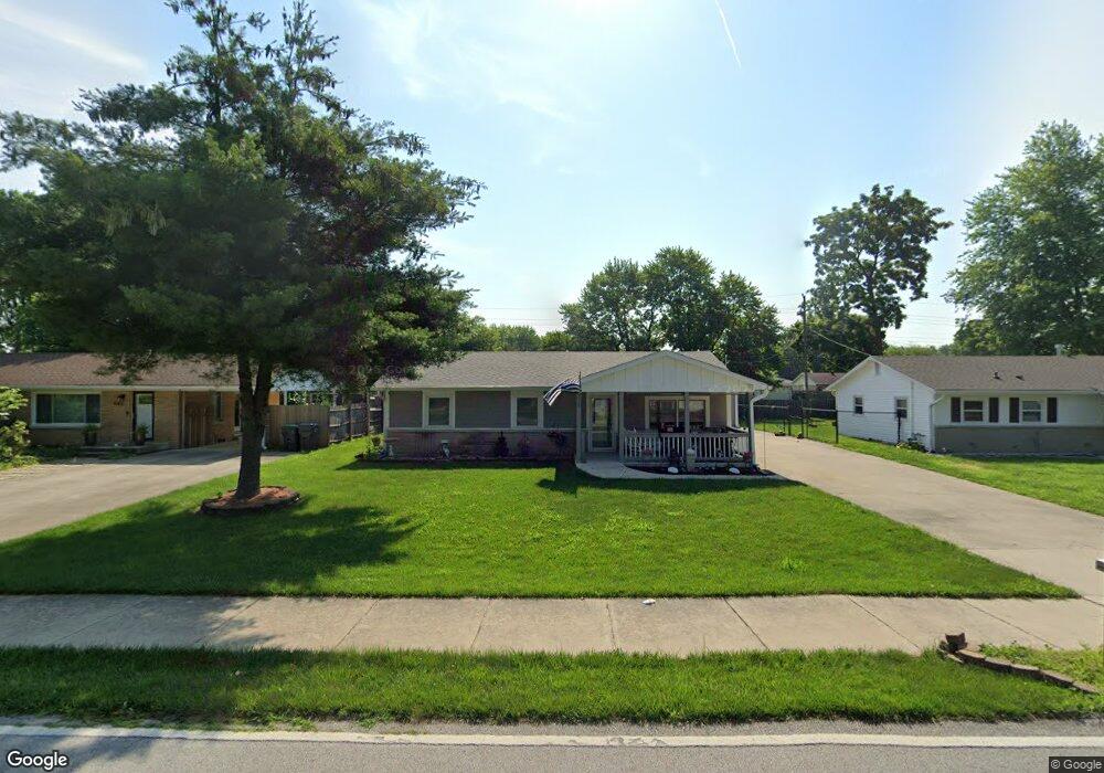
655 Howard Rd Greenwood, IN 46142
Estimated Value: $224,000 - $286,120
3
Beds
1
Bath
1,624
Sq Ft
$159/Sq Ft
Est. Value
About This Home
This home is located at 655 Howard Rd, Greenwood, IN 46142 and is currently estimated at $258,780, approximately $159 per square foot. 655 Howard Rd is a home located in Johnson County with nearby schools including Southwest Elementary School, Greenwood Middle School, and Greenwood Community High School.
Ownership History
Date
Name
Owned For
Owner Type
Purchase Details
Closed on
Aug 5, 2011
Sold by
Gipson Frances I
Bought by
Gipson Frances I
Current Estimated Value
Purchase Details
Closed on
Oct 7, 2010
Sold by
Gipson Frances I
Bought by
Gipson Frances I
Home Financials for this Owner
Home Financials are based on the most recent Mortgage that was taken out on this home.
Original Mortgage
$25,000
Interest Rate
4.3%
Mortgage Type
New Conventional
Purchase Details
Closed on
Apr 27, 2010
Sold by
Gipson Frances I
Bought by
Gipson Frances I
Create a Home Valuation Report for This Property
The Home Valuation Report is an in-depth analysis detailing your home's value as well as a comparison with similar homes in the area
Home Values in the Area
Average Home Value in this Area
Purchase History
| Date | Buyer | Sale Price | Title Company |
|---|---|---|---|
| Gipson Frances I | -- | None Available | |
| Gipson Frances I | -- | None Available | |
| Gipson Frances I | -- | None Available |
Source: Public Records
Mortgage History
| Date | Status | Borrower | Loan Amount |
|---|---|---|---|
| Closed | Gipson Frances I | $25,000 |
Source: Public Records
Tax History Compared to Growth
Tax History
| Year | Tax Paid | Tax Assessment Tax Assessment Total Assessment is a certain percentage of the fair market value that is determined by local assessors to be the total taxable value of land and additions on the property. | Land | Improvement |
|---|---|---|---|---|
| 2025 | $1,860 | $246,500 | $37,600 | $208,900 |
| 2024 | $1,860 | $228,000 | $38,300 | $189,700 |
| 2023 | $1,665 | $219,300 | $38,300 | $181,000 |
| 2022 | $1,731 | $208,400 | $34,100 | $174,300 |
| 2021 | $767 | $133,300 | $22,100 | $111,200 |
| 2020 | $605 | $126,100 | $22,100 | $104,000 |
| 2019 | $593 | $116,800 | $22,100 | $94,700 |
| 2018 | $616 | $114,200 | $16,500 | $97,700 |
| 2017 | $605 | $113,300 | $16,500 | $96,800 |
| 2016 | $584 | $105,000 | $16,500 | $88,500 |
| 2014 | $615 | $104,800 | $17,200 | $87,600 |
| 2013 | $615 | $102,400 | $17,200 | $85,200 |
Source: Public Records
Map
Nearby Homes
- 1081 Lawndale Dr
- 1065 Lawndale Ct
- 610 Wood Dale Terrace
- 935 Fry Rd
- 601 Lawnwood Dr
- 344 Lawnwood Dr
- 805 Riverside Dr
- 855 Gazebo Way Unit C
- 399 Us Highway 31 N
- 1064 Laurelwood Ln
- 783 Colonial Way
- 520 Valley Lane Dr N
- 1039 Galaxie Dr
- 320 Elmead Ct Unit 2002
- 975 Rolling Hill Rd
- 314 Elmead Ct Unit 2007
- 988 Rolling Hill Rd
- 300 Maple St
- 583 Shady Creek Dr
- 1021 Hudson Bay Dr