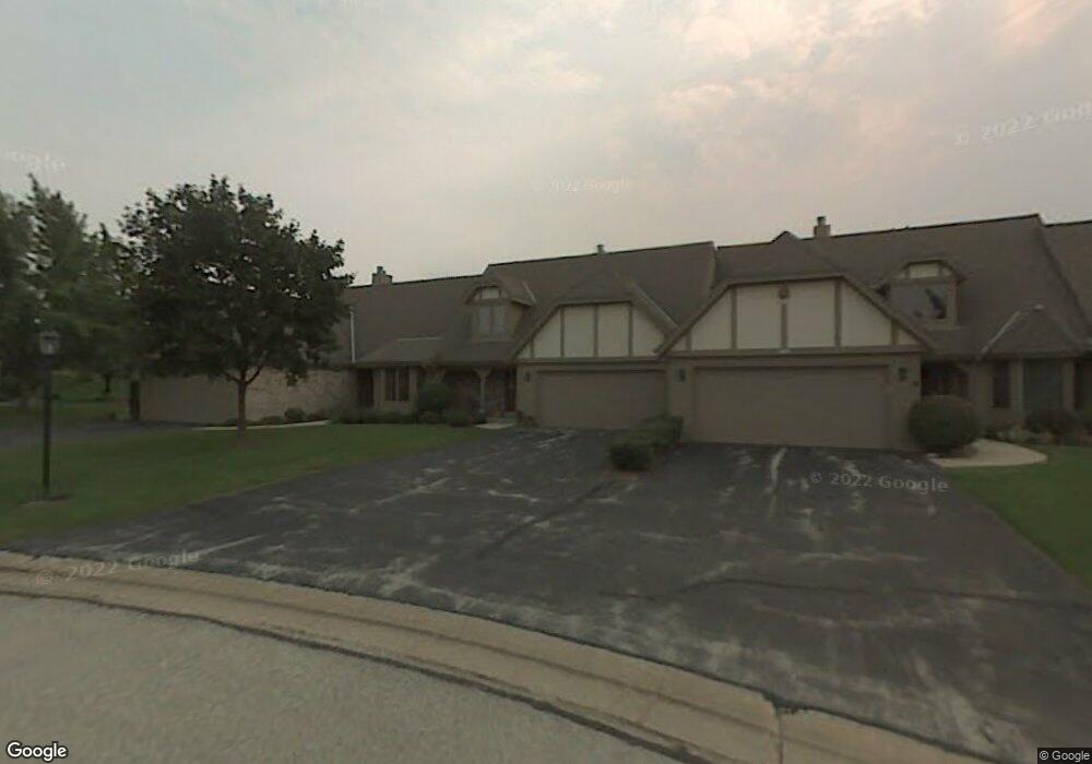
655 Mac Henry Cir Unit C Brookfield, WI 53045
Estimated Value: $440,000 - $513,000
2
Beds
3
Baths
2,053
Sq Ft
$228/Sq Ft
Est. Value
About This Home
This home is located at 655 Mac Henry Cir Unit C, Brookfield, WI 53045 and is currently estimated at $468,472, approximately $228 per square foot. 655 Mac Henry Cir Unit C is a home located in Waukesha County with nearby schools including Hillcrest Elementary School, Horning Middle School, and South High School.
Ownership History
Date
Name
Owned For
Owner Type
Purchase Details
Closed on
Jun 25, 2020
Sold by
Cairns Trust
Bought by
Lecher Gregory and Lecher Zee
Current Estimated Value
Home Financials for this Owner
Home Financials are based on the most recent Mortgage that was taken out on this home.
Original Mortgage
$252,000
Outstanding Balance
$223,457
Interest Rate
3.1%
Mortgage Type
New Conventional
Estimated Equity
$245,015
Purchase Details
Closed on
Jun 18, 2004
Sold by
Cairns Allan R and Cairns Barbara A
Bought by
Cairns Allan R and Cairns Barbara A
Purchase Details
Closed on
Oct 16, 1997
Sold by
Foss Patrick J and Foss Tracy M
Bought by
Cairns Allan R and Cairns Barbara A
Home Financials for this Owner
Home Financials are based on the most recent Mortgage that was taken out on this home.
Original Mortgage
$167,600
Interest Rate
7.65%
Purchase Details
Closed on
May 24, 1996
Sold by
Weston Hills Llc
Bought by
Foss Patrick J and Davies Tracy M
Create a Home Valuation Report for This Property
The Home Valuation Report is an in-depth analysis detailing your home's value as well as a comparison with similar homes in the area
Home Values in the Area
Average Home Value in this Area
Purchase History
| Date | Buyer | Sale Price | Title Company |
|---|---|---|---|
| Lecher Gregory | $315,000 | None Available | |
| Cairns Allan R | -- | -- | |
| Cairns Allan R | $223,500 | -- | |
| Foss Patrick J | $79,900 | -- |
Source: Public Records
Mortgage History
| Date | Status | Borrower | Loan Amount |
|---|---|---|---|
| Open | Lecher Gregory | $252,000 | |
| Previous Owner | Cairns Allan R | $167,600 | |
| Closed | Foss Patrick J | $0 |
Source: Public Records
Tax History Compared to Growth
Tax History
| Year | Tax Paid | Tax Assessment Tax Assessment Total Assessment is a certain percentage of the fair market value that is determined by local assessors to be the total taxable value of land and additions on the property. | Land | Improvement |
|---|---|---|---|---|
| 2024 | $3,906 | $395,000 | $100,000 | $295,000 |
| 2023 | $3,897 | $395,000 | $100,000 | $295,000 |
| 2022 | $4,151 | $311,800 | $90,000 | $221,800 |
| 2021 | $4,198 | $311,800 | $90,000 | $221,800 |
| 2020 | $4,315 | $311,800 | $90,000 | $221,800 |
| 2019 | $4,236 | $311,800 | $90,000 | $221,800 |
| 2018 | $3,983 | $292,100 | $70,000 | $222,100 |
| 2017 | $4,709 | $292,100 | $70,000 | $222,100 |
| 2016 | $4,281 | $292,100 | $70,000 | $222,100 |
| 2015 | $4,076 | $292,100 | $70,000 | $222,100 |
| 2014 | $4,314 | $292,100 | $70,000 | $222,100 |
| 2013 | $4,422 | $292,100 | $70,000 | $222,100 |
Source: Public Records
Map
Nearby Homes
- 655 Mac Henry Cir Unit B
- 18740 Emerald Cir Unit E
- 18525 Emerald Cir
- 19450 Whitehall Dr
- 165 Aerie Cir Unit 104
- 165 Aerie Cir Unit 106
- 165 Aerie Cir Unit 105
- 165 Aerie Cir Unit 102
- 935 Auburn Ct
- Lt1 Davidson Rd
- 17900 Anthony Ln
- 18600 Brookfield Lake Dr Unit 53
- 17525 Tremont St
- 730 Lois Ave
- 17460 Burnet St
- 18415 W Wisconsin Ave Unit 18415
- 19000 Toldt Woods Dr Unit 39
- 18107 W Wisconsin Ave Unit 201
- 840 Tanglewood Dr
- 745 Hi Ridge Ave
- 655 Mac Henry Cir Unit D
- 655 Mac Henry Cir Unit A
- 665C Mac Henry Cir
- 670 Willowick Ct Unit A
- 670 Willowick Ct Unit B
- 650 Mac Henry Cir Unit A
- 650 Mac Henry Cir Unit B
- 650 Mac Henry Cir Unit D
- 650 Mac Henry Cir
- 665 Mac Henry Cir Unit D
- 665 Mac Henry Cir Unit A
- 665 Mac Henry Cir Unit B
- 615 Mac Henry Cir Unit B
- 615 Mac Henry Cir Unit D
- 615 Mac Henry Cir Unit C
- 615 Mac Henry Cir
- 640 Mac Henry Cir Unit A
- 640 Mac Henry Cir Unit B
- 620 Willowick Ct Unit D
- 620 Willowick Ct Unit C