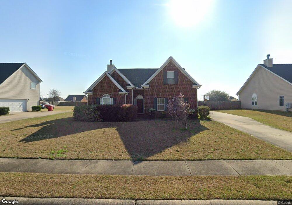
655 Manning Mill Macon, GA 31216
Estimated Value: $230,949 - $267,000
4
Beds
2
Baths
1,768
Sq Ft
$140/Sq Ft
Est. Value
About This Home
This home is located at 655 Manning Mill, Macon, GA 31216 and is currently estimated at $247,487, approximately $139 per square foot. 655 Manning Mill is a home located in Bibb County with nearby schools including Heard Elementary School, Rutland Middle School, and Rutland High School.
Ownership History
Date
Name
Owned For
Owner Type
Purchase Details
Closed on
Nov 22, 2005
Sold by
Choice Homes Inc
Bought by
Evans Robert L and Evans Faleshia D
Current Estimated Value
Home Financials for this Owner
Home Financials are based on the most recent Mortgage that was taken out on this home.
Original Mortgage
$171,917
Outstanding Balance
$93,405
Interest Rate
6%
Mortgage Type
Unknown
Estimated Equity
$154,082
Purchase Details
Closed on
Jul 12, 2005
Create a Home Valuation Report for This Property
The Home Valuation Report is an in-depth analysis detailing your home's value as well as a comparison with similar homes in the area
Home Values in the Area
Average Home Value in this Area
Purchase History
| Date | Buyer | Sale Price | Title Company |
|---|---|---|---|
| Evans Robert L | $171,917 | None Available | |
| -- | $75,900 | -- |
Source: Public Records
Mortgage History
| Date | Status | Borrower | Loan Amount |
|---|---|---|---|
| Open | Evans Robert L | $171,917 |
Source: Public Records
Tax History Compared to Growth
Tax History
| Year | Tax Paid | Tax Assessment Tax Assessment Total Assessment is a certain percentage of the fair market value that is determined by local assessors to be the total taxable value of land and additions on the property. | Land | Improvement |
|---|---|---|---|---|
| 2025 | $1,862 | $82,761 | $10,000 | $72,761 |
| 2024 | $1,924 | $82,761 | $10,000 | $72,761 |
| 2023 | $1,409 | $80,463 | $10,000 | $70,463 |
| 2022 | $2,325 | $74,155 | $9,200 | $64,955 |
| 2021 | $2,041 | $60,699 | $8,000 | $52,699 |
| 2020 | $1,847 | $54,571 | $8,000 | $46,571 |
| 2019 | $1,790 | $52,733 | $8,000 | $44,733 |
| 2018 | $2,922 | $52,733 | $8,000 | $44,733 |
| 2017 | $1,599 | $49,669 | $8,000 | $41,669 |
| 2016 | $1,476 | $49,669 | $8,000 | $41,669 |
| 2015 | $2,090 | $49,669 | $8,000 | $41,669 |
| 2014 | $2,003 | $47,831 | $8,000 | $39,831 |
Source: Public Records
Map
Nearby Homes
- 411 Bob White Rd
- 428 Bob White Rd
- 408 Resting Fawn Place
- 465 Bob White Rd
- DUPONT Plan at Quail Ridge
- GARDNER Plan at Quail Ridge
- KINGSTON Plan at Quail Ridge
- ESSEX Plan at Quail Ridge
- 708 Coopers Lnd
- 436 Joseph Chandler Dr
- 3160 Walden Rd
- 116 Wynens Way
- 405 Stonecrest Ct
- 813 Ocala National Trail
- 6530 Bevin Dr
- 214 Golden Ocala Blvd
- 326 Thoroughbred Ln
- 0 Houston Rd Unit 10572705
- 653 Manning Mill
- 657 Manning Mill
- 659 Manning Mill
- 807 Farm View Ln
- 804 Farm View Ln
- 811 Farm View Ln
- 656 Manning Mill
- 812 Farm View Ln
- 805 Farm View Ln
- 658 Manning Mill
- 808 Farm View Ln
- 117 Quail Ridge Dr
- 111 Quail Ridge Dr
- 115 Quail Ridge Dr
- 113 Quail Ridge Dr
- 141 Quail Ridge Dr
- 139 Quail Ridge Dr
- 131 Quail Ridge Dr
- 125 Quail Ridge Dr
- 123 Quail Ridge Dr