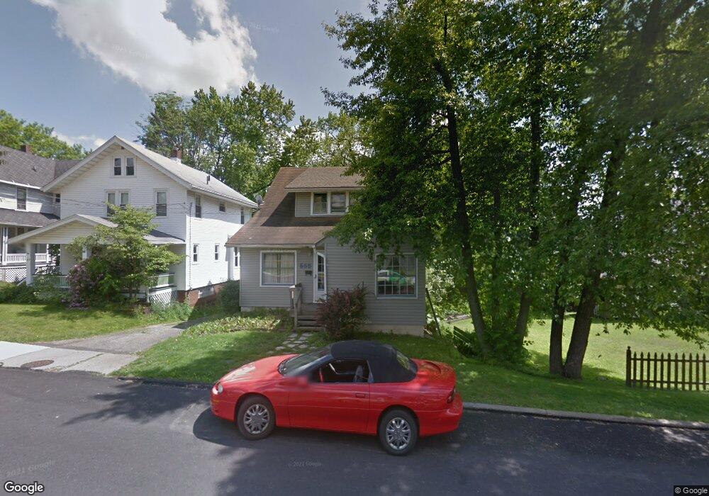
655 Maple St Mansfield, OH 44906
Estimated Value: $110,048 - $163,000
3
Beds
2
Baths
1,756
Sq Ft
$81/Sq Ft
Est. Value
About This Home
This home is located at 655 Maple St, Mansfield, OH 44906 and is currently estimated at $141,762, approximately $80 per square foot. 655 Maple St is a home located in Richland County with nearby schools including Goal Digital Academy, Discovery School, and St. Peter's Junior High / High School.
Ownership History
Date
Name
Owned For
Owner Type
Purchase Details
Closed on
Jan 21, 2010
Sold by
Merwine Larry D
Bought by
Ifm Properties Of Mansfield Llc
Current Estimated Value
Purchase Details
Closed on
Aug 6, 2008
Sold by
Deutsche Bank National Trust Co
Bought by
Merwine Larry D
Purchase Details
Closed on
Nov 14, 2007
Sold by
Weaver Scott and Weaver Tamara J
Bought by
Deutsche Bank National Trust Co
Create a Home Valuation Report for This Property
The Home Valuation Report is an in-depth analysis detailing your home's value as well as a comparison with similar homes in the area
Home Values in the Area
Average Home Value in this Area
Purchase History
| Date | Buyer | Sale Price | Title Company |
|---|---|---|---|
| Ifm Properties Of Mansfield Llc | -- | Attorney | |
| Merwine Larry D | $31,750 | Southern Title | |
| Deutsche Bank National Trust Co | $40,000 | None Available |
Source: Public Records
Tax History
| Year | Tax Paid | Tax Assessment Tax Assessment Total Assessment is a certain percentage of the fair market value that is determined by local assessors to be the total taxable value of land and additions on the property. | Land | Improvement |
|---|---|---|---|---|
| 2024 | $893 | $18,640 | $3,270 | $15,370 |
| 2023 | $893 | $18,640 | $3,270 | $15,370 |
| 2022 | $795 | $13,910 | $2,800 | $11,110 |
| 2021 | $800 | $13,910 | $2,800 | $11,110 |
| 2020 | $818 | $13,910 | $2,800 | $11,110 |
| 2019 | $907 | $13,910 | $2,800 | $11,110 |
| 2018 | $895 | $13,910 | $2,800 | $11,110 |
| 2017 | $905 | $13,910 | $2,800 | $11,110 |
| 2016 | $939 | $14,540 | $3,860 | $10,680 |
| 2015 | $939 | $14,540 | $3,860 | $10,680 |
| 2014 | $885 | $14,540 | $3,860 | $10,680 |
| 2012 | $357 | $15,300 | $4,060 | $11,240 |
Source: Public Records
Map
Nearby Homes
- 169 Euclid Ave
- 189 Westwood Ave
- 116 Stewart Ave S
- 108 Stewart Ave S
- 143 Fairlawn Ave
- 190 Dawson Ave
- 135 Fairlawn Ave
- 129 Fairlawn Ave
- 126 Dawson Ave
- 31 Parkwood Blvd
- 679 Coleman Rd
- 686 Barnard Ave
- 71 Dawson Ave
- 455 Marion Ave
- 616 Cline Ave
- 356 S Linden Rd
- 30 Douglas Ave
- 519 Heineman Blvd
- 51 Lind Ave
- 988 Kentland Dr
Your Personal Tour Guide
Ask me questions while you tour the home.