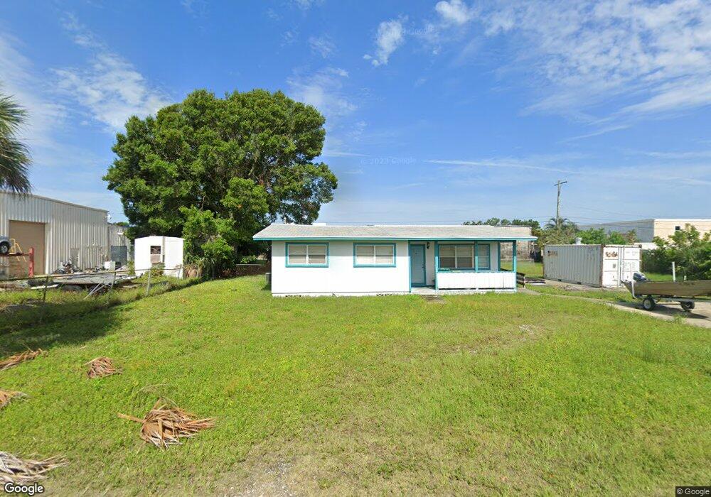
655 Oleander Dr Merritt Island, FL 32952
Estimated Value: $243,000 - $251,966
3
Beds
2
Baths
1,092
Sq Ft
$227/Sq Ft
Est. Value
About This Home
This home is located at 655 Oleander Dr, Merritt Island, FL 32952 and is currently estimated at $247,992, approximately $227 per square foot. 655 Oleander Dr is a home located in Brevard County with nearby schools including Tropical Elementary School, Thomas Jefferson Middle School, and Merritt Island High School.
Ownership History
Date
Name
Owned For
Owner Type
Purchase Details
Closed on
Oct 19, 2023
Sold by
Vanepp Robert J and Vanepp Van Epp
Bought by
Foley Family Trust and Foley
Current Estimated Value
Purchase Details
Closed on
Sep 21, 1998
Sold by
Moon Jay D and Moon Marilyn M
Bought by
Vanepp Richard J
Home Financials for this Owner
Home Financials are based on the most recent Mortgage that was taken out on this home.
Original Mortgage
$68,700
Interest Rate
6.92%
Create a Home Valuation Report for This Property
The Home Valuation Report is an in-depth analysis detailing your home's value as well as a comparison with similar homes in the area
Home Values in the Area
Average Home Value in this Area
Purchase History
| Date | Buyer | Sale Price | Title Company |
|---|---|---|---|
| Foley Family Trust | $200,000 | None Listed On Document | |
| Vanepp Richard J | $76,500 | -- |
Source: Public Records
Mortgage History
| Date | Status | Borrower | Loan Amount |
|---|---|---|---|
| Previous Owner | Vanepp Richard J | $68,700 |
Source: Public Records
Tax History Compared to Growth
Tax History
| Year | Tax Paid | Tax Assessment Tax Assessment Total Assessment is a certain percentage of the fair market value that is determined by local assessors to be the total taxable value of land and additions on the property. | Land | Improvement |
|---|---|---|---|---|
| 2025 | $2,301 | $142,990 | -- | -- |
| 2024 | $1,812 | $151,120 | -- | -- |
| 2023 | $1,812 | $107,890 | $50,330 | $57,560 |
| 2022 | $1,740 | $106,950 | $0 | $0 |
| 2021 | $1,756 | $99,350 | $50,330 | $49,020 |
| 2020 | $872 | $69,010 | $0 | $0 |
| 2019 | $820 | $67,460 | $0 | $0 |
| 2018 | $821 | $66,210 | $0 | $0 |
| 2017 | $824 | $64,850 | $0 | $0 |
| 2016 | $831 | $63,520 | $45,760 | $17,760 |
| 2015 | $839 | $63,080 | $35,080 | $28,000 |
| 2014 | $844 | $62,580 | $35,080 | $27,500 |
Source: Public Records
Map
Nearby Homes
- 476 Nancie Ave
- 489 Kennwood Ave
- 185 Moore Ave
- 90 S Tropical Way
- 180 Brandy Ln
- 140 Brandy Ln
- 66 Moore Ave
- 355 Aztec Ave
- 220 Bel Aire Dr S
- 455 Catamaran Dr Unit 48
- 115 Carib Dr
- 435 Catamaran Dr Unit 49
- 505 Landings Way Unit 10
- 280 Andros Dr
- 95 Peck Ave
- 270 W Lauren Ct
- 30 Victoria St
- 230 Andros Dr
- 3190 S Courtenay Pkwy
- 106 Victoria St
- 650 Azalea Ave
- 675 Oleander Dr
- 630 Azalea Ave
- 630 Azalea Ave Unit 1st fl
- 630 Azalea Ave Unit 203
- 630 Azalea Ave Unit 202
- 630 Azalea Ave Unit 101
- 630 Azalea Ave Unit 102
- 630 Azalea Ave Unit 201
- 670 Oleander Dr
- 675 Azalea Ave
- 225 Manor Dr
- 685 Azalea Ave
- 605 Oleander Dr Unit A
- 605 Oleander Dr Unit B
- 605 Oleander Dr Unit C
- 605 Oleander Dr
- 695 Fern Dr
- 699 Fern Dr
- 625 Fern Dr