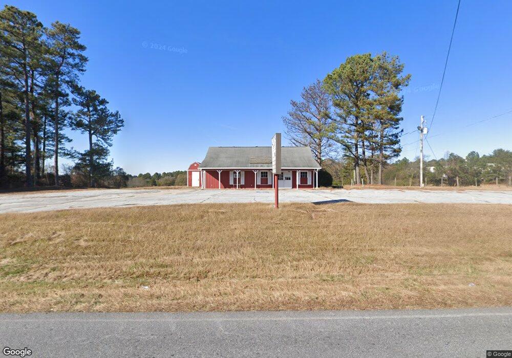
655 Patrick Mill Rd SW Winder, GA 30680
Estimated Value: $236,441
Studio
--
Bath
1,320
Sq Ft
$179/Sq Ft
Est. Value
About This Home
This home is located at 655 Patrick Mill Rd SW, Winder, GA 30680 and is currently estimated at $236,441, approximately $179 per square foot. 655 Patrick Mill Rd SW is a home located in Barrow County with nearby schools including Yargo Elementary School, Haymon-Morris Middle School, and Apalachee High School.
Ownership History
Date
Name
Owned For
Owner Type
Purchase Details
Closed on
Jun 30, 2023
Sold by
Gunn Real Estate Holdings Llc
Bought by
655 Patrick Mill Llc
Current Estimated Value
Purchase Details
Closed on
Feb 25, 2011
Sold by
Rutledge Hugh A
Bought by
Gunn Real Estate Holdings Llc
Purchase Details
Closed on
Jan 30, 1987
Sold by
Rutledge Hugh A
Bought by
Rutledge Hugh A
Create a Home Valuation Report for This Property
The Home Valuation Report is an in-depth analysis detailing your home's value as well as a comparison with similar homes in the area
Home Values in the Area
Average Home Value in this Area
Purchase History
| Date | Buyer | Sale Price | Title Company |
|---|---|---|---|
| 655 Patrick Mill Llc | $230,000 | -- | |
| Gunn Real Estate Holdings Llc | $230,000 | -- | |
| Rutledge Hugh A | -- | -- |
Source: Public Records
Tax History
| Year | Tax Paid | Tax Assessment Tax Assessment Total Assessment is a certain percentage of the fair market value that is determined by local assessors to be the total taxable value of land and additions on the property. | Land | Improvement |
|---|---|---|---|---|
| 2025 | $2,555 | $100,110 | $60,116 | $39,994 |
| 2024 | $2,605 | $100,110 | $60,116 | $39,994 |
| 2023 | $2,983 | $100,110 | $60,116 | $39,994 |
| 2022 | $3,044 | $100,110 | $60,116 | $39,994 |
| 2021 | $2,144 | $65,894 | $22,542 | $43,352 |
| 2020 | $2,150 | $65,894 | $22,542 | $43,352 |
| 2019 | $2,186 | $65,894 | $22,542 | $43,352 |
| 2018 | $2,107 | $65,650 | $22,542 | $43,108 |
| 2017 | $1,861 | $63,906 | $22,542 | $41,364 |
| 2016 | $1,372 | $42,497 | $22,542 | $19,955 |
| 2015 | $1,379 | $42,497 | $22,542 | $19,955 |
| 2014 | $1,113 | $32,578 | $12,624 | $19,955 |
| 2013 | -- | $30,167 | $11,045 | $19,122 |
Source: Public Records
Map
Nearby Homes
- 1214 Roxey Maxey Rd
- 105 Grand Highlands Ln
- 107 Grand Highlands Ln
- 107 Grand Highland Ln
- 103 Grand Highlands Ln
- 740 Patrick Mill Rd SW
- 1752 Maxey Ln
- 921 Roxeywood Dr
- 920 Roxeywood Dr
- 1259 Maxey Ct
- 1250 Maxey Ct
- 1898 Roxey Ln
- 99 Holland Cove
- 98 Holland Cove
- 89 Holland Cove
- 86 Holland Cove
- 79 Holland Cove
- 170 Bristol Blvd
- 150 Bristol Blvd
- 129 Bristol Blvd
- 696 Patrick Mill Rd SW
- 1223 Roxey Maxey Rd
- 1211 Roxey Maxey Rd
- 650 Patrick Mill Rd SW
- 1210 Roxey Maxey Rd
- 687 Patrick Mill Rd SW Unit 36437956
- 687 Patrick Mill Rd SW
- 642 Patrick Mill Rd SW
- 684 Patrick Mill Rd SW
- 1196 Roxey Maxey Rd
- 706 Patrick Mill Rd SW
- 697 Patrick Mill Rd SW
- 697 Patrick Mill Rd SW Unit 38319809
- 719 Winding River Ln
- 1185 Roxey Maxey Rd
- 0 Barrow Industrial Park Unit 3244180
- 725 Winding River Ln
- 741 Winding River Ln
- 734 Patrick Mill Rd SW
- 1160 Roxey Maxey Rd
Your Personal Tour Guide
Ask me questions while you tour the home.