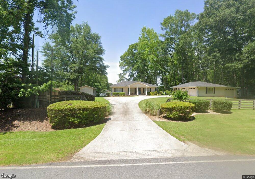
655 Ragsdale Rd Sharpsburg, GA 30277
Estimated Value: $304,487 - $424,000
3
Beds
2
Baths
1,553
Sq Ft
$230/Sq Ft
Est. Value
About This Home
This home is located at 655 Ragsdale Rd, Sharpsburg, GA 30277 and is currently estimated at $357,122, approximately $229 per square foot. 655 Ragsdale Rd is a home located in Coweta County with nearby schools including Poplar Road Elementary School, East Coweta Middle School, and East Coweta High School.
Ownership History
Date
Name
Owned For
Owner Type
Purchase Details
Closed on
Dec 1, 2023
Sold by
Reets Kathryn A
Bought by
Reets Rental Properties Llc
Current Estimated Value
Purchase Details
Closed on
May 25, 2011
Sold by
Reets Joel and Reets Kathy
Bought by
Reets Kathryn A
Purchase Details
Closed on
Feb 28, 1994
Sold by
Winkles J W
Bought by
Byron Alex E and Byron Dorothy E
Home Financials for this Owner
Home Financials are based on the most recent Mortgage that was taken out on this home.
Original Mortgage
$61,750
Interest Rate
7.04%
Purchase Details
Closed on
Apr 11, 1974
Bought by
Winkles J W
Create a Home Valuation Report for This Property
The Home Valuation Report is an in-depth analysis detailing your home's value as well as a comparison with similar homes in the area
Home Values in the Area
Average Home Value in this Area
Purchase History
| Date | Buyer | Sale Price | Title Company |
|---|---|---|---|
| Reets Rental Properties Llc | -- | -- | |
| Reets Kathryn A | -- | -- | |
| Byron Alex E | $65,000 | -- | |
| Winkles J W | -- | -- |
Source: Public Records
Mortgage History
| Date | Status | Borrower | Loan Amount |
|---|---|---|---|
| Previous Owner | Byron Alex E | $61,750 |
Source: Public Records
Tax History Compared to Growth
Tax History
| Year | Tax Paid | Tax Assessment Tax Assessment Total Assessment is a certain percentage of the fair market value that is determined by local assessors to be the total taxable value of land and additions on the property. | Land | Improvement |
|---|---|---|---|---|
| 2025 | $2,001 | $84,701 | $18,000 | $66,701 |
| 2024 | $2,015 | $86,811 | $18,000 | $68,811 |
| 2023 | $2,015 | $92,280 | $18,000 | $74,280 |
| 2022 | $1,638 | $66,512 | $14,000 | $52,512 |
| 2021 | $1,541 | $58,549 | $14,000 | $44,549 |
| 2020 | $1,552 | $58,549 | $14,000 | $44,549 |
| 2019 | $1,856 | $63,400 | $12,000 | $51,400 |
| 2018 | $1,859 | $63,400 | $12,000 | $51,400 |
| 2017 | $1,575 | $53,743 | $12,000 | $41,743 |
| 2016 | $1,556 | $53,743 | $12,000 | $41,743 |
| 2015 | $1,530 | $53,743 | $12,000 | $41,743 |
| 2014 | $1,518 | $53,743 | $12,000 | $41,743 |
Source: Public Records
Map
Nearby Homes
- 165 Durham Estates Dr
- 0 Cannon Rd Unit 7627017
- 0 Cannon Rd Unit 10566028
- 65 Oakhurst Trail
- 69 Oakhurst Trail
- 49 Durham Estates Dr
- 565 Timberbrook Dr
- 4083 Highway 54
- 46 Lullwater Ct
- 465 Little Rd
- 2812 Highway 16 E
- 20 Water Oak Dr
- 0 Johnson Rd Unit LOT 4 10583889
- 0 Johnson Rd Unit LOT 3 10583885
- 143 Linchwood Dr
- 135 Graceton Farms Dr
- 0 Sid Hunter Rd Unit LOT 1
- 0 Sid Hunter Rd Unit LOT 2 10583878
- 242 Township Dr
- 106 Graceton Farms Dr
- 641 Ragsdale Rd
- 619 Ragsdale Rd
- 615 Ragsdale Rd
- 669 Ragsdale Rd
- 669 Ragsdale Rd
- 605 Ragsdale Rd
- 679 Ragsdale Rd
- 685 Ragsdale Rd
- 6 Peachtree Dr
- 695 Ragsdale Rd
- 642 Ragsdale Rd
- 634 Ragsdale Rd
- 30 Peachtree Dr
- 715 Ragsdale Rd
- 721 Ragsdale Rd
- 42 Peachtree Dr
- 714 Ragsdale Rd
- 563 Ragsdale Rd
- 729 Ragsdale Rd
- 48 Peachtree Dr