
Seller's Agent in 2019
Cole Blackburn
Key Results Real Estate
(360) 430-9466
1 in this area
117 Total Sales
Estimated Value: $442,269 - $548,000
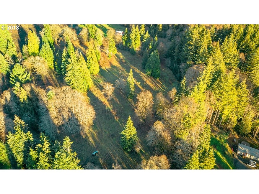
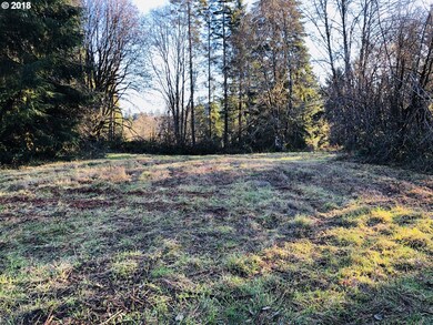
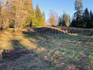
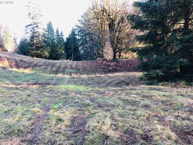
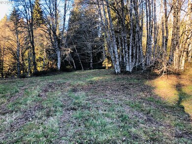
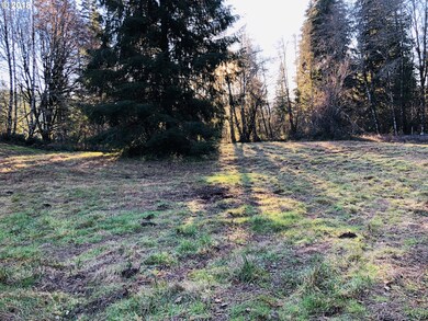
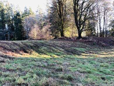
Beautiful acreage with level to rolling pasture land with fir and cedar trees sprinkled throughout. Approx. 8 miles from Coal Creek Rd/Ocean Beach Hwy. Includes shared well with approx. 20 GPM and new soils test for standard septic system. Build what you like, no restrictions. An additional 2+/- lot adjacent and 3.26 +/- acre next door. Purchase all together for $210,000.
Last Agent to Sell the Property
Key Results Real Estate License #87797 Listed on: 12/13/2018
| Date | Buyer | Sale Price | Title Company |
|---|---|---|---|
| Helm Hunter M | -- | Stewart Title Co | |
| Heim Hunter | -- | None Available | |
| Heim Hunter M | $75,000 | Stewart Title Cowlitz County |
| Date | Status | Borrower | Loan Amount |
|---|---|---|---|
| Previous Owner | Heim Hunter M | $67,000 |
| Date | Event | Price | List to Sale | Price per Sq Ft |
|---|---|---|---|---|
| 11/12/2019 11/12/19 | Sold | $75,000 | -5.1% | -- |
| 10/14/2019 10/14/19 | Pending | -- | -- | -- |
| 12/13/2018 12/13/18 | For Sale | $79,000 | -- | -- |
| Year | Tax Paid | Tax Assessment Tax Assessment Total Assessment is a certain percentage of the fair market value that is determined by local assessors to be the total taxable value of land and additions on the property. | Land | Improvement |
|---|---|---|---|---|
| 2024 | $3,603 | $388,760 | $69,930 | $318,830 |
| 2023 | $3,573 | $388,430 | $69,930 | $318,500 |
| 2022 | $2,951 | $372,320 | $67,240 | $305,080 |
| 2021 | $541 | $325,320 | $60,030 | $265,290 |
| 2020 | $510 | $53,600 | $53,600 | $0 |
| 2019 | -- | $53,600 | $53,600 | $0 |
Seller's Agent in 2019
Cole Blackburn
Key Results Real Estate
(360) 430-9466
1 in this area
117 Total Sales
Seller Co-Listing Agent in 2019
Debbie Nelson
Key Results Real Estate
(360) 431-5605
92 Total Sales
Source: Regional Multiple Listing Service (RMLS)
MLS Number: 18021956
APN: 6-05810200
Disclaimer: Certain information contained herein is derived from information provided by parties other than Homes.com. All information provided is deemed reliable, but is not guaranteed to be accurate and should be independently verified.
![]() The content relating to real estate for sale on this web site comes in part from the IDX program of the RMLS™ of Portland, Oregon. Real estate listings held by brokerage firms other than Ten-X are marked with the RMLS™ logo, and detailed information about these properties includes the names of the listing brokers. Listing content is copyright © 2025 RMLS™, Portland, Oregon. Some properties which appear for sale on this web site may subsequently have sold or may no longer be available. All information provided is deemed reliable but is not guaranteed and should be independently verified.
The content relating to real estate for sale on this web site comes in part from the IDX program of the RMLS™ of Portland, Oregon. Real estate listings held by brokerage firms other than Ten-X are marked with the RMLS™ logo, and detailed information about these properties includes the names of the listing brokers. Listing content is copyright © 2025 RMLS™, Portland, Oregon. Some properties which appear for sale on this web site may subsequently have sold or may no longer be available. All information provided is deemed reliable but is not guaranteed and should be independently verified.