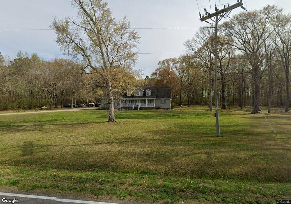
655 Snowden Rd Moyock, NC 27958
Estimated Value: $455,000
3
Beds
3
Baths
2,421
Sq Ft
$188/Sq Ft
Est. Value
About This Home
This home is located at 655 Snowden Rd, Moyock, NC 27958 and is currently estimated at $455,000, approximately $187 per square foot. 655 Snowden Rd is a home located in Currituck County with nearby schools including Shawboro Elementary School, Moyock Middle School, and Currituck County High School.
Ownership History
Date
Name
Owned For
Owner Type
Purchase Details
Closed on
Jun 11, 2015
Sold by
Burgess Elizbeth H and Burgess Vernon L
Bought by
Twiddy Richard E and Twiddy Natalie R
Current Estimated Value
Home Financials for this Owner
Home Financials are based on the most recent Mortgage that was taken out on this home.
Original Mortgage
$170,000
Outstanding Balance
$62,754
Interest Rate
3.88%
Mortgage Type
Purchase Money Mortgage
Estimated Equity
$392,246
Purchase Details
Closed on
Jul 24, 2014
Sold by
Twiddy Natalie R and Neal Marsha R
Bought by
Twiddy Natalie R and Twiddy Richard E
Create a Home Valuation Report for This Property
The Home Valuation Report is an in-depth analysis detailing your home's value as well as a comparison with similar homes in the area
Home Values in the Area
Average Home Value in this Area
Purchase History
| Date | Buyer | Sale Price | Title Company |
|---|---|---|---|
| Twiddy Richard E | $168,000 | Attorney | |
| Twiddy Natalie R | -- | Attorney |
Source: Public Records
Mortgage History
| Date | Status | Borrower | Loan Amount |
|---|---|---|---|
| Open | Twiddy Richard E | $170,000 |
Source: Public Records
Tax History
| Year | Tax Paid | Tax Assessment Tax Assessment Total Assessment is a certain percentage of the fair market value that is determined by local assessors to be the total taxable value of land and additions on the property. | Land | Improvement |
|---|---|---|---|---|
| 2025 | $2,012 | $281,800 | $68,100 | $213,700 |
| 2024 | $2,012 | $281,800 | $68,100 | $213,700 |
| 2023 | $2,003 | $281,800 | $68,100 | $213,700 |
| 2022 | $1,535 | $281,800 | $68,100 | $213,700 |
| 2021 | $1,527 | $250,700 | $57,100 | $193,600 |
| 2020 | $1,353 | $250,700 | $57,100 | $193,600 |
| 2019 | $1,353 | $250,700 | $57,100 | $193,600 |
| 2018 | $0 | $250,700 | $57,100 | $193,600 |
| 2017 | $1,317 | $250,700 | $57,100 | $193,600 |
| 2016 | $1,317 | $250,700 | $57,100 | $193,600 |
| 2015 | $1,317 | $248,700 | $55,100 | $193,600 |
Source: Public Records
Map
Nearby Homes
- 190 Sorrel Ln
- 0000 Snowden
- 104 Sligo Way
- #9 E Ridge Rd
- #10 E Ridge Rd
- 216 E Ridge Rd
- 2141 Caratoke Hwy
- 500 E Ridge Rd
- 0 Shawboro
- 111 N Marshall Rd
- 1861 Caratoke Hwy
- 1671 Caratoke Hwy
- 130 Ballance Farms Dr
- 113 Hastings Dr
- 50+AC Poyners Rd
- TBD Poyners Rd
- 1270 Shawboro Rd
- 438 N Indiantown Rd
- 130 Rowland Creek Rd
- 112 Rosedale Dr
- 000 Snowden Rd
- 0 Snowden Rd
- 632 Snowden Rd
- 626 Snowden Rd
- 436 Shawboro Rd
- 452 Shawboro Rd
- 440 Shawboro Rd
- 426 Shawboro Rd
- 101 Snowden Crossing Dr
- 101 Snowden Crossing
- 103 Snowden Crossing Dr
- 105 Snowden Crossing Dr
- 494 Shawboro Rd
- 100 Bullyard Station Ct
- 579 Snowden Rd
- 107 Snowden Crossing
- 107 Snowden Crossing Dr
- 527 Shawboro Rd
- 116 Bullyard Rd
- 116 Bullyard Rd
Your Personal Tour Guide
Ask me questions while you tour the home.