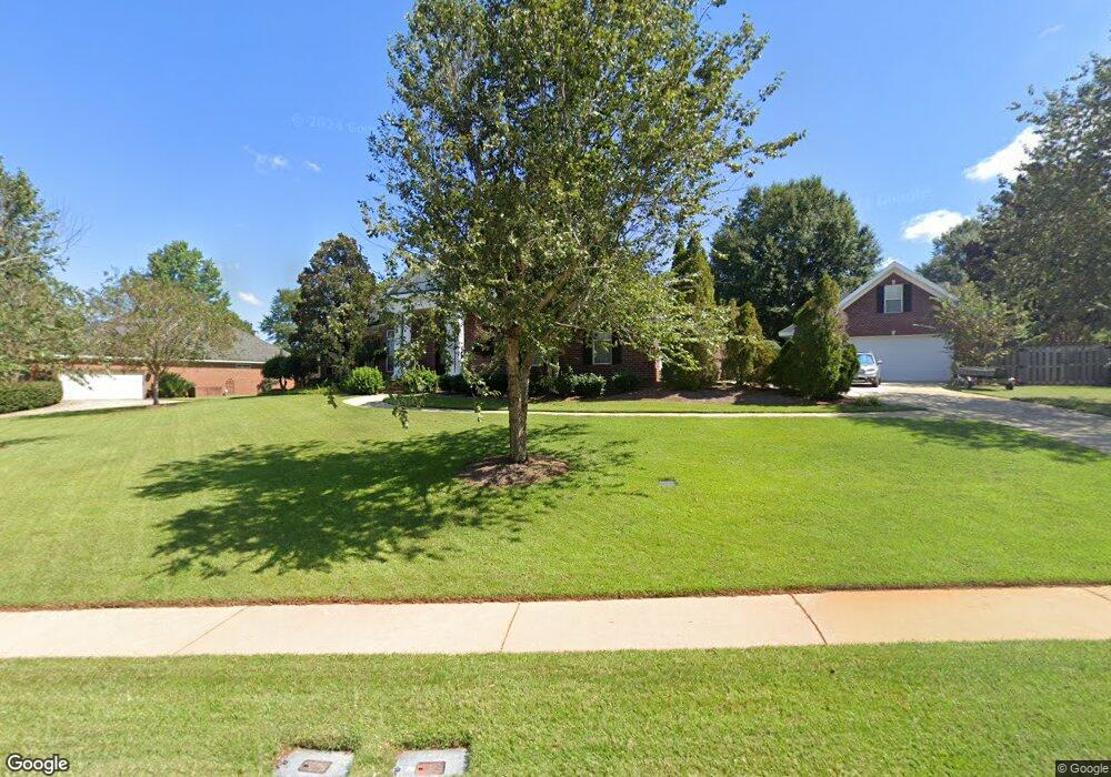
655 Westbrook Rd Dothan, AL 36303
Estimated Value: $491,000 - $646,000
4
Beds
5
Baths
3,219
Sq Ft
$168/Sq Ft
Est. Value
About This Home
This home is located at 655 Westbrook Rd, Dothan, AL 36303 and is currently estimated at $540,163, approximately $167 per square foot. 655 Westbrook Rd is a home located in Houston County with nearby schools including Dothan City Early Education Center, Highlands Elementary School, and Dothan Preparatory Academy.
Ownership History
Date
Name
Owned For
Owner Type
Purchase Details
Closed on
Nov 30, 2016
Sold by
Ford Barry Marlon and Ford Mary Pamela
Bought by
Lawson Michael E and Lawson Gretchen A
Current Estimated Value
Purchase Details
Closed on
Jan 4, 2011
Sold by
Liles Jeffrey B and Liles Karen A
Bought by
Ford Barry Marlon and Ford Mary Pamela
Home Financials for this Owner
Home Financials are based on the most recent Mortgage that was taken out on this home.
Original Mortgage
$323,200
Interest Rate
4.58%
Mortgage Type
Purchase Money Mortgage
Create a Home Valuation Report for This Property
The Home Valuation Report is an in-depth analysis detailing your home's value as well as a comparison with similar homes in the area
Purchase History
| Date | Buyer | Sale Price | Title Company |
|---|---|---|---|
| Lawson Michael E | $410,000 | -- | |
| Ford Barry Marlon | $404,000 | -- |
Source: Public Records
Mortgage History
| Date | Status | Borrower | Loan Amount |
|---|---|---|---|
| Previous Owner | Ford Barry Marlon | $323,200 |
Source: Public Records
Tax History
| Year | Tax Paid | Tax Assessment Tax Assessment Total Assessment is a certain percentage of the fair market value that is determined by local assessors to be the total taxable value of land and additions on the property. | Land | Improvement |
|---|---|---|---|---|
| 2025 | $1,660 | $47,640 | $0 | $0 |
| 2024 | $1,660 | $46,940 | $0 | $0 |
| 2023 | $1,635 | $44,800 | $0 | $0 |
| 2022 | $1,372 | $41,280 | $0 | $0 |
| 2021 | $1,228 | $43,340 | $0 | $0 |
| 2020 | $1,228 | $37,100 | $0 | $0 |
| 2019 | $1,228 | $37,100 | $0 | $0 |
| 2018 | $1,228 | $37,100 | $0 | $0 |
| 2017 | $1,305 | $39,320 | $0 | $0 |
| 2016 | $1,305 | $0 | $0 | $0 |
| 2015 | $1,305 | $0 | $0 | $0 |
| 2014 | $1,250 | $0 | $0 | $0 |
Source: Public Records
Map
Nearby Homes
- 647 Westbrook Rd
- 223 Windemere Ln
- 221 Windemere Ln
- 113 Ayreswood Dr
- 1603 Selkirk Dr
- 336 Cypressglade Ln
- 103 Red Cypress Run
- 0 W Main St Unit 196595
- 108 Sandy Springs Rd
- 305 Cypress Glade Ln
- 224 Chloe Ct
- 107 Gary Ct
- 100 Timberline Ct
- 1144 Appian Way
- 105 Rainbow Dr
- 115 Pond Cypress Loop
- 314 Orchard Cir
- 100 Mulberry Ct
- 1683 John D Odom Rd
- 1125 Appian Way
- 653 Westbrook Rd
- 603 Westbrook Rd
- 605 Westbrook Rd
- 661 Westbrook Rd
- 658 Westbrook Rd
- 660 Westbrook Rd
- 651 Westbrook Rd
- 656 Westbrook Rd
- 662 Westbrook Rd
- 607 Westbrook Rd
- 654 Westbrook Rd
- 664 Westbrook Rd
- 652 Westbrook Rd
- 649 Westbrook Rd
- 609 Westbrook Rd
- 604 Westbrook Rd
- 602 Westbrook Rd
- 509 Westbrook Rd
- 606 Westbrook Rd
- 600 Westbrook Rd
Your Personal Tour Guide
Ask me questions while you tour the home.