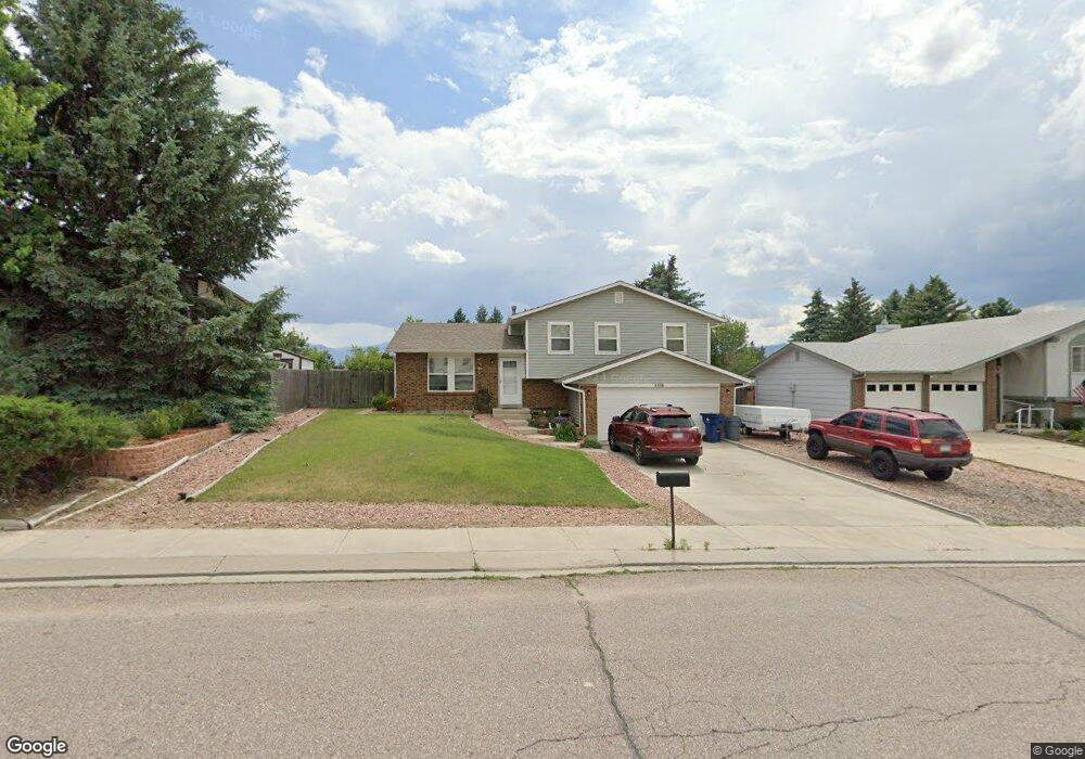
6550 Snowbird Dr Colorado Springs, CO 80918
Pulpit Rock NeighborhoodEstimated Value: $411,254 - $444,000
3
Beds
2
Baths
1,218
Sq Ft
$353/Sq Ft
Est. Value
About This Home
This home is located at 6550 Snowbird Dr, Colorado Springs, CO 80918 and is currently estimated at $430,064, approximately $353 per square foot. 6550 Snowbird Dr is a home located in El Paso County with nearby schools including King Elementary School, Russell Middle School, and Coronado High School.
Ownership History
Date
Name
Owned For
Owner Type
Purchase Details
Closed on
Nov 22, 2011
Sold by
Oneill George F
Bought by
Oneill Andrea B
Current Estimated Value
Purchase Details
Closed on
Sep 22, 2006
Sold by
Rasic Stanley and Rasic Sarah
Bought by
Oneill Andrea B and Oneill George F
Home Financials for this Owner
Home Financials are based on the most recent Mortgage that was taken out on this home.
Original Mortgage
$156,000
Interest Rate
6.55%
Mortgage Type
Unknown
Purchase Details
Closed on
May 10, 2006
Sold by
Harris Ronald James
Bought by
Rasic Stanley and Rasic Sarah
Home Financials for this Owner
Home Financials are based on the most recent Mortgage that was taken out on this home.
Original Mortgage
$127,200
Interest Rate
6.4%
Mortgage Type
Unknown
Purchase Details
Closed on
Mar 1, 1979
Bought by
Oneill Andrea B
Create a Home Valuation Report for This Property
The Home Valuation Report is an in-depth analysis detailing your home's value as well as a comparison with similar homes in the area
Home Values in the Area
Average Home Value in this Area
Purchase History
| Date | Buyer | Sale Price | Title Company |
|---|---|---|---|
| Oneill Andrea B | -- | None Available | |
| Oneill Andrea B | $195,000 | Empire Title Co Springs Llc | |
| Rasic Stanley | $159,900 | Empire Title Co Springs Llc | |
| Oneill Andrea B | -- | -- |
Source: Public Records
Mortgage History
| Date | Status | Borrower | Loan Amount |
|---|---|---|---|
| Closed | Oneill Andrea B | $156,000 | |
| Previous Owner | Rasic Stanley | $127,200 |
Source: Public Records
Tax History Compared to Growth
Tax History
| Year | Tax Paid | Tax Assessment Tax Assessment Total Assessment is a certain percentage of the fair market value that is determined by local assessors to be the total taxable value of land and additions on the property. | Land | Improvement |
|---|---|---|---|---|
| 2025 | $1,318 | $28,220 | -- | -- |
| 2024 | $1,206 | $28,130 | $4,840 | $23,290 |
| 2022 | $1,116 | $19,940 | $4,300 | $15,640 |
| 2021 | $1,211 | $20,520 | $4,430 | $16,090 |
| 2020 | $1,123 | $16,550 | $3,850 | $12,700 |
| 2019 | $1,117 | $16,550 | $3,850 | $12,700 |
| 2018 | $1,029 | $14,020 | $3,240 | $10,780 |
| 2017 | $974 | $14,020 | $3,240 | $10,780 |
| 2016 | $774 | $13,350 | $3,340 | $10,010 |
| 2015 | $771 | $13,350 | $3,340 | $10,010 |
| 2014 | $731 | $12,140 | $3,300 | $8,840 |
Source: Public Records
Map
Nearby Homes
- 6470 Lehman Dr
- 2113 Roundtop Ct
- 6530 Brook Park Dr
- 6145 Pine Hill Dr
- 6119 Pine Hill Dr
- 6633 Dublin Loop W Unit 4
- 6107 Pine Hill Dr
- 6632 Dublin Loop W
- 6641 Gambol Quail Dr W
- 1850 Brookdale Dr
- 6447 Jonathan Ct Unit E1
- 1892 Brookdale Dr
- 6041 Kingdom View
- 1871 Brookwood Dr
- 6655 Sproul Ln
- 6075 Castlewood Ln
- 6035 Tuckerman Ln
- 6438 Village Ln Unit 6438
- 6170 Castlewood Ln
- 5950 Ridge Brook Ln
- 6540 Snowbird Dr
- 6560 Snowbird Dr
- 2218 Ptarmigan Ln
- 2222 Ptarmigan Ln
- 2214 Ptarmigan Ln
- 6530 Snowbird Dr
- 6570 Snowbird Dr
- 2226 Ptarmigan Ln
- 2210 Ptarmigan Ln
- 6545 Snowbird Dr
- 6555 Snowbird Dr
- 6520 Snowbird Dr
- 6535 Snowbird Dr
- 6565 Snowbird Dr
- 6580 Snowbird Dr
- 2230 Ptarmigan Ln
- 2206 Ptarmigan Ln
- 6525 Snowbird Dr
- 6575 Snowbird Dr
- 6590 Snowbird Dr