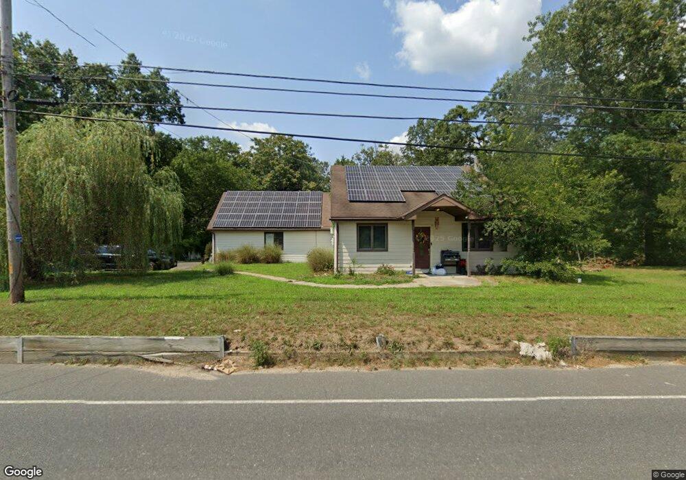
6551 Millville Ave Mays Landing, NJ 08330
Estimated Value: $408,000 - $567,027
--
Bed
--
Bath
2,930
Sq Ft
$161/Sq Ft
Est. Value
About This Home
This home is located at 6551 Millville Ave, Mays Landing, NJ 08330 and is currently estimated at $472,007, approximately $161 per square foot. 6551 Millville Ave is a home located in Atlantic County with nearby schools including Joseph Shaner School, George L. Hess Educational Complex, and William Davies Middle School.
Ownership History
Date
Name
Owned For
Owner Type
Purchase Details
Closed on
Mar 23, 2018
Sold by
Fannie Mae
Bought by
Patterson Preston T
Current Estimated Value
Home Financials for this Owner
Home Financials are based on the most recent Mortgage that was taken out on this home.
Original Mortgage
$152,192
Outstanding Balance
$131,893
Interest Rate
4.87%
Mortgage Type
FHA
Estimated Equity
$340,114
Purchase Details
Closed on
Aug 22, 2017
Sold by
Wilford James and Wilford Keri
Bought by
Federal National Mortgage Association
Purchase Details
Closed on
May 9, 2003
Sold by
Piperato Kathleen
Bought by
Wilford James and Wilford Keri
Home Financials for this Owner
Home Financials are based on the most recent Mortgage that was taken out on this home.
Original Mortgage
$155,600
Interest Rate
5.84%
Mortgage Type
Purchase Money Mortgage
Create a Home Valuation Report for This Property
The Home Valuation Report is an in-depth analysis detailing your home's value as well as a comparison with similar homes in the area
Home Values in the Area
Average Home Value in this Area
Purchase History
| Date | Buyer | Sale Price | Title Company |
|---|---|---|---|
| Patterson Preston T | $155,000 | Atlantic Shore Title Llc | |
| Federal National Mortgage Association | $1,000 | None Available | |
| Wilford James | $194,510 | -- | |
| Wilford James | $194,500 | Commonwealth Land Title Insu |
Source: Public Records
Mortgage History
| Date | Status | Borrower | Loan Amount |
|---|---|---|---|
| Open | Patterson Preston T | $152,192 | |
| Previous Owner | Wilford James | $155,600 |
Source: Public Records
Tax History Compared to Growth
Tax History
| Year | Tax Paid | Tax Assessment Tax Assessment Total Assessment is a certain percentage of the fair market value that is determined by local assessors to be the total taxable value of land and additions on the property. | Land | Improvement |
|---|---|---|---|---|
| 2025 | $7,613 | $221,900 | $46,700 | $175,200 |
| 2024 | $7,613 | $221,900 | $46,700 | $175,200 |
| 2023 | $7,158 | $221,900 | $46,700 | $175,200 |
| 2022 | $7,158 | $221,900 | $46,700 | $175,200 |
| 2021 | $7,143 | $221,900 | $46,700 | $175,200 |
| 2020 | $7,143 | $221,900 | $46,700 | $175,200 |
| 2019 | $7,161 | $221,900 | $46,700 | $175,200 |
| 2018 | $6,910 | $221,900 | $46,700 | $175,200 |
| 2017 | $6,801 | $221,900 | $46,700 | $175,200 |
| 2016 | $6,610 | $221,900 | $46,700 | $175,200 |
| 2015 | $6,386 | $221,900 | $46,700 | $175,200 |
| 2014 | $6,370 | $242,500 | $53,800 | $188,700 |
Source: Public Records
Map
Nearby Homes
- 0 Wheeling Ave Unit NJAC2018470
- 37 Delancy Ct
- 87 Devon Rd
- 1 Walnut Ct
- 6310 Phillips Ave
- 6314 Lance Ave
- 11 Maple Ct
- 6301 Knight Ave
- 39 Dogwood Ln Unit OAKS OF WEYMOUTH
- 39 Dogwood Ln
- 16 Holly Ct
- 24 Holly Ct
- 54 Pine Tree Ln
- 60 Pine Tree Ln
- 9 Oaks Dr Unit 341
- 4 Laurel Ct Unit 291
- 6202 Lance Ave
- 7 Laurel Ct
- 0 Harding Hwy Unit 597638
- 0 Harding Hwy Unit NJAC2019438
- 6551 Millville Ave
- 6557 Millville Ave
- 6557 Millville Ave
- 6554 Millville Ave
- 6559 Millville Ave
- 6556 Millville Ave
- 6561 Millville Ave
- 6561 Millville Ave
- 6558 Millville Ave
- 6563 Millville Ave
- 6563 Millville Ave
- 6567 Millville Ave
- 6567 Millville Ave
- 6568 Millville Ave
- 6572 Millville Ave
- 6571 Millville Ave
- 6573 Millville Ave
- 6573 Millville Ave
- 6574 Millville Ave
- 6574 Millville Rd