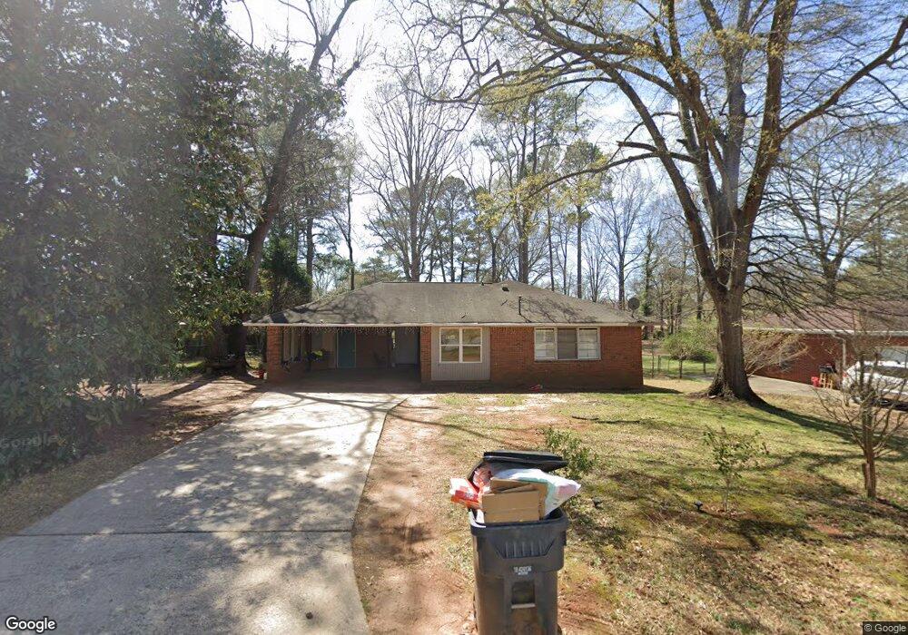
6551 Randall Mark Dr Unit 9 Morrow, GA 30260
Estimated Value: $219,000 - $269,000
3
Beds
2
Baths
1,188
Sq Ft
$201/Sq Ft
Est. Value
About This Home
This home is located at 6551 Randall Mark Dr Unit 9, Morrow, GA 30260 and is currently estimated at $238,456, approximately $200 per square foot. 6551 Randall Mark Dr Unit 9 is a home located in Clayton County with nearby schools including Morrow Elementary School, Morrow Middle School, and Morrow High School.
Ownership History
Date
Name
Owned For
Owner Type
Purchase Details
Closed on
Nov 9, 2018
Sold by
Atlanta Investor Grp Lp
Bought by
Guerrero Manuel
Current Estimated Value
Home Financials for this Owner
Home Financials are based on the most recent Mortgage that was taken out on this home.
Original Mortgage
$130,841
Outstanding Balance
$114,252
Interest Rate
4.9%
Mortgage Type
New Conventional
Estimated Equity
$124,204
Purchase Details
Closed on
Sep 26, 2018
Sold by
Corley Christopher Lyle
Bought by
Atlanta Investor Grp Lp
Home Financials for this Owner
Home Financials are based on the most recent Mortgage that was taken out on this home.
Original Mortgage
$130,841
Outstanding Balance
$114,252
Interest Rate
4.9%
Mortgage Type
New Conventional
Estimated Equity
$124,204
Create a Home Valuation Report for This Property
The Home Valuation Report is an in-depth analysis detailing your home's value as well as a comparison with similar homes in the area
Home Values in the Area
Average Home Value in this Area
Purchase History
| Date | Buyer | Sale Price | Title Company |
|---|---|---|---|
| Guerrero Manuel | $134,888 | -- | |
| Atlanta Investor Grp Lp | $84,488 | -- |
Source: Public Records
Mortgage History
| Date | Status | Borrower | Loan Amount |
|---|---|---|---|
| Open | Guerrero Manuel | $130,841 | |
| Closed | Atlanta Investor Grp Lp | $75,500 |
Source: Public Records
Tax History Compared to Growth
Tax History
| Year | Tax Paid | Tax Assessment Tax Assessment Total Assessment is a certain percentage of the fair market value that is determined by local assessors to be the total taxable value of land and additions on the property. | Land | Improvement |
|---|---|---|---|---|
| 2024 | $3,514 | $100,080 | $8,000 | $92,080 |
| 2023 | $3,291 | $91,160 | $8,000 | $83,160 |
| 2022 | $2,940 | $74,920 | $8,000 | $66,920 |
| 2021 | $2,284 | $57,840 | $8,000 | $49,840 |
| 2020 | $2,225 | $55,636 | $8,000 | $47,636 |
| 2019 | $2,190 | $53,955 | $6,400 | $47,555 |
| 2018 | $452 | $35,968 | $6,400 | $29,568 |
| 2017 | $388 | $31,958 | $6,400 | $25,558 |
| 2016 | $358 | $30,590 | $6,400 | $24,190 |
| 2015 | $153 | $0 | $0 | $0 |
| 2014 | $92 | $18,607 | $6,400 | $12,207 |
Source: Public Records
Map
Nearby Homes
- 6663 Peacock Blvd
- 6553 Meadowbrook Ln
- 6495 Revena Dr
- 2117 Amish Ct
- 2203 Willoby Ct Unit 2
- 6627 Cameron Rd
- The Rose Interior Plan at Sonata
- The Azalea Interior Plan at Sonata
- The Rose Exterior Plan at Sonata
- The Lily Interior Plan at Sonata
- The Daisy Exterior Plan at Sonata
- 1804 Carla Dr
- 2217 Willoby Ct
- 6605 Demere Dr Unit 3
- 6679 Cameron Rd
- 1902 Mural Cir Unit 5
- 6481 Northridge Way Unit 6481
- 2057 Fort Trail
- 6172 Princeton Ave Unit 6
- 6446 Oakleaf Way
- 6551 Randall Mark Dr
- 6547 Randall Mark Dr
- 6561 Randall Mark Dr Unit 2
- 6577 Randall Mark Dr Unit 11
- 6577 Randall Mark Dr
- 6543 Randall Mark Dr
- 1968 Judith Ann Dr
- 6551 Debbie Sue Ln
- 6552 Debbie Sue Ln
- 1958 Judith Ann Dr
- 1978 Judith Ann Dr
- 1948 Judith Ann Dr
- 6605 Randall Mark Dr
- 6539 Randall Mark Dr
- 6544 Randall Mark Dr
- 6560 Randall Mark Dr
- 6542 Debbie Sue Ln
- 6568 Randall Mark Dr
- 1938 Judith Ann Dr
- 6540 Randall Mark Dr