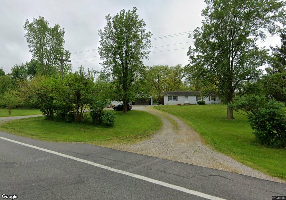
6552 State Route 197 Wapakoneta, OH 45895
Estimated Value: $211,000 - $269,000
3
Beds
2
Baths
1,326
Sq Ft
$181/Sq Ft
Est. Value
About This Home
This home is located at 6552 State Route 197, Wapakoneta, OH 45895 and is currently estimated at $239,981, approximately $180 per square foot. 6552 State Route 197 is a home located in Auglaize County with nearby schools including Wapakoneta Elementary School, Wapakoneta High School, and Wapakoneta Middle School.
Ownership History
Date
Name
Owned For
Owner Type
Purchase Details
Closed on
Nov 27, 2020
Sold by
Morris Clinton E and Morris Taylor M
Bought by
Burggraf Steven M
Current Estimated Value
Purchase Details
Closed on
Sep 7, 2012
Sold by
Leniheck Jack D and Lenehick Rebecca
Bought by
Morris Clinton E and Ritchie Taylor M
Home Financials for this Owner
Home Financials are based on the most recent Mortgage that was taken out on this home.
Original Mortgage
$109,250
Interest Rate
3.59%
Mortgage Type
New Conventional
Purchase Details
Closed on
Feb 26, 1992
Create a Home Valuation Report for This Property
The Home Valuation Report is an in-depth analysis detailing your home's value as well as a comparison with similar homes in the area
Home Values in the Area
Average Home Value in this Area
Purchase History
| Date | Buyer | Sale Price | Title Company |
|---|---|---|---|
| Burggraf Steven M | $155,500 | First Lima Title | |
| Morris Clinton E | $115,000 | Attorney | |
| -- | $5,000 | -- |
Source: Public Records
Mortgage History
| Date | Status | Borrower | Loan Amount |
|---|---|---|---|
| Previous Owner | Morris Clinton E | $109,250 |
Source: Public Records
Tax History Compared to Growth
Tax History
| Year | Tax Paid | Tax Assessment Tax Assessment Total Assessment is a certain percentage of the fair market value that is determined by local assessors to be the total taxable value of land and additions on the property. | Land | Improvement |
|---|---|---|---|---|
| 2024 | $2,335 | $48,140 | $11,530 | $36,610 |
| 2023 | $1,596 | $48,140 | $11,530 | $36,610 |
| 2022 | $1,446 | $40,040 | $10,480 | $29,560 |
| 2021 | $1,424 | $40,040 | $10,480 | $29,560 |
| 2020 | $700 | $40,041 | $10,483 | $29,558 |
| 2019 | $1,207 | $33,825 | $8,810 | $25,015 |
| 2018 | $1,248 | $33,825 | $8,810 | $25,015 |
| 2017 | $1,243 | $33,825 | $8,810 | $25,015 |
| 2016 | $1,236 | $34,717 | $8,390 | $26,327 |
| 2015 | $1,235 | $34,717 | $8,390 | $26,327 |
| 2014 | $1,238 | $34,717 | $8,390 | $26,327 |
| 2013 | $1,274 | $34,717 | $8,390 | $26,327 |
Source: Public Records
Map
Nearby Homes
- 18341 Saint Marys River Rd
- 22284 Ohio 198
- 00 Kleinoeder Rd
- 521 S Broadway St
- 123 Oakland Ave
- 510 S Broadway St
- 601 Sunset Ave
- 420 S Canal St
- 406 S Mulberry St
- 316 E 4th St
- 213 N Pearl St
- 417 W 4th St
- 421 W 4th St
- 433 W 4th St
- 425 N Main St
- 408 N Mulberry St
- 15644 Bay Rd
- 620 N Broadway St
- 714 Briggs Ave Unit 1
- 7470 Fort Amanda Rd
- 6552 197
- 6552 Ohio 197
- 06552 State Route 197
- 06520 State Route 197
- 06545 State Route 197
- 06533 State Route 197
- 06434 State Route 197
- 06386 State Route 197
- 06318 State Route 197
- 19719 Williams Rd
- 19742 Williams Rd
- 6210 Ohio 197
- 06210 State Route 197
- 19617 Williams Rd
- 20015 Eisley Rd
- 20522 Kossuth Loop Rd
- 19533 Williams Rd
- 19652 Williams Rd
- 20168 Eisley Rd
- 20168 Eisley Rd