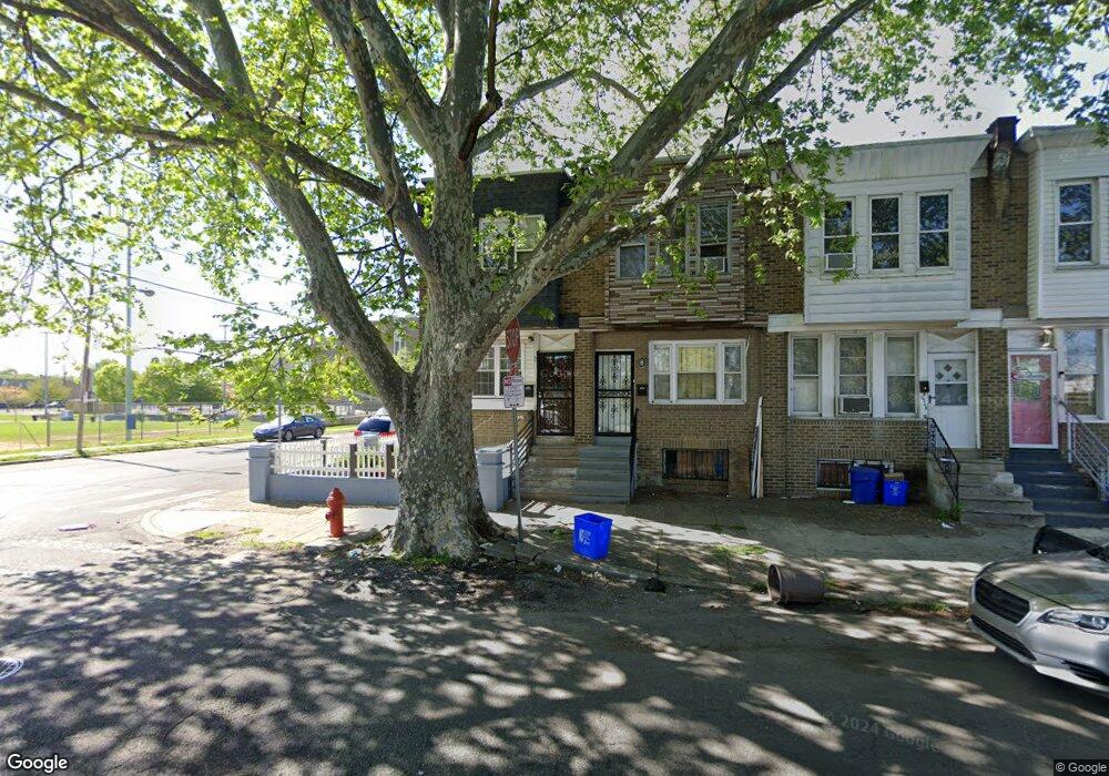
6553 Kingsessing Ave Philadelphia, PA 19142
Paschall NeighborhoodEstimated Value: $111,000 - $139,000
--
Bed
--
Bath
1,092
Sq Ft
$118/Sq Ft
Est. Value
About This Home
This home is located at 6553 Kingsessing Ave, Philadelphia, PA 19142 and is currently estimated at $129,274, approximately $118 per square foot. 6553 Kingsessing Ave is a home located in Philadelphia County with nearby schools including Joseph W. Catharine School, Tilden Middle School, and John Bartram High School.
Ownership History
Date
Name
Owned For
Owner Type
Purchase Details
Closed on
Mar 7, 2005
Sold by
Klein Michael and Leahy Francine
Bought by
Tran Houng Kim
Current Estimated Value
Purchase Details
Closed on
May 5, 2003
Sold by
Hero Michael L
Bought by
Leahy Francine and Klein Michael
Purchase Details
Closed on
Nov 4, 1997
Sold by
Financial Salvage
Bought by
Hero Michael L
Purchase Details
Closed on
Oct 16, 1997
Sold by
Police & Fire Fcu
Bought by
Financial Salvage
Purchase Details
Closed on
Jul 15, 1994
Sold by
Primerano Elaine Abonyi
Bought by
Police & Fire Fcu
Create a Home Valuation Report for This Property
The Home Valuation Report is an in-depth analysis detailing your home's value as well as a comparison with similar homes in the area
Home Values in the Area
Average Home Value in this Area
Purchase History
| Date | Buyer | Sale Price | Title Company |
|---|---|---|---|
| Tran Houng Kim | $10,000 | -- | |
| Leahy Francine | $6,400 | -- | |
| Hero Michael L | $17,500 | -- | |
| Financial Salvage | $6,750 | -- | |
| Police & Fire Fcu | $19,965 | -- |
Source: Public Records
Tax History Compared to Growth
Tax History
| Year | Tax Paid | Tax Assessment Tax Assessment Total Assessment is a certain percentage of the fair market value that is determined by local assessors to be the total taxable value of land and additions on the property. | Land | Improvement |
|---|---|---|---|---|
| 2025 | $1,047 | $98,800 | $19,760 | $79,040 |
| 2024 | $1,047 | $98,800 | $19,760 | $79,040 |
| 2023 | $1,047 | $74,800 | $14,900 | $59,900 |
| 2022 | $417 | $29,800 | $14,900 | $14,900 |
| 2021 | $1,050 | $0 | $0 | $0 |
| 2020 | $1,050 | $0 | $0 | $0 |
| 2019 | $969 | $0 | $0 | $0 |
| 2018 | $815 | $0 | $0 | $0 |
| 2017 | $815 | $0 | $0 | $0 |
| 2016 | $815 | $0 | $0 | $0 |
| 2015 | $780 | $0 | $0 | $0 |
| 2014 | -- | $58,200 | $4,367 | $53,833 |
| 2012 | -- | $7,296 | $1,505 | $5,791 |
Source: Public Records
Map
Nearby Homes
- 6549 Regent St
- 6520 Allman St
- 6514 Allman St
- 6508 Allman St
- 1918 S 65th St
- 2032 S 66th St
- 2024 S 65th St
- 6543 Greenway Ave
- 1903 S 65th St
- 6517 Greenway Ave
- 6348 Kingsessing Ave
- 6310 Chester Ave
- 6447 Upland St
- 6310 Allman St
- 1824 S 65th St
- 2016 S Simpson St
- 2109 S 66th St
- 2030 S 67th St
- 6306 Regent St
- 6564 Belmar St
- 6551 Kingsessing Ave
- 6549 Kingsessing Ave
- 6547 Kingsessing Ave
- 6541 Kingsessing Ave
- 6548 Regent St
- 6552 Regent St
- 6546 Regent St
- 6539 Kingsessing Ave
- 6544 Regent St
- 6542 Regent St
- 6540 Regent St
- 6537 Kingsessing Ave
- 6535 Kingsessing Ave
- 6538 Regent St
- 6536 Regent St
- 6533 Kingsessing Ave
- 6531 Kingsessing Ave
- 6532 Regent St
- 6529 Kingsessing Ave
- 6530 Regent St