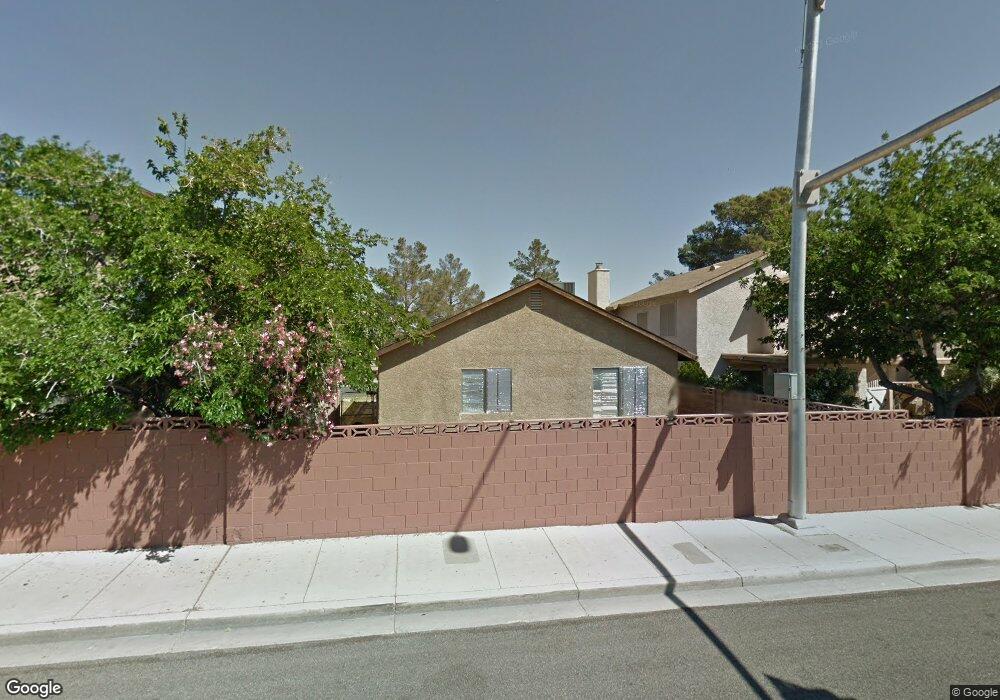
6553 Peartree Rd Las Vegas, NV 89108
Michael Way NeighborhoodEstimated Value: $322,728 - $351,000
3
Beds
2
Baths
1,092
Sq Ft
$313/Sq Ft
Est. Value
About This Home
This home is located at 6553 Peartree Rd, Las Vegas, NV 89108 and is currently estimated at $341,682, approximately $312 per square foot. 6553 Peartree Rd is a home located in Clark County with nearby schools including Lilly & Wing Fong Elementary School, J. Harold Brinley Middle School, and Cimarron Memorial High School.
Ownership History
Date
Name
Owned For
Owner Type
Purchase Details
Closed on
Feb 13, 2012
Sold by
Secretary Of Housing & Urban Development
Bought by
Iniguez Juan
Current Estimated Value
Home Financials for this Owner
Home Financials are based on the most recent Mortgage that was taken out on this home.
Original Mortgage
$40,320
Outstanding Balance
$27,584
Interest Rate
3.86%
Mortgage Type
New Conventional
Estimated Equity
$314,098
Purchase Details
Closed on
Sep 8, 2011
Sold by
Wells Fargo Bank Na
Bought by
Secretary Of Housing & Urban Development
Create a Home Valuation Report for This Property
The Home Valuation Report is an in-depth analysis detailing your home's value as well as a comparison with similar homes in the area
Home Values in the Area
Average Home Value in this Area
Purchase History
| Date | Buyer | Sale Price | Title Company |
|---|---|---|---|
| Iniguez Juan | $50,400 | Nevada Title Las Vegas | |
| Secretary Of Housing & Urban Development | $120,439 | Lsi Title Agency Inc | |
| Wells Fargo Bank N A | $120,439 | Lsi Title Agency Inc |
Source: Public Records
Mortgage History
| Date | Status | Borrower | Loan Amount |
|---|---|---|---|
| Open | Iniguez Juan | $40,320 |
Source: Public Records
Tax History Compared to Growth
Tax History
| Year | Tax Paid | Tax Assessment Tax Assessment Total Assessment is a certain percentage of the fair market value that is determined by local assessors to be the total taxable value of land and additions on the property. | Land | Improvement |
|---|---|---|---|---|
| 2025 | $1,084 | $50,380 | $25,900 | $24,480 |
| 2024 | $1,004 | $50,380 | $25,900 | $24,480 |
| 2023 | $668 | $50,213 | $26,250 | $23,963 |
| 2022 | $930 | $43,981 | $21,700 | $22,281 |
| 2021 | $861 | $40,446 | $18,900 | $21,546 |
| 2020 | $797 | $39,549 | $17,850 | $21,699 |
| 2019 | $747 | $37,352 | $15,750 | $21,602 |
| 2018 | $713 | $32,964 | $11,900 | $21,064 |
| 2017 | $1,098 | $33,489 | $11,900 | $21,589 |
| 2016 | $668 | $31,897 | $9,800 | $22,097 |
| 2015 | $666 | $23,733 | $6,300 | $17,433 |
| 2014 | $645 | $19,091 | $5,250 | $13,841 |
Source: Public Records
Map
Nearby Homes
- 6444 Peartree Rd
- 6437 Peachwood Rd
- 6557 Sweetzer Way
- 6544 Gumwood Rd
- 6577 Goldensun Ct
- 2248 Short Pine Dr
- 6529 Hartwood Rd
- 6465 Big Pine Way
- 2433 Cycad Tree St
- 2308 Avery Dr
- 2228 Silver Pine Dr Unit 3
- 2204 Short Pine Dr
- 6513 Deadwood Rd
- 6516 Deadwood Rd
- 6444 Deadwood Rd
- 2532 Goldenmoon St
- 6436 Deadwood Rd
- 2536 Charteroak St
- 2201 James Bilbray Dr
- 6428 Deadwood Rd
- 6549 Peartree Rd
- 6557 Peartree Rd
- 6545 Peartree Rd
- 6561 Peartree Rd
- 6541 Peartree Rd
- 2400 Cherrywood St
- 6532 Smokey Pine Way
- 6536 Smokey Pine Way
- 6528 Smokey Pine Way
- 2404 Cherrywood St
- 6540 Smokey Pine Way
- 2408 Cherrywood St
- 6533 Peartree Rd
- 6524 Smokey Pine Way
- 6544 Smokey Pine Way
- 2412 Cherrywood St
- 6520 Smokey Pine Way
- 6529 Peartree Rd
- 2400 Goldenmoon St
- 2416 Cherrywood St