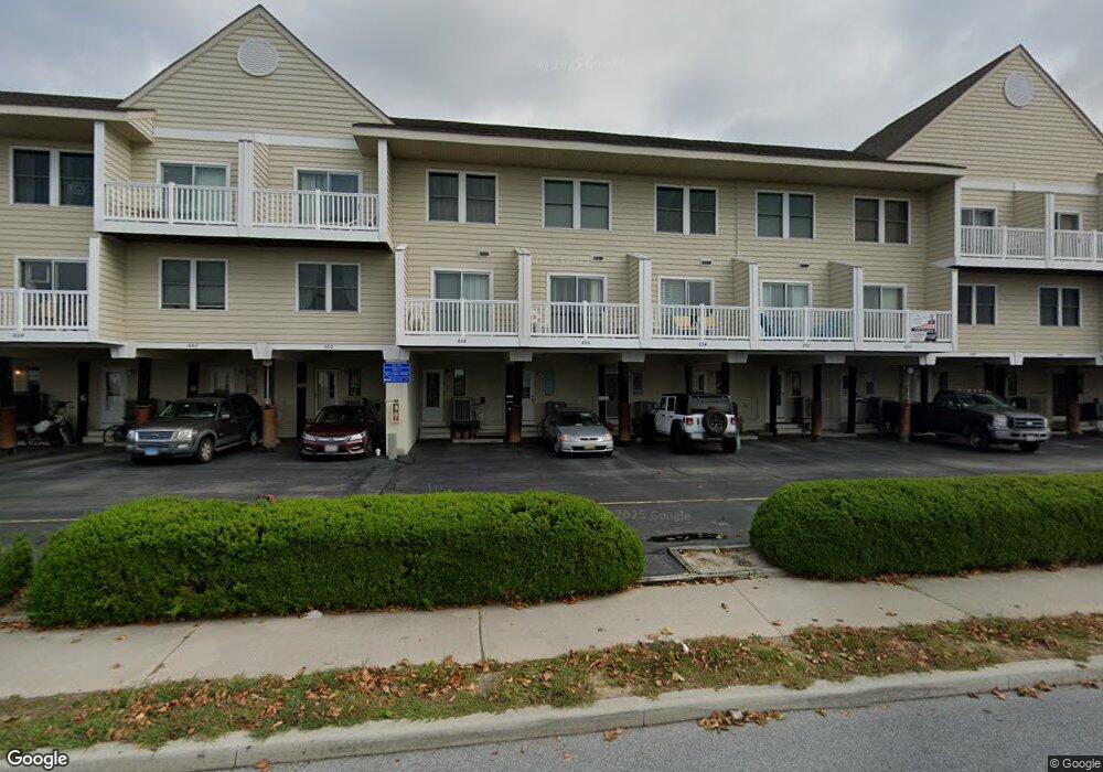
656 94th St Ocean City, MD 21842
Estimated Value: $506,000 - $548,000
3
Beds
2
Baths
1,392
Sq Ft
$376/Sq Ft
Est. Value
About This Home
This home is located at 656 94th St, Ocean City, MD 21842 and is currently estimated at $522,872, approximately $375 per square foot. 656 94th St is a home located in Worcester County with nearby schools including Ocean City Elementary School, Stephen Decatur Middle School, and Berlin Intermediate School.
Ownership History
Date
Name
Owned For
Owner Type
Purchase Details
Closed on
Feb 18, 2012
Sold by
Schaub Joseph H and Schaub Karen K
Bought by
Ramina Paul Joseph and Ramina Margaret Mary
Current Estimated Value
Home Financials for this Owner
Home Financials are based on the most recent Mortgage that was taken out on this home.
Original Mortgage
$172,500
Outstanding Balance
$118,124
Interest Rate
3.88%
Mortgage Type
New Conventional
Estimated Equity
$404,748
Purchase Details
Closed on
Sep 26, 2000
Sold by
Simons Morton J and Simons Helen
Bought by
Schaub Joseph H
Create a Home Valuation Report for This Property
The Home Valuation Report is an in-depth analysis detailing your home's value as well as a comparison with similar homes in the area
Home Values in the Area
Average Home Value in this Area
Purchase History
| Date | Buyer | Sale Price | Title Company |
|---|---|---|---|
| Ramina Paul Joseph | $230,000 | First American Title | |
| Schaub Joseph H | $145,000 | -- |
Source: Public Records
Mortgage History
| Date | Status | Borrower | Loan Amount |
|---|---|---|---|
| Open | Ramina Paul Joseph | $172,500 |
Source: Public Records
Tax History Compared to Growth
Tax History
| Year | Tax Paid | Tax Assessment Tax Assessment Total Assessment is a certain percentage of the fair market value that is determined by local assessors to be the total taxable value of land and additions on the property. | Land | Improvement |
|---|---|---|---|---|
| 2025 | $5,347 | $391,600 | $0 | $0 |
| 2024 | $4,655 | $333,600 | $0 | $0 |
| 2023 | $3,885 | $275,600 | $137,800 | $137,800 |
| 2022 | $3,756 | $267,233 | $0 | $0 |
| 2021 | $3,658 | $258,867 | $0 | $0 |
| 2020 | $3,310 | $250,500 | $125,200 | $125,300 |
| 2019 | $3,310 | $233,333 | $0 | $0 |
| 2018 | $3,045 | $216,167 | $0 | $0 |
| 2017 | $2,825 | $199,000 | $0 | $0 |
| 2016 | -- | $199,000 | $0 | $0 |
| 2015 | $3,591 | $199,000 | $0 | $0 |
| 2014 | $3,591 | $208,800 | $0 | $0 |
Source: Public Records
Map
Nearby Homes
- 616 Salt Spray Rd Unit 6
- 615 Salt Spray Rd
- 9307 Chesapeake Dr
- 9307 Chesapeake Dr
- 9203 Rusty Anchor Rd
- 9203 Rusty Anchor Rd
- 707 94th St Unit 302
- 8601 Chesapeake Dr
- 726 Mooring Rd
- 746 94th St
- 604 S Pacific Ave
- 710 Bradley Rd Unit A2
- 712 Bradley Rd Unit E
- 714 Mooring Rd Unit 304C
- 8703 Mediterranean Dr
- 722 Mooring Rd
- 718 Mooring Rd Unit 203B
- 701 Rusty Anchor Rd Unit 17
- 9106 E Biscayne Dr
- 720 Rusty Anchor Rd