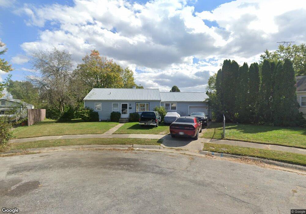
656 Feese Place Springfield, OH 45505
Estimated Value: $110,000 - $161,000
2
Beds
1
Bath
1,096
Sq Ft
$126/Sq Ft
Est. Value
About This Home
This home is located at 656 Feese Place, Springfield, OH 45505 and is currently estimated at $137,630, approximately $125 per square foot. 656 Feese Place is a home located in Clark County with nearby schools including Mann Elementary School, Schaefer Middle School, and Springfield High School.
Ownership History
Date
Name
Owned For
Owner Type
Purchase Details
Closed on
Aug 18, 2023
Sold by
Hufford William Mark
Bought by
Chexis Llc
Current Estimated Value
Purchase Details
Closed on
Sep 26, 2002
Sold by
Lannom Steven and Lannom Jennifer
Bought by
Hufford William Mark
Purchase Details
Closed on
Sep 18, 2000
Sold by
Lannom Jennifer D
Bought by
Lannom Steve L
Create a Home Valuation Report for This Property
The Home Valuation Report is an in-depth analysis detailing your home's value as well as a comparison with similar homes in the area
Home Values in the Area
Average Home Value in this Area
Purchase History
| Date | Buyer | Sale Price | Title Company |
|---|---|---|---|
| Chexis Llc | $62,000 | None Listed On Document | |
| Chexis Llc | $62,000 | None Listed On Document | |
| Hufford William Mark | $51,400 | -- | |
| Lannom Steve L | -- | -- |
Source: Public Records
Tax History
| Year | Tax Paid | Tax Assessment Tax Assessment Total Assessment is a certain percentage of the fair market value that is determined by local assessors to be the total taxable value of land and additions on the property. | Land | Improvement |
|---|---|---|---|---|
| 2025 | $1,490 | $40,740 | $10,160 | $30,580 |
| 2024 | $1,452 | $29,400 | $9,150 | $20,250 |
| 2023 | $1,452 | $29,400 | $9,150 | $20,250 |
| 2022 | $1,485 | $29,400 | $9,150 | $20,250 |
| 2021 | $1,277 | $23,230 | $7,260 | $15,970 |
| 2020 | $1,279 | $23,230 | $7,260 | $15,970 |
| 2019 | $1,283 | $23,230 | $7,260 | $15,970 |
| 2018 | $1,110 | $19,290 | $5,450 | $13,840 |
| 2017 | $1,109 | $20,426 | $5,446 | $14,980 |
| 2016 | $1,110 | $20,426 | $5,446 | $14,980 |
| 2015 | $1,698 | $20,426 | $5,446 | $14,980 |
| 2014 | $1,091 | $20,426 | $5,446 | $14,980 |
| 2013 | $1,079 | $20,426 | $5,446 | $14,980 |
Source: Public Records
Map
Nearby Homes
- 2338 Dellwood Dr
- 2670 Duncan St
- 374 Raffensperger Ave
- 360 Buxton Ave
- 1011 Mount Joy St
- 400 S Arlington Ave Unit 402
- 2804 Lowman St
- 2560 Kenton St
- 2425 Kenilworth Ave
- 273 S Clairmont Ave
- 2111 Kenilworth Ave
- 250 S Douglas Ave Unit 254
- 1714 Kenton St
- 115 S Burnett Rd
- 2424-2426 E High St
- 1652 Kenton St
- 2108 Sunset Ave
- 3012 E High St
- 1701 Lexington Ave
- 1823 Rutland Ave
- 660 Feese Place
- 711 Eastmoor Dr
- 717 Eastmoor Dr
- 652 Feese Place
- 707 Eastmoor Dr
- 721 Eastmoor Dr
- 703 Eastmoor Dr
- 2504 Leland Dr
- 2442 Leland Dr
- 2510 Leland Dr
- 644 Feese Place
- 727 Eastmoor Dr
- 655 Feese Place
- 643 Eastmoor Dr
- 2516 Leland Dr
- 2434 Leland Dr
- 635 Eastmoor Dr
- 651 Feese Place
- 2511 Dellwood Dr
- 2524 Leland Dr
Your Personal Tour Guide
Ask me questions while you tour the home.