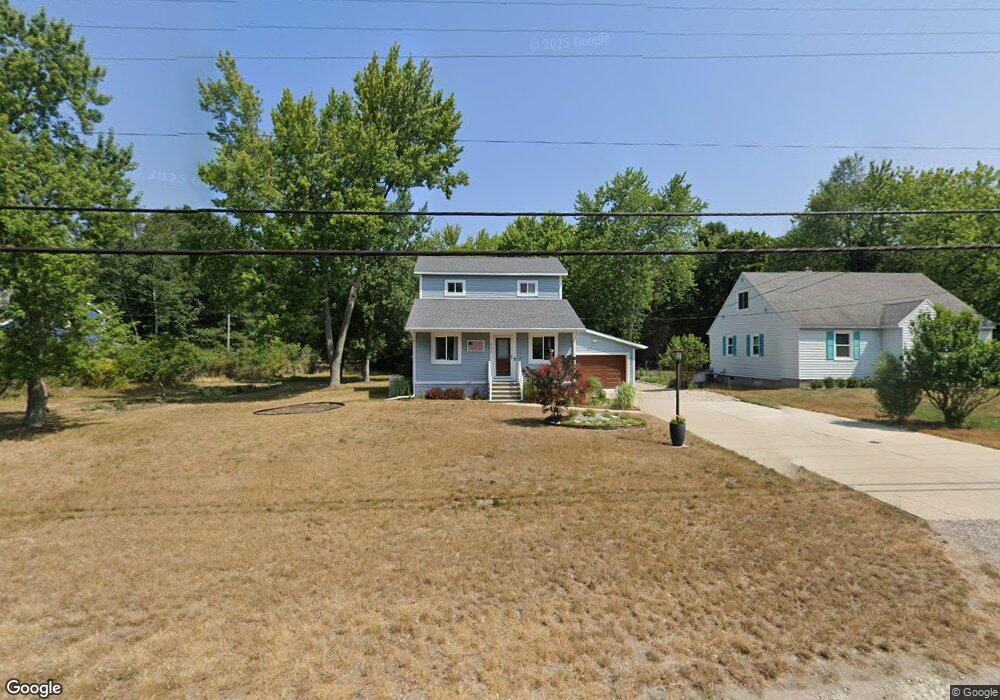
656 Porter Rd Norton Shores, MI 49441
Estimated Value: $294,779 - $361,000
1
Bed
2
Baths
1,352
Sq Ft
$238/Sq Ft
Est. Value
About This Home
This home is located at 656 Porter Rd, Norton Shores, MI 49441 and is currently estimated at $321,945, approximately $238 per square foot. 656 Porter Rd is a home located in Muskegon County with nearby schools including Mona Shores High School, Michigan Dunes Montessori School, and West Shore Lutheran School.
Ownership History
Date
Name
Owned For
Owner Type
Purchase Details
Closed on
Jul 16, 2018
Sold by
Knisely Antony J
Bought by
Rosich John Jay and Rosich Carol Kathleen
Current Estimated Value
Purchase Details
Closed on
Sep 19, 2017
Sold by
Lowe Margaret and Knop Kurt
Bought by
Knisely Antony J
Home Financials for this Owner
Home Financials are based on the most recent Mortgage that was taken out on this home.
Original Mortgage
$142,000
Interest Rate
3.9%
Mortgage Type
New Conventional
Purchase Details
Closed on
Jul 15, 2015
Sold by
Turrell Bruce W and Turrell Sara K
Bought by
Lowe Margaret and Knop Kurt
Create a Home Valuation Report for This Property
The Home Valuation Report is an in-depth analysis detailing your home's value as well as a comparison with similar homes in the area
Home Values in the Area
Average Home Value in this Area
Purchase History
| Date | Buyer | Sale Price | Title Company |
|---|---|---|---|
| Rosich John Jay | -- | None Available | |
| Knisely Antony J | -- | None Available | |
| Lowe Margaret | $39,000 | Lighthouse Title Inc |
Source: Public Records
Mortgage History
| Date | Status | Borrower | Loan Amount |
|---|---|---|---|
| Previous Owner | Knisely Antony J | $142,000 |
Source: Public Records
Tax History Compared to Growth
Tax History
| Year | Tax Paid | Tax Assessment Tax Assessment Total Assessment is a certain percentage of the fair market value that is determined by local assessors to be the total taxable value of land and additions on the property. | Land | Improvement |
|---|---|---|---|---|
| 2025 | $4,181 | $159,300 | $0 | $0 |
| 2024 | $3,277 | $147,900 | $0 | $0 |
| 2023 | $3,130 | $130,000 | $0 | $0 |
| 2022 | $3,816 | $112,600 | $0 | $0 |
| 2021 | $3,707 | $103,500 | $0 | $0 |
| 2020 | $3,666 | $97,900 | $0 | $0 |
| 2019 | $4,409 | $89,200 | $0 | $0 |
| 2018 | $3,110 | $77,100 | $0 | $0 |
| 2017 | $2,646 | $46,000 | $0 | $0 |
| 2016 | $1,990 | $48,600 | $0 | $0 |
| 2015 | -- | $39,400 | $0 | $0 |
| 2014 | $1,923 | $39,900 | $0 | $0 |
| 2013 | -- | $38,100 | $0 | $0 |
Source: Public Records
Map
Nearby Homes
- 608 Porter Rd
- 5128 Henry St
- 516 Hendrick Rd
- 5153 Shady Creek Dr
- 263 Churchill Dr
- 4655 Henry St
- 4666 Heinicke St
- 5473 Martin Rd
- 5579 Martin Rd
- 5085 Gay St
- 1087 W Mount Garfield Rd
- 1103 W Mount Garfield Rd
- 4676 Earl St
- 6023 Henry St
- 5075 Wickham Dr
- 243 Lake Dr
- 740 Bridgeview Bay Dr
- 1558 Brookwood Dr
- 1769 Bayview Dr
- 5959 Lake Harbor Rd