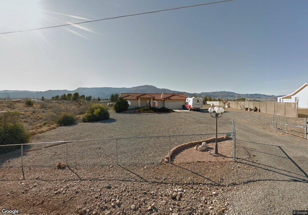
656 S 10th St Cottonwood, AZ 86326
Cottonwood NeighborhoodEstimated Value: $604,141 - $671,000
3
Beds
--
Bath
4,148
Sq Ft
$152/Sq Ft
Est. Value
About This Home
This home is located at 656 S 10th St, Cottonwood, AZ 86326 and is currently estimated at $631,785, approximately $152 per square foot. 656 S 10th St is a home located in Yavapai County with nearby schools including Cottonwood Elementary School, Dr Daniel Bright Elementary School, and Cottonwood Community School.
Ownership History
Date
Name
Owned For
Owner Type
Purchase Details
Closed on
May 28, 2013
Sold by
Pinner Ronald George
Bought by
Pinner Ronald George
Current Estimated Value
Home Financials for this Owner
Home Financials are based on the most recent Mortgage that was taken out on this home.
Original Mortgage
$104,529
Outstanding Balance
$73,990
Interest Rate
3.38%
Mortgage Type
New Conventional
Estimated Equity
$557,795
Purchase Details
Closed on
Apr 4, 2001
Sold by
Nielsen Jack and Nielsen Carol A
Bought by
Pinner Ronald George and Hamilton Teresa Ann
Home Financials for this Owner
Home Financials are based on the most recent Mortgage that was taken out on this home.
Original Mortgage
$149,600
Interest Rate
6.98%
Mortgage Type
New Conventional
Create a Home Valuation Report for This Property
The Home Valuation Report is an in-depth analysis detailing your home's value as well as a comparison with similar homes in the area
Home Values in the Area
Average Home Value in this Area
Purchase History
| Date | Buyer | Sale Price | Title Company |
|---|---|---|---|
| Pinner Ronald George | -- | None Available | |
| Pinner Ronald George | $187,000 | Chicago Title Insurance Co |
Source: Public Records
Mortgage History
| Date | Status | Borrower | Loan Amount |
|---|---|---|---|
| Open | Pinner Ronald George | $104,529 | |
| Closed | Pinner Ronald George | $149,600 |
Source: Public Records
Tax History Compared to Growth
Tax History
| Year | Tax Paid | Tax Assessment Tax Assessment Total Assessment is a certain percentage of the fair market value that is determined by local assessors to be the total taxable value of land and additions on the property. | Land | Improvement |
|---|---|---|---|---|
| 2026 | $1,786 | $60,532 | -- | -- |
| 2024 | $1,750 | $61,919 | -- | -- |
| 2023 | $1,750 | $50,489 | $8,327 | $42,162 |
| 2022 | $1,745 | $38,216 | $6,964 | $31,252 |
| 2021 | $1,897 | $35,231 | $6,124 | $29,107 |
| 2020 | $1,884 | $0 | $0 | $0 |
| 2019 | $1,873 | $0 | $0 | $0 |
| 2018 | $1,799 | $0 | $0 | $0 |
| 2017 | $1,723 | $0 | $0 | $0 |
| 2016 | $1,694 | $0 | $0 | $0 |
| 2015 | $1,696 | $0 | $0 | $0 |
| 2014 | -- | $0 | $0 | $0 |
Source: Public Records
Map
Nearby Homes
- 1161 S 10th St
- 1151 E State Route 89a --
- 705 S 16th St
- 720 Skyview Ln
- 713 Skyview Ln
- 421 Boulder Ln
- 1295 E Ridgeview Dr
- 345 Arizona 89a
- 1461 E Cherry St
- 912 S 6th St
- 1615 E Crestview Cir
- 630 E Elm St
- 1655 Oro Dr
- 1322 E Five Star Blvd
- 1520 E Elm St
- 425 S Main St
- 2050 W Highway 89a Unit 410
- 1707 Sawmill Rd
- 807 S Tigres Trail
- 1775 Pinon Dr