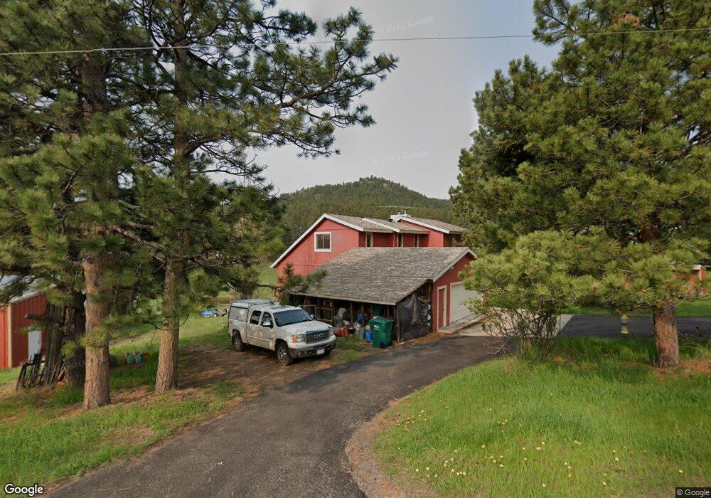
6564 High Cir Morrison, CO 80465
North Turkey Creek NeighborhoodEstimated Value: $821,990 - $965,000
3
Beds
7
Baths
2,067
Sq Ft
$421/Sq Ft
Est. Value
About This Home
This home is located at 6564 High Cir, Morrison, CO 80465 and is currently estimated at $869,748, approximately $420 per square foot. 6564 High Cir is a home located in Jefferson County with nearby schools including Marshdale Elementary School, West Jefferson Middle School, and Conifer Senior High School.
Ownership History
Date
Name
Owned For
Owner Type
Purchase Details
Closed on
Jun 13, 2000
Sold by
Miller Lucinda Lynne
Bought by
Algya Sharon W and Reichow Kent R
Current Estimated Value
Home Financials for this Owner
Home Financials are based on the most recent Mortgage that was taken out on this home.
Original Mortgage
$165,000
Outstanding Balance
$58,500
Interest Rate
8.3%
Estimated Equity
$811,248
Purchase Details
Closed on
Mar 6, 2000
Sold by
Kaminski Edmund Paul
Bought by
Miller Lucinda Lynne
Create a Home Valuation Report for This Property
The Home Valuation Report is an in-depth analysis detailing your home's value as well as a comparison with similar homes in the area
Home Values in the Area
Average Home Value in this Area
Purchase History
| Date | Buyer | Sale Price | Title Company |
|---|---|---|---|
| Algya Sharon W | $278,462 | Colorado National Title | |
| Miller Lucinda Lynne | -- | -- |
Source: Public Records
Mortgage History
| Date | Status | Borrower | Loan Amount |
|---|---|---|---|
| Open | Algya Sharon W | $165,000 |
Source: Public Records
Tax History
| Year | Tax Paid | Tax Assessment Tax Assessment Total Assessment is a certain percentage of the fair market value that is determined by local assessors to be the total taxable value of land and additions on the property. | Land | Improvement |
|---|---|---|---|---|
| 2024 | $4,624 | $56,577 | $21,206 | $35,371 |
| 2023 | $4,624 | $56,577 | $21,206 | $35,371 |
| 2022 | $3,761 | $46,341 | $12,373 | $33,968 |
| 2021 | $3,800 | $47,675 | $12,729 | $34,946 |
| 2020 | $3,241 | $41,447 | $8,695 | $32,752 |
| 2019 | $3,196 | $41,447 | $8,695 | $32,752 |
| 2018 | $3,136 | $39,815 | $9,667 | $30,148 |
| 2017 | $3,478 | $39,815 | $9,667 | $30,148 |
| 2016 | $3,583 | $38,329 | $9,315 | $29,014 |
| 2015 | $2,931 | $38,329 | $9,315 | $29,014 |
| 2014 | $2,931 | $30,396 | $10,146 | $20,250 |
Source: Public Records
Map
Nearby Homes
- 6616 High Dr
- 22354 Park Ln
- 6387 High Dr
- 6530 Ridgeview Dr
- 7307 S Settlers Dr
- 7262 S Sourdough Dr
- 5704 Santa Clara Rd
- 22637 Shawnee Rd
- 22056 High Spring Trail
- 5296 Cherokee Rd
- 21965 High Springs Trail
- 5312 Adahi Rd
- 6498 S Turkey Creek Rd
- 5211 Parmalee Gulch Rd
- 7033 Silverhorn Dr
- 7082 Silverhorn Dr
- 7552 Surrey Dr
- 24597 Stanley Park Rd
- 8001 S Homesteader Dr
- 24844 N Turkey Creek Rd
Your Personal Tour Guide
Ask me questions while you tour the home.