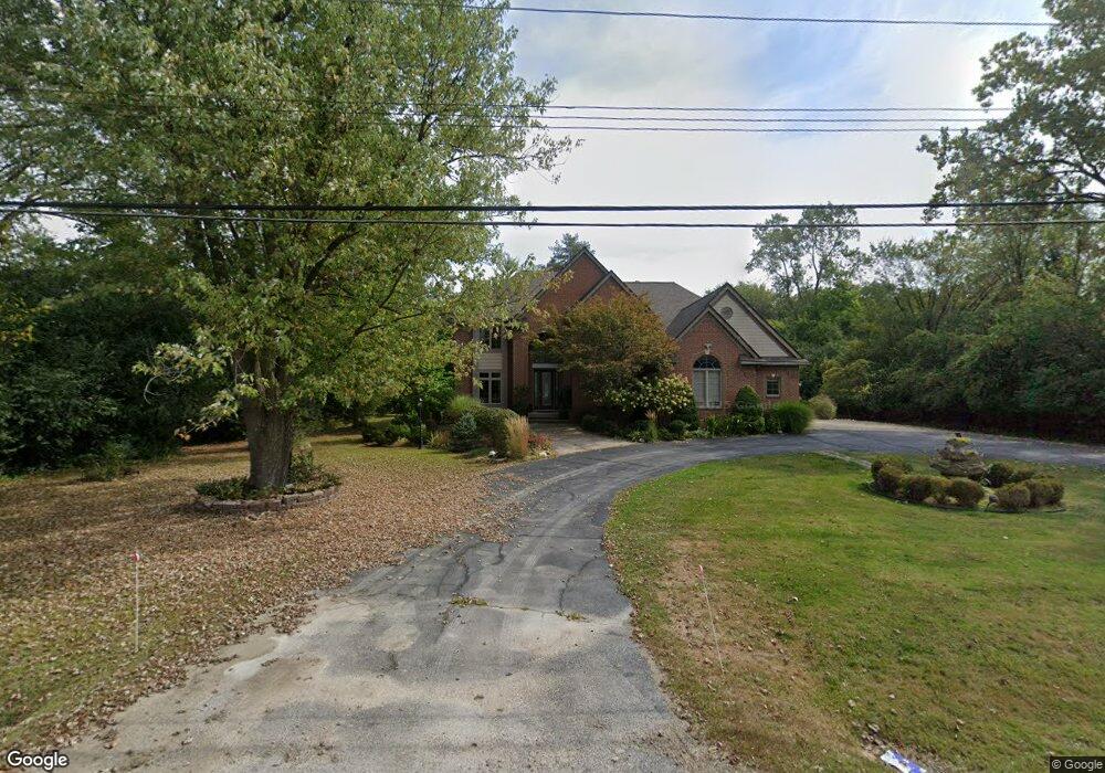
6565 Colby Ln Bloomfield Hills, MI 48301
Estimated Value: $1,042,000 - $1,591,000
4
Beds
5
Baths
4,278
Sq Ft
$322/Sq Ft
Est. Value
About This Home
This home is located at 6565 Colby Ln, Bloomfield Hills, MI 48301 and is currently estimated at $1,377,399, approximately $321 per square foot. 6565 Colby Ln is a home located in Oakland County with nearby schools including Conant Elementary School, South Hills Middle School, and Bloomfield Hills High School.
Ownership History
Date
Name
Owned For
Owner Type
Purchase Details
Closed on
Jan 13, 2023
Sold by
Dassanayake Mahendra S and Dassanayake Champa L
Bought by
Dassanayake Mahendra S and Dassanayake Mahendra S
Current Estimated Value
Purchase Details
Closed on
Jan 4, 2002
Sold by
Toma Tarik C
Bought by
Dassanayake Mahendra
Purchase Details
Closed on
Dec 27, 2000
Sold by
Toma Tarik C
Bought by
Toma Tarik C
Purchase Details
Closed on
Jul 20, 2000
Sold by
Miscallef Joseph
Bought by
Miscallef Joseph
Purchase Details
Closed on
Jan 12, 2000
Sold by
Micallef Joseph
Bought by
Micallef Joseph
Purchase Details
Closed on
Sep 2, 1999
Sold by
Khan Ahmed
Bought by
Micallef Joseph
Purchase Details
Closed on
May 26, 1998
Sold by
Lee Gloria G
Bought by
Khan Ahmed
Create a Home Valuation Report for This Property
The Home Valuation Report is an in-depth analysis detailing your home's value as well as a comparison with similar homes in the area
Home Values in the Area
Average Home Value in this Area
Purchase History
| Date | Buyer | Sale Price | Title Company |
|---|---|---|---|
| Dassanayake Mahendra S | -- | Land Title | |
| Dassanayake Mahendra S | -- | Land Title | |
| Dassanayake Mahendra | $850,000 | -- | |
| Toma Tarik C | -- | -- | |
| Miscallef Joseph | -- | -- | |
| Micallef Joseph | -- | -- | |
| Micallef Joseph | $210,000 | -- | |
| Khan Ahmed | $250,000 | -- |
Source: Public Records
Tax History Compared to Growth
Tax History
| Year | Tax Paid | Tax Assessment Tax Assessment Total Assessment is a certain percentage of the fair market value that is determined by local assessors to be the total taxable value of land and additions on the property. | Land | Improvement |
|---|---|---|---|---|
| 2024 | $6,683 | $586,080 | $0 | $0 |
| 2023 | $6,467 | $562,110 | $0 | $0 |
| 2022 | $12,154 | $547,710 | $0 | $0 |
| 2021 | $12,067 | $542,570 | $0 | $0 |
| 2020 | $5,915 | $477,270 | $0 | $0 |
| 2019 | $11,354 | $456,340 | $0 | $0 |
| 2018 | $11,406 | $433,740 | $0 | $0 |
| 2017 | $11,324 | $422,510 | $0 | $0 |
| 2016 | $11,346 | $390,590 | $0 | $0 |
| 2015 | -- | $328,740 | $0 | $0 |
| 2014 | -- | $294,310 | $0 | $0 |
| 2011 | -- | $296,750 | $0 | $0 |
Source: Public Records
Map
Nearby Homes
- 6572 Spruce Dr
- 4200 Surrey Cross
- 6660 Woodbank Dr
- 6750 Wing Lake Rd
- 750 Trailwood Path Unit B
- 450 Billingsgate Ct Unit C
- 1760 Trailwood Path
- 4456 W Maple Rd
- 6701 Franklin Rd
- 7005 Cathedral Dr
- 6952 Sandalwood Dr
- 7100 Wing Lake Rd
- 4088 Cranbrook Ct Unit 34
- 4017 Hidden Woods Dr
- 7200 Telegraph Rd
- 4428 Old Trinity Ct
- 7303 Brookside Village Ct
- 6720 Castle Dr
- 6041 Eastmoor Rd
- 6360 Hills Dr
- 6601 Colby Ln
- 4275 W Maple Rd
- 4295 W Maple Rd
- 6560 Colby Ln
- LOT 5 Colby Ln
- 4313 W Maple Rd
- 6635 Colby Ln
- 6550 Spruce Dr
- 6528 Spruce Dr
- 4305 W Maple Rd
- 6506 Spruce Dr
- 6600 Colby Ln
- 6604 Spruce Dr
- 6490 Thurber Rd
- 6485 Sheringham Rd
- 6665 Colby Ln
- 6626 Spruce Dr
- 6630 Colby Ln
- 4315 W Maple Rd
- 6480 Sheringham Rd