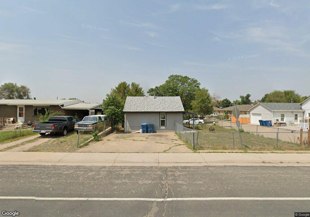
6565 Olive St Commerce City, CO 80022
Kemp NeighborhoodEstimated Value: $360,000 - $484,000
4
Beds
2
Baths
1,248
Sq Ft
$332/Sq Ft
Est. Value
About This Home
This home is located at 6565 Olive St, Commerce City, CO 80022 and is currently estimated at $414,301, approximately $331 per square foot. 6565 Olive St is a home located in Adams County with nearby schools including Kemp Elementary School, Kearney Middle School, and Adams City High School.
Ownership History
Date
Name
Owned For
Owner Type
Purchase Details
Closed on
Sep 25, 2001
Sold by
Franzen Ruby I
Bought by
Atencio Ernie and Atencio Nancy
Current Estimated Value
Home Financials for this Owner
Home Financials are based on the most recent Mortgage that was taken out on this home.
Original Mortgage
$108,000
Outstanding Balance
$40,357
Interest Rate
6.88%
Estimated Equity
$373,944
Create a Home Valuation Report for This Property
The Home Valuation Report is an in-depth analysis detailing your home's value as well as a comparison with similar homes in the area
Home Values in the Area
Average Home Value in this Area
Purchase History
| Date | Buyer | Sale Price | Title Company |
|---|---|---|---|
| Atencio Ernie | $135,000 | Land Title Guarantee Company |
Source: Public Records
Mortgage History
| Date | Status | Borrower | Loan Amount |
|---|---|---|---|
| Open | Atencio Ernie | $108,000 |
Source: Public Records
Tax History
| Year | Tax Paid | Tax Assessment Tax Assessment Total Assessment is a certain percentage of the fair market value that is determined by local assessors to be the total taxable value of land and additions on the property. | Land | Improvement |
|---|---|---|---|---|
| 2025 | $2,535 | $27,950 | $8,670 | $19,280 |
| 2024 | $2,535 | $25,690 | $7,970 | $17,720 |
| 2023 | $2,230 | $29,360 | $8,630 | $20,730 |
| 2022 | $1,976 | $21,980 | $8,470 | $13,510 |
| 2021 | $2,048 | $21,980 | $8,470 | $13,510 |
| 2020 | $1,930 | $21,420 | $7,510 | $13,910 |
| 2019 | $1,926 | $21,420 | $7,510 | $13,910 |
| 2018 | $1,298 | $14,060 | $6,700 | $7,360 |
| 2017 | $1,233 | $14,060 | $6,700 | $7,360 |
| 2016 | $802 | $8,850 | $3,340 | $5,510 |
| 2015 | $818 | $8,850 | $3,340 | $5,510 |
| 2014 | -- | $10,240 | $4,420 | $5,820 |
Source: Public Records
Map
Nearby Homes
- 6540 Poplar St
- 6780 Bax Ct
- 6625 Locust St
- 6721 Leyden St
- 6502 E 62nd Way
- 6813 Locust St Unit 6813/6815
- 6170 Oneida St
- 6493 E 62nd Ave
- 6721 E 61st Ave
- 7131 Pontiac St
- 6312 Kearney St
- 6601 E 71st Ave
- 5651 E 62nd Ave Unit 1
- 5391 E 63rd Place
- 6195 E 61st Ave
- 5681 Demott Ave
- 6322 Ivanhoe St
- 5997 Magnolia St
- 5971 E 69th Ave
- 5971 E 69th Ave Unit 21
Your Personal Tour Guide
Ask me questions while you tour the home.