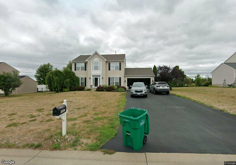
6567 Harvest Ridge Way Lockport, NY 14094
South Lockport NeighborhoodEstimated Value: $371,000 - $494,000
4
Beds
3
Baths
2,176
Sq Ft
$197/Sq Ft
Est. Value
About This Home
This home is located at 6567 Harvest Ridge Way, Lockport, NY 14094 and is currently estimated at $429,627, approximately $197 per square foot. 6567 Harvest Ridge Way is a home located in Niagara County with nearby schools including Aaron Mossell Junior High School and Lockport High School.
Ownership History
Date
Name
Owned For
Owner Type
Purchase Details
Closed on
Nov 28, 2005
Sold by
Nvr Inc
Bought by
Peracciny Louis
Current Estimated Value
Home Financials for this Owner
Home Financials are based on the most recent Mortgage that was taken out on this home.
Original Mortgage
$192,086
Outstanding Balance
$106,000
Interest Rate
6.06%
Mortgage Type
New Conventional
Estimated Equity
$323,627
Create a Home Valuation Report for This Property
The Home Valuation Report is an in-depth analysis detailing your home's value as well as a comparison with similar homes in the area
Home Values in the Area
Average Home Value in this Area
Purchase History
| Date | Buyer | Sale Price | Title Company |
|---|---|---|---|
| Peracciny Louis | $196,977 | Tronolone & Surgalla |
Source: Public Records
Mortgage History
| Date | Status | Borrower | Loan Amount |
|---|---|---|---|
| Open | Peracciny Louis | $192,086 |
Source: Public Records
Tax History Compared to Growth
Tax History
| Year | Tax Paid | Tax Assessment Tax Assessment Total Assessment is a certain percentage of the fair market value that is determined by local assessors to be the total taxable value of land and additions on the property. | Land | Improvement |
|---|---|---|---|---|
| 2024 | $9,705 | $380,000 | $32,000 | $348,000 |
| 2023 | $9,705 | $352,500 | $32,000 | $320,500 |
| 2022 | $8,871 | $311,000 | $32,000 | $279,000 |
| 2021 | $8,519 | $234,100 | $32,000 | $202,100 |
| 2020 | $7,529 | $234,100 | $32,000 | $202,100 |
| 2019 | $4,344 | $234,100 | $32,000 | $202,100 |
| 2018 | $7,216 | $210,000 | $32,000 | $178,000 |
| 2017 | $7,337 | $210,000 | $32,000 | $178,000 |
| 2016 | $7,014 | $200,000 | $32,000 | $168,000 |
| 2015 | -- | $200,000 | $32,000 | $168,000 |
| 2014 | -- | $196,900 | $20,000 | $176,900 |
Source: Public Records
Map
Nearby Homes
- 6571 Harvest Ridge Way
- 779 Fernwood Dr
- Pine End Home Plan at Westcott Townhomes
- Poplar Plan at Westcott Townhomes
- Pine Plan at Westcott Townhomes
- 828 Willowbrook Dr Unit 828
- 351 Applewood Dr
- 519 Applewood Dr Unit 519
- 909 Hollywood Dr
- 313 Applewood Dr
- 583 Evergreen Dr
- 438 Chestnut Dr
- 865 Birchwood Dr
- 472 Chestnut Dr
- 383 Birchwood Dr
- 643 Birchwood Dr
- 648 Birchwood Dr
- 846 Birchwood Dr Unit 846
- 670 Gardenwood Dr
- 306 Dogwood Dr
- 6563 Harvest Ridge Way
- 6575 Harvest Ridge Way
- 6559 Harvest Ridge Way
- 6395 Green Valley Ln
- 6579 Harvest Ridge Way
- 6555 Harvest Ridge Way
- 6400 Cherrywood Ln
- 6405 Cherrywood Ln
- 6228 Thornden Park Dr
- 6391 Green Valley Ln
- 6583 Harvest Ridge Way
- 6551 Harvest Ridge Way
- 6404 Cherrywood Ln
- 6409 Cherrywood Ln
- 6387 Green Valley Ln
- 6301 Green Valley Ln
- 6408 Cherrywood Ln
- 6392 Green Valley Ln
- 6585 Harvest Ridge Way
- 6305 Green Valley Ln