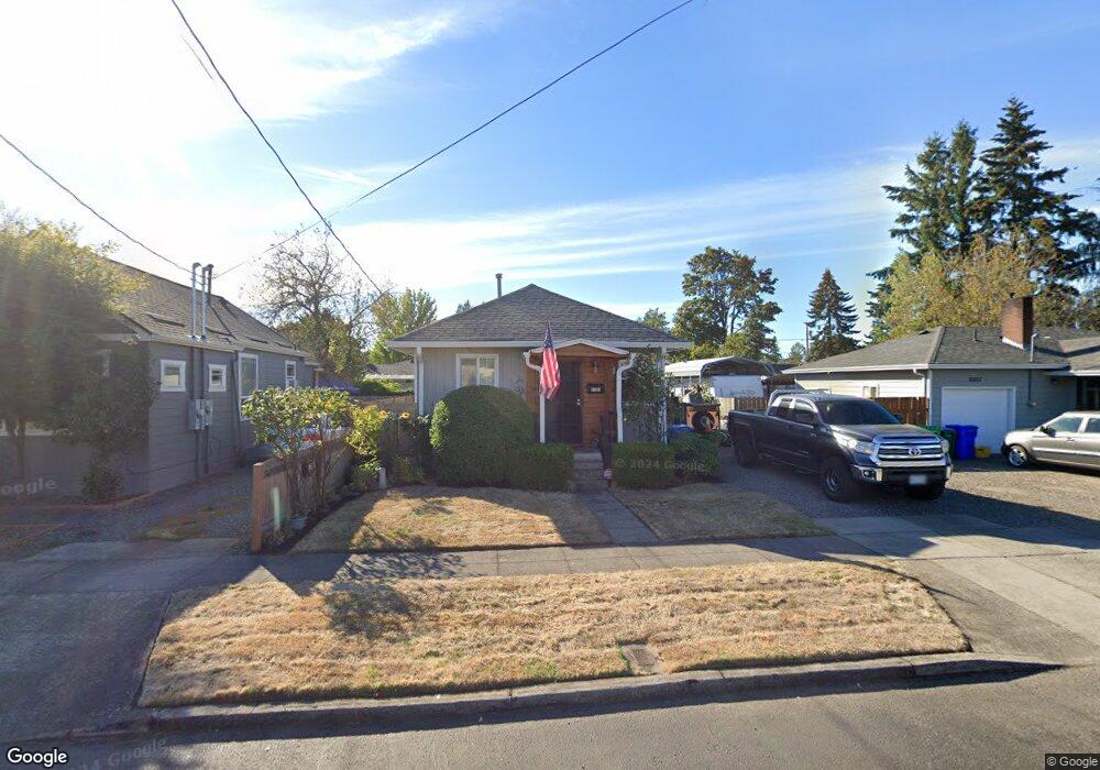
6567 SE 94th Ave Portland, OR 97266
Lents NeighborhoodEstimated Value: $303,000 - $323,000
2
Beds
1
Bath
808
Sq Ft
$383/Sq Ft
Est. Value
About This Home
This home is located at 6567 SE 94th Ave, Portland, OR 97266 and is currently estimated at $309,235, approximately $382 per square foot. 6567 SE 94th Ave is a home located in Multnomah County with nearby schools including Kelly Elementary School, Lane Middle School, and Franklin High School.
Ownership History
Date
Name
Owned For
Owner Type
Purchase Details
Closed on
Apr 8, 2002
Sold by
Barkle John E and Barkle Sigrid H
Bought by
Mortgage Electronic Registration Systems and Household Finance Corp
Current Estimated Value
Purchase Details
Closed on
Jan 30, 1997
Sold by
Varce Donald G and Irene Varce H
Bought by
Barkle John E and Barkle Sigrid H
Home Financials for this Owner
Home Financials are based on the most recent Mortgage that was taken out on this home.
Original Mortgage
$65,100
Interest Rate
8.75%
Mortgage Type
Purchase Money Mortgage
Create a Home Valuation Report for This Property
The Home Valuation Report is an in-depth analysis detailing your home's value as well as a comparison with similar homes in the area
Home Values in the Area
Average Home Value in this Area
Purchase History
| Date | Buyer | Sale Price | Title Company |
|---|---|---|---|
| Mortgage Electronic Registration Systems | -- | -- | |
| Barkle John E | $89,950 | Stewart Title |
Source: Public Records
Mortgage History
| Date | Status | Borrower | Loan Amount |
|---|---|---|---|
| Previous Owner | Barkle John E | $65,100 | |
| Closed | Barkle John E | $17,850 |
Source: Public Records
Tax History Compared to Growth
Tax History
| Year | Tax Paid | Tax Assessment Tax Assessment Total Assessment is a certain percentage of the fair market value that is determined by local assessors to be the total taxable value of land and additions on the property. | Land | Improvement |
|---|---|---|---|---|
| 2024 | $2,642 | $98,750 | -- | -- |
| 2023 | $2,541 | $95,880 | $0 | $0 |
| 2022 | $2,486 | $93,090 | $0 | $0 |
| 2021 | $2,444 | $90,380 | $0 | $0 |
| 2020 | $2,242 | $87,750 | $0 | $0 |
| 2019 | $2,160 | $85,200 | $0 | $0 |
| 2018 | $2,096 | $82,720 | $0 | $0 |
| 2017 | $2,009 | $80,320 | $0 | $0 |
| 2016 | $1,839 | $77,990 | $0 | $0 |
| 2015 | $1,791 | $75,720 | $0 | $0 |
| 2014 | $1,707 | $73,520 | $0 | $0 |
Source: Public Records
Map
Nearby Homes
- 9328 SE Glenwood St
- 6530 SE 96th Ave
- 6318 SE 93rd Ave
- 6417 SE 97th Ave
- 6320 SE 97th Ave
- 9746 SE Woodstock Blvd
- 9630 SE Foster Rd Unit 9634
- 9911 SE Duke St
- 6524 SE 86th Ave
- 6604 SE 86th Ave
- 5843 SE 90th Ave
- 8941 SE Knapp St
- 6131 SE 87th Ave
- 9971 SE Yukon St
- 6126 SE 86th Ave
- 9819 SE Knight St
- 9826 SE Ramona St
- 8936 SE Knapp St
- 7028 SE 86th Ave
- 6336 SE 84th Place
- 6601 SE 94th Ave
- 6601 SE 94th Ave Unit A
- 6557 SE 94th Ave
- 6606 SE 93rd Ave
- 6562 SE 93rd Ave
- 6611 SE 94th Ave
- 6545 SE 94th Ave
- 6550 SE 93rd Ave
- 6614 SE 93rd Ave
- 6539 SE 94th Ave
- 6627 SE 94th Ave
- 6622 SE 93rd Ave
- 6546 SE 93rd Ave
- 6631 SE 94th Ave
- 6529 SE 94th Ave
- 6565 SE 93rd Ave
- 6605 SE 93rd Ave
- 6603 SE 93rd Ave
- 6561 SE 93rd Ave
- 6636 SE 93rd Ave