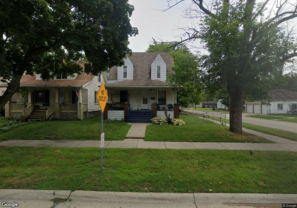
6567 Westpoint St Taylor, MI 48180
Taylor AreaEstimated Value: $166,000 - $184,000
About This Home
This home is located at 6567 Westpoint St, Taylor, MI 48180 and is currently estimated at $171,898, approximately $113 per square foot. 6567 Westpoint St is a home located in Wayne County with nearby schools including Clarence Randall Elementary School, Hoover Middle School, and Quest Charter Academy.
Ownership History
We collect this data history from publicly available records. To have your information removed, we recommend requesting removal directly through your county’s website.
Purchase Details
Purchase Details
Purchase Details
Home Financials for this Owner
Home Financials are based on the most recent Mortgage that was taken out on this home.Purchase Details
Home Values in the Area
Average Home Value in this Area
Purchase History
We collect this data history from publicly available records. To have your information removed, we recommend requesting removal directly through your county’s website.
| Date | Buyer | Sale Price | Title Company |
|---|---|---|---|
| -- | None Listed On Document | ||
| $12,164 | None Available | ||
| -- | Netco | ||
| -- | -- |
Mortgage History
We collect this data history from publicly available records. To have your information removed, we recommend requesting removal directly through your county’s website.
| Date | Status | Borrower | Loan Amount |
|---|---|---|---|
| Previous Owner | $113,600 |
Tax History
We collect this data history from publicly available records. To have your information removed, we recommend requesting removal directly through your county’s website.
| Year | Tax Paid | Tax Assessment Tax Assessment Total Assessment is a certain percentage of the fair market value that is determined by local assessors to be the total taxable value of land and additions on the property. | Land | Improvement |
|---|---|---|---|---|
| 2025 | $2,736 | $84,500 | $0 | $0 |
| 2024 | $2,657 | $75,900 | $0 | $0 |
| 2023 | $2,841 | $72,200 | $0 | $0 |
| 2022 | $1,794 | $69,700 | $0 | $0 |
| 2021 | $2,687 | $62,100 | $0 | $0 |
| 2020 | $5,242 | $50,600 | $0 | $0 |
| 2019 | $217,199 | $46,300 | $0 | $0 |
| 2018 | $2,202 | $44,800 | $0 | $0 |
| 2017 | $2,386 | $40,000 | $0 | $0 |
| 2016 | $4,914 | $38,800 | $0 | $0 |
| 2015 | $3,480 | $34,800 | $0 | $0 |
| 2013 | $3,480 | $36,500 | $0 | $0 |
| 2012 | $1,948 | $35,800 | $5,200 | $30,600 |
Map
- 6562 Westpoint St
- 6606 Cornell St
- 6657 Westpoint St
- 6469 Westpoint St
- 6602 Banner St
- 6784 Cooper St
- 6864 Cornell St
- 6430 Banner St
- 6456 Birch St
- 6871 Troy St
- 6537 Pardee Rd
- 5953 Cooper St
- 7546 Pine St
- 5871 Cooper St
- 7912 Pine St
- 23328 Hayes St
- 5689 Cornell St
- 7128 Cherokee St
- 7608 Tulane St
- 01 Hanover St
- 6608 Westpoint St
- 6608 Westpoint St Unit 1
- 6616 Westpoint St
- 6624 Westpoint St
- 6632 Westpoint St
- 6568 Westpoint St
- 6640 Westpoint St Unit Bldg-Unit
- 6640 Westpoint St
- 6607 Westpoint St Unit Bldg-Unit
- 6607 Westpoint St
- 6617 Westpoint St
- 6625 Westpoint St
- 6625 W Point St
- 6648 Westpoint St
- 6633 Westpoint St
- 6554 Westpoint St
- 6641 Westpoint St
- 6561 Westpoint St
- 6658 Westpoint St
- 6546 Westpoint St
Ask me questions while you tour the home.