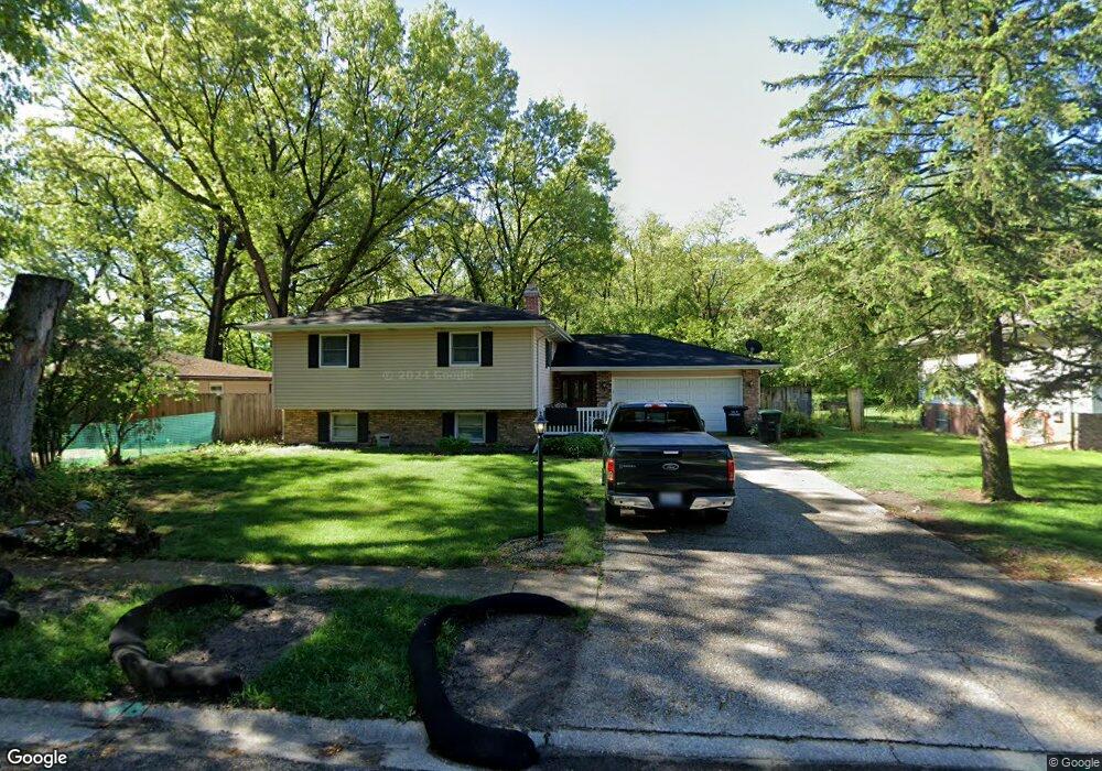
6569 Kandi Ave Portage, IN 46368
Estimated Value: $263,000 - $309,856
5
Beds
2
Baths
2,388
Sq Ft
$122/Sq Ft
Est. Value
About This Home
This home is located at 6569 Kandi Ave, Portage, IN 46368 and is currently estimated at $290,214, approximately $121 per square foot. 6569 Kandi Ave is a home located in Porter County with nearby schools including Crisman Elementary School, Willowcreek Middle School, and Portage High School.
Ownership History
Date
Name
Owned For
Owner Type
Purchase Details
Closed on
Aug 22, 2005
Sold by
Gandy Richard D and Gandy Shelley Ann
Bought by
Wilson John L and Wilson Mona M
Current Estimated Value
Home Financials for this Owner
Home Financials are based on the most recent Mortgage that was taken out on this home.
Original Mortgage
$132,400
Outstanding Balance
$70,576
Interest Rate
5.89%
Mortgage Type
Fannie Mae Freddie Mac
Estimated Equity
$219,638
Create a Home Valuation Report for This Property
The Home Valuation Report is an in-depth analysis detailing your home's value as well as a comparison with similar homes in the area
Home Values in the Area
Average Home Value in this Area
Purchase History
| Date | Buyer | Sale Price | Title Company |
|---|---|---|---|
| Wilson John L | -- | Ticor Title Insurance |
Source: Public Records
Mortgage History
| Date | Status | Borrower | Loan Amount |
|---|---|---|---|
| Open | Wilson John L | $132,400 |
Source: Public Records
Tax History Compared to Growth
Tax History
| Year | Tax Paid | Tax Assessment Tax Assessment Total Assessment is a certain percentage of the fair market value that is determined by local assessors to be the total taxable value of land and additions on the property. | Land | Improvement |
|---|---|---|---|---|
| 2024 | $2,456 | $250,000 | $30,900 | $219,100 |
| 2023 | $2,168 | $242,800 | $29,700 | $213,100 |
| 2022 | $2,148 | $215,300 | $29,700 | $185,600 |
| 2021 | $1,977 | $196,200 | $29,700 | $166,500 |
| 2020 | $1,843 | $182,800 | $25,800 | $157,000 |
| 2019 | $1,783 | $176,800 | $25,800 | $151,000 |
| 2018 | $1,732 | $170,100 | $25,800 | $144,300 |
| 2017 | $1,904 | $159,600 | $25,800 | $133,800 |
| 2016 | $1,573 | $154,400 | $32,000 | $122,400 |
| 2014 | $1,597 | $155,300 | $31,700 | $123,600 |
| 2013 | -- | $148,900 | $32,400 | $116,500 |
Source: Public Records
Map
Nearby Homes
- 1902 Driftwood St
- 6490 Old Porter Rd
- 6540 Monument Ave
- 6698 Monument Ave
- 1766 Samuelson Rd
- 2065 Jefferson St
- 1935 Samuelson Rd
- 6340 Melton Rd
- 0 Northwood Trail Unit NRA811704
- 6281 Old Porter Rd
- 2191 Hamilton St
- 1980 Crisman Rd
- 1848 Truman St
- 6697 Federal Ave
- 2183 Foley St
- 2230 Foley St
- 2182 Foley St
- 2262 Rodeo St
- 2168 Austin St
- 2086 Bluebird Ct