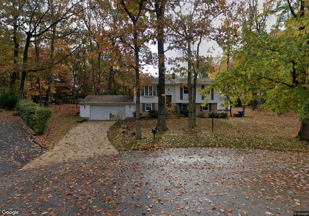
657 Colston Ln Pasadena, MD 21122
Estimated Value: $426,725 - $470,000
Studio
3
Baths
1,082
Sq Ft
$419/Sq Ft
Est. Value
About This Home
This home is located at 657 Colston Ln, Pasadena, MD 21122 and is currently estimated at $453,681, approximately $419 per square foot. 657 Colston Ln is a home located in Anne Arundel County with nearby schools including Lake Shore Elementary School, Chesapeake Bay Middle School, and Chesapeake High School.
Ownership History
Date
Name
Owned For
Owner Type
Purchase Details
Closed on
Aug 27, 2014
Sold by
Hill Gary W
Bought by
Hill Gary W and Hill Josephine M
Current Estimated Value
Purchase Details
Closed on
May 16, 1978
Bought by
Hill Gary W and Hill Margaret A
Home Financials for this Owner
Home Financials are based on the most recent Mortgage that was taken out on this home.
Original Mortgage
$46,000
Interest Rate
9.55%
Create a Home Valuation Report for This Property
The Home Valuation Report is an in-depth analysis detailing your home's value as well as a comparison with similar homes in the area
Home Values in the Area
Average Home Value in this Area
Purchase History
| Date | Buyer | Sale Price | Title Company |
|---|---|---|---|
| Hill Gary W | -- | None Available | |
| Hill Gary W | $58,000 | -- |
Source: Public Records
Mortgage History
| Date | Status | Borrower | Loan Amount |
|---|---|---|---|
| Closed | Hill Gary W | $46,000 |
Source: Public Records
Tax History Compared to Growth
Tax History
| Year | Tax Paid | Tax Assessment Tax Assessment Total Assessment is a certain percentage of the fair market value that is determined by local assessors to be the total taxable value of land and additions on the property. | Land | Improvement |
|---|---|---|---|---|
| 2025 | $3,034 | $379,867 | -- | -- |
| 2024 | $3,034 | $363,100 | $219,700 | $143,400 |
| 2023 | $2,959 | $363,100 | $219,700 | $143,400 |
| 2022 | $2,781 | $363,100 | $219,700 | $143,400 |
| 2020 | $2,650 | $348,000 | $0 | $0 |
| 2019 | $2,598 | $331,800 | $0 | $0 |
| 2018 | $3,200 | $315,600 | $179,700 | $135,900 |
| 2017 | $2,434 | $296,767 | $0 | $0 |
| 2016 | -- | $277,933 | $0 | $0 |
| 2015 | -- | $259,100 | $0 | $0 |
| 2014 | -- | $259,100 | $0 | $0 |
Source: Public Records
Map
Nearby Homes
- 301 Sturtons Ln
- 308 Cockey Dr
- 94 Pine Rd
- 219 C St
- 325 Beach Ave
- 342 Beach Ave
- 394 North Dr
- 260 Magothy Blvd
- 13 Luke Dr
- 4477 Mountain Rd
- 370 Magothy Rd
- 207 Oak Ave
- 360 Magothy Rd Unit 8H
- 360 Magothy Rd Unit 8J
- 360 Magothy Rd Unit 5A
- 360 Magothy Rd Unit 4I
- 360 Magothy Rd Unit L2
- 360 Magothy Rd Unit 11K
- 360 Magothy Rd Unit 14H
- 360 Magothy Rd Unit 27J
- 658 Rossburg Ct
- 662 Colston Ln
- 658 Colston Ln
- 654 Colston Ln
- 649 Colston Ln
- 650 Rossburg Ct
- 650 Colston Ln
- 653 Rossburg Ct
- 1201 Coomes Ln
- 649 Rossburg Ct
- 633 Ross Dr
- 1203 Coomes Ln
- 370 Lake Shore Dr
- 634 Ross Dr
- 353 Lake Shore Dr
- 194 Lake Shore Dr
- 350 Lake Shore Dr
- 200 Lake Shore Dr
- 216 Lake Shore Dr
- 630 Ross Dr