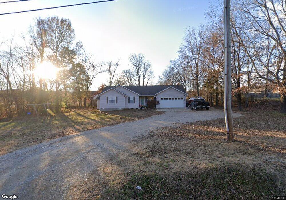
657 Township Line Rd Poplar Bluff, MO 63901
Estimated Value: $193,185 - $264,000
Studio
--
Bath
1,694
Sq Ft
$133/Sq Ft
Est. Value
About This Home
This home is located at 657 Township Line Rd, Poplar Bluff, MO 63901 and is currently estimated at $225,796, approximately $133 per square foot. 657 Township Line Rd is a home with nearby schools including Poplar Bluff Fifth & Sixth Grade Center, Oak Grove Elementary School, and Poplar Bluff Junior High School.
Ownership History
Date
Name
Owned For
Owner Type
Purchase Details
Closed on
Jun 7, 2019
Sold by
Chronister Bradley and Chronister Frances
Bought by
Hatfield Mark A and Hatfield Kathy A
Current Estimated Value
Home Financials for this Owner
Home Financials are based on the most recent Mortgage that was taken out on this home.
Original Mortgage
$134,048
Outstanding Balance
$120,442
Interest Rate
5.75%
Mortgage Type
FHA
Estimated Equity
$105,354
Purchase Details
Closed on
Jan 17, 2017
Sold by
Federal Home Loan Mortgage Corporation
Bought by
Chronister Bradley and Chronister Frances
Create a Home Valuation Report for This Property
The Home Valuation Report is an in-depth analysis detailing your home's value as well as a comparison with similar homes in the area
Home Values in the Area
Average Home Value in this Area
Purchase History
| Date | Buyer | Sale Price | Title Company |
|---|---|---|---|
| Hatfield Mark A | -- | None Available | |
| Chronister Bradley | -- | Stewart Title |
Source: Public Records
Mortgage History
| Date | Status | Borrower | Loan Amount |
|---|---|---|---|
| Open | Hatfield Mark A | $134,048 |
Source: Public Records
Tax History
| Year | Tax Paid | Tax Assessment Tax Assessment Total Assessment is a certain percentage of the fair market value that is determined by local assessors to be the total taxable value of land and additions on the property. | Land | Improvement |
|---|---|---|---|---|
| 2025 | $1,138 | $26,180 | $0 | $0 |
| 2024 | $11 | $24,350 | $0 | $0 |
| 2023 | $1,084 | $24,350 | $0 | $0 |
| 2022 | $1,050 | $23,620 | $0 | $0 |
| 2021 | $1,050 | $23,620 | $0 | $0 |
| 2020 | $988 | $21,870 | $0 | $0 |
| 2019 | $987 | $21,870 | $0 | $0 |
| 2018 | $987 | $24,790 | $0 | $0 |
| 2017 | -- | $24,790 | $0 | $0 |
| 2016 | -- | $24,790 | $0 | $0 |
| 2015 | -- | $24,790 | $0 | $0 |
| 2014 | -- | $23,240 | $0 | $0 |
| 2012 | $885 | $23,240 | $0 | $0 |
Source: Public Records
Map
Nearby Homes
- 265 Berkshire Dr
- 269 Berkshire Dr
- 0 Lot 22 Legacy Estates Unit MAR25007101
- 0 Lot 15 Legacy Estates
- 0 Lot 23 Legacy Estates
- 325 County Road 467
- 0 Lot 62 Legacy Estates
- 246 Berkshire Dr
- 0 Estates
- 194 Duranda Dr
- 0 Lot 59 Legacy Estates
- 5914 Melissa Ln
- 5931 Melissa Ln
- 233 Ruth Harris Ln
- 1487 County Road 467
- 647 County Road 470
- 5711 Cedar Valley Dr
- Lot 1 W Highland Cir
- Lot 3 W Highland Cir
- Lot 2 W Highland Cir
- 0 N & W of County Road 467 Unit 20048591
- 303 Grady
- 317 Apple Park Way
- 0 Lot 35 Legacy Estates Unit 9941113
- 111 County Road 467
- 0 Lot 41 Legacy Estates
- 517 Township Line Rd
- 0 Lot 58 Legacy Estates
- 330 Apple Park Way
- 0 Lot 2 Legacy Estates Unit 20031657
- 333 Apple Park Way
- 325 Apple Park Way
- 292 County Road 470
- 243 County Road 470
- 491 Township Line Rd
- 102 County Road 470
- 0 Lot 38 Legacy Estates
- 0 Lot 3 Legacy Estates
- 115 County Road 470
- 0 Lot 4 Legacy Estates
Your Personal Tour Guide
Ask me questions while you tour the home.