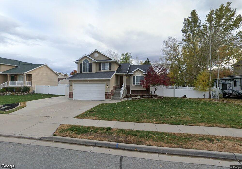
657 W 2025 N Centerville, UT 84014
Estimated Value: $555,802 - $605,000
4
Beds
3
Baths
2,003
Sq Ft
$292/Sq Ft
Est. Value
About This Home
This home is located at 657 W 2025 N, Centerville, UT 84014 and is currently estimated at $584,701, approximately $291 per square foot. 657 W 2025 N is a home located in Davis County with nearby schools including Reading School, Centerville Jr High, and Viewmont High School.
Ownership History
Date
Name
Owned For
Owner Type
Purchase Details
Closed on
Feb 13, 2026
Sold by
Wood Brandon
Bought by
Wwmf Lc
Current Estimated Value
Purchase Details
Closed on
Apr 13, 2006
Sold by
Webb Jason R and Webb Ryann K
Bought by
Wood Brandon
Purchase Details
Closed on
Sep 14, 2005
Sold by
Mckay David F and Mckay Layna Marie
Bought by
Webb Jason R and Webb Ryann K
Home Financials for this Owner
Home Financials are based on the most recent Mortgage that was taken out on this home.
Original Mortgage
$45,000
Interest Rate
5.72%
Mortgage Type
Stand Alone Second
Purchase Details
Closed on
Jun 28, 1999
Sold by
Symphony Development Corp
Bought by
Mckay David F and Mckay Layna Marie
Home Financials for this Owner
Home Financials are based on the most recent Mortgage that was taken out on this home.
Original Mortgage
$124,700
Interest Rate
7.05%
Create a Home Valuation Report for This Property
The Home Valuation Report is an in-depth analysis detailing your home's value as well as a comparison with similar homes in the area
Purchase History
| Date | Buyer | Sale Price | Title Company |
|---|---|---|---|
| Wwmf Lc | -- | None Listed On Document | |
| Wood Brandon | -- | Integrated Title Ins Srv | |
| Webb Jason R | -- | Backman Title Services | |
| Mckay David F | -- | Bonneville Title Company Inc |
Source: Public Records
Mortgage History
| Date | Status | Borrower | Loan Amount |
|---|---|---|---|
| Previous Owner | Webb Jason R | $45,000 | |
| Previous Owner | Webb Jason R | $180,000 | |
| Previous Owner | Mckay David F | $124,700 |
Source: Public Records
Tax History
| Year | Tax Paid | Tax Assessment Tax Assessment Total Assessment is a certain percentage of the fair market value that is determined by local assessors to be the total taxable value of land and additions on the property. | Land | Improvement |
|---|---|---|---|---|
| 2025 | $3,316 | $267,300 | $159,158 | $108,142 |
| 2024 | $3,073 | $257,949 | $142,070 | $115,879 |
| 2023 | $2,820 | $244,750 | $128,882 | $115,867 |
| 2022 | $2,944 | $470,000 | $214,656 | $255,344 |
| 2021 | $2,616 | $355,000 | $178,671 | $176,329 |
| 2020 | $2,351 | $317,000 | $176,716 | $140,284 |
| 2019 | $2,340 | $311,000 | $179,271 | $131,729 |
| 2018 | $2,296 | $303,000 | $166,466 | $136,534 |
| 2016 | $1,862 | $138,050 | $52,715 | $85,335 |
| 2015 | $1,901 | $133,485 | $52,715 | $80,770 |
| 2014 | $1,978 | $142,837 | $52,715 | $90,122 |
| 2013 | -- | $120,527 | $47,025 | $73,502 |
Source: Public Records
Map
Nearby Homes
- 687 W 2025 N
- 586 W 1950 N
- 551 W Summerhill Ln
- 2132 N 725 W
- 461 W Summerhill Ln
- 2136 N 725 W
- 283 W Summerhill Ln
- 286 W Summerhill Ln
- 136 W Summerhill Ln
- 2340 N 650 W
- 5 W Summerhill Ln
- 354 S 525 W
- 393 S 525 W
- 374 S 525 W
- 373 S 525 W
- 386 S 525 W
- 1692 Willow Creek Cir
- 19 E 1500 S
- 23 E 1500 S
- 1549 N 400 W
Your Personal Tour Guide
Ask me questions while you tour the home.