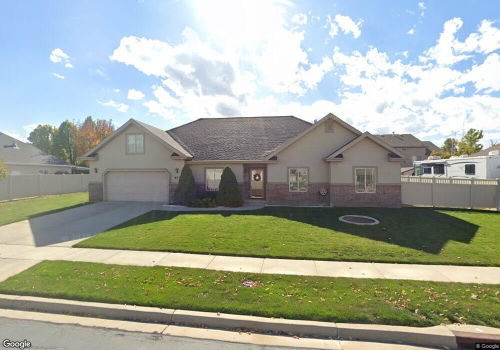
657 W 300 N Spanish Fork, UT 84660
Estimated Value: $570,000 - $651,000
5
Beds
3
Baths
2,355
Sq Ft
$256/Sq Ft
Est. Value
About This Home
This home is located at 657 W 300 N, Spanish Fork, UT 84660 and is currently estimated at $603,669, approximately $256 per square foot. 657 W 300 N is a home located in Utah County with nearby schools including Brockbank Elementary School, Spanish Fork Jr High School, and Spanish Fork High School.
Ownership History
Date
Name
Owned For
Owner Type
Purchase Details
Closed on
Oct 8, 2015
Sold by
Flood Sara
Bought by
Mitchell Warren John and Flood Sara
Current Estimated Value
Purchase Details
Closed on
Apr 30, 2014
Sold by
Lawrence Saundra N and Lawrence Saundra
Bought by
Lawrence Saundra Mae Norton
Purchase Details
Closed on
Jan 21, 2003
Sold by
Hansen Linda S
Bought by
Lawrence Fred and Lawrence Saundra
Purchase Details
Closed on
Aug 15, 2002
Sold by
Hansen Danny M
Bought by
Hansen Linda S
Purchase Details
Closed on
Feb 27, 2002
Sold by
Mtm Ltd
Bought by
Hansen Danny M and Hansen Linda S
Create a Home Valuation Report for This Property
The Home Valuation Report is an in-depth analysis detailing your home's value as well as a comparison with similar homes in the area
Home Values in the Area
Average Home Value in this Area
Purchase History
| Date | Buyer | Sale Price | Title Company |
|---|---|---|---|
| Mitchell Warren John | -- | Pro Title & Escrow Inc | |
| Lawrence Saundra Mae Norton | -- | None Available | |
| Lawrence Fred | -- | Pro Title & Escrow Inc | |
| Hansen Linda S | -- | -- | |
| Hansen Danny M | -- | Title West Title Co |
Source: Public Records
Tax History Compared to Growth
Tax History
| Year | Tax Paid | Tax Assessment Tax Assessment Total Assessment is a certain percentage of the fair market value that is determined by local assessors to be the total taxable value of land and additions on the property. | Land | Improvement |
|---|---|---|---|---|
| 2025 | $2,682 | $317,075 | $219,100 | $357,400 |
| 2024 | $2,682 | $276,430 | $0 | $0 |
| 2023 | $2,695 | $278,080 | $0 | $0 |
| 2022 | $2,620 | $265,155 | $0 | $0 |
| 2021 | $2,204 | $356,800 | $130,900 | $225,900 |
| 2020 | $2,049 | $322,500 | $119,000 | $203,500 |
| 2019 | $1,833 | $303,600 | $111,700 | $191,900 |
| 2018 | $1,667 | $266,900 | $97,300 | $169,600 |
| 2017 | $1,557 | $133,980 | $0 | $0 |
| 2016 | $1,564 | $132,825 | $0 | $0 |
| 2015 | $1,583 | $132,825 | $0 | $0 |
| 2014 | -- | $121,440 | $0 | $0 |
Source: Public Records
Map
Nearby Homes
- 1841 N 630 St W Unit 71
- 1788 N 630 St W Unit 47
- 1826 N 630 St W Unit 101
- 833 W 250 N
- 226 N 860 W Unit 156
- 13 N 710 W
- 393 N 400 W
- 559 N Mitchell Dr
- 1040 W Center St
- 956 W 40 N
- 294 W 200 N
- 134 N 300 W
- 88 S 400 W
- 433 N 100 W
- 231 S 880 W
- 40 W 400 N Unit 1-6
- 2645 W 360 S Unit 1
- 2576 W 360 S Unit 5
- 1026 W 350 S
- 225 W 300 S